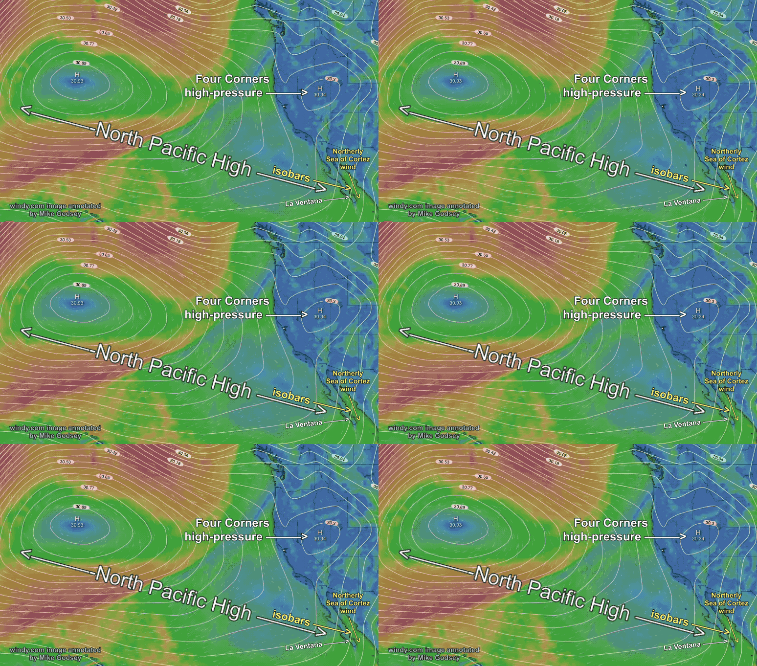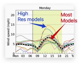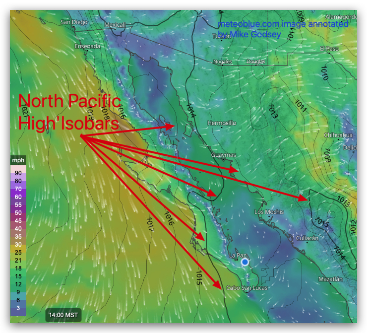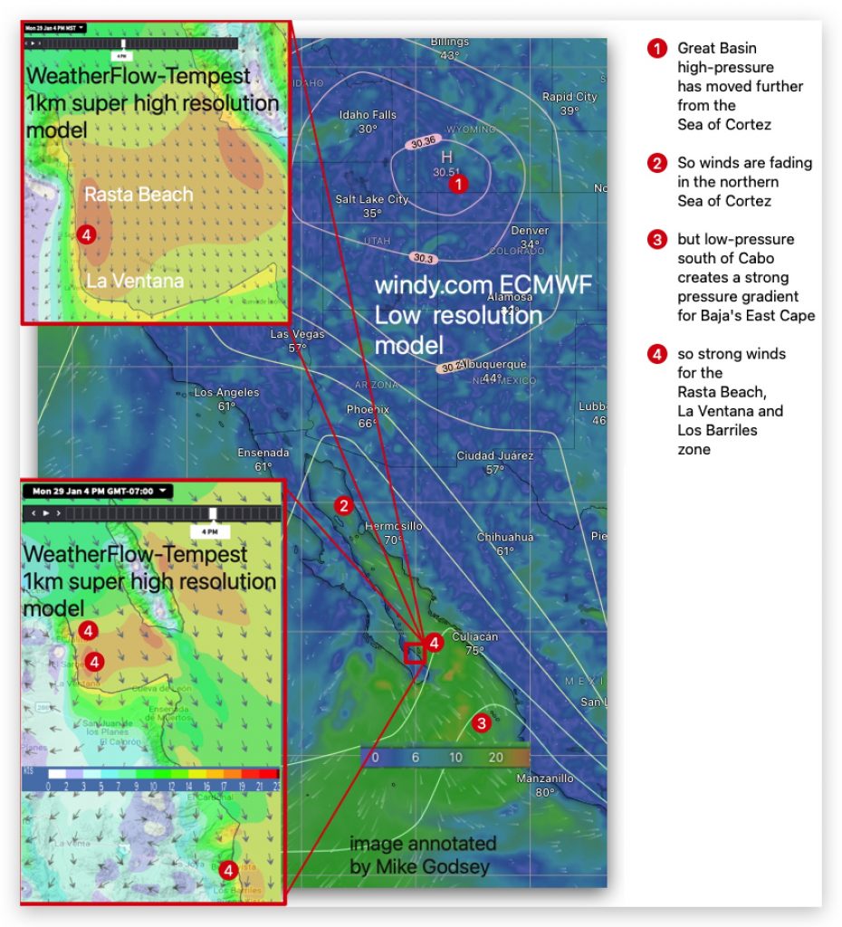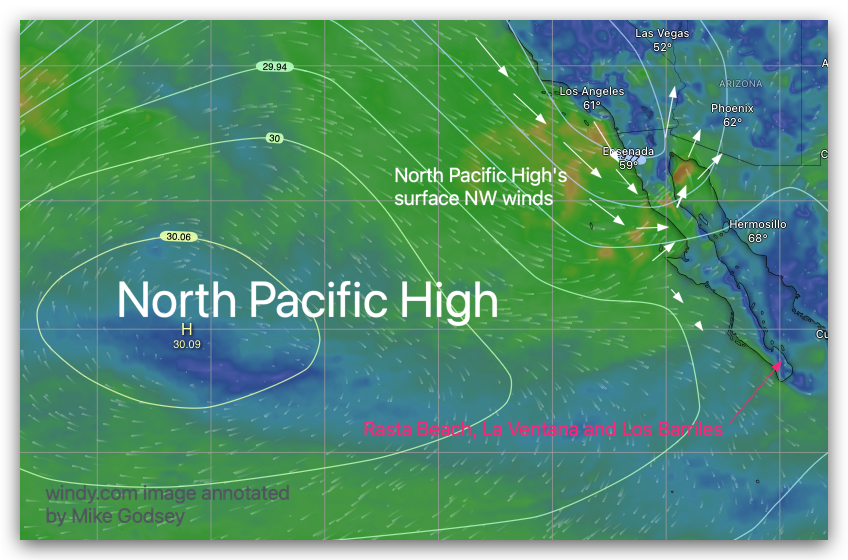
by Mike Godsey Forecast Jargon Decoder: April 2, 2024 Amazingly in April, we have a perfect mid-winter pattern with Windy Duo, the North Pacific High, and the Four Corners high-pressure making a cameo appearance. Their isobars merge over the southern Sea of Cortez pumping northerly winds towards a low-pressure well south of Cabo Wabo. Add…

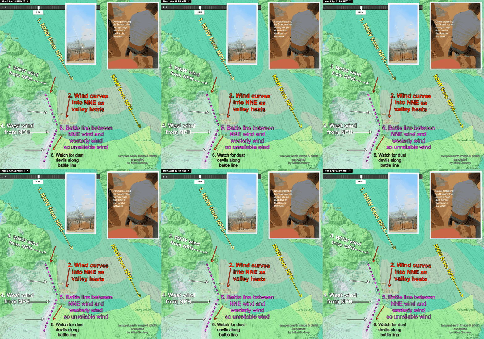
by Mike Godsey Forecast Jargon Decoder: Monday April 1, 2024 As a storm departs Southern Californians moves into the Great Basin the North Pacific High’s surface NW winds ramp up on the Pacific side along with huge swell. The North Pacific High’s winds take two pathways in Baja Sur: 1. Part of the wind flows…

by Mike Godsey Historically the winds on Baja’s East Cape, Rasta Beach to La Ventana to Los Barriles corridor, begin to fade as spring approaches. This happens as the North Pacific High moves towards Alta California and high-pressure systems in Four Corners become less common. This leaves Baja’s East Cape with only Local Sea Breezes…

Mike Godsey Reading Matt Sounders forecast for solid NNE wind yesterday I was very skeptical. From my house, I was looking at lots of wind-killing clouds and a glassy Sea of Cortez. But, like magic, the clouds parted and a delightful combo of mild “El Norte” winds and robust Local Sea Breezes sent hundreds of…
Mike Godsey During El Niño years it is more common to have the clouds of the Sub-Tropical Jetstream over Baja Sur. While La Ventana often has nice sunrises these jet clouds This often create spectacular sunrises in the La Ventana area making the village a window to the eastern sunrise. Sometimes the clouds linger the…

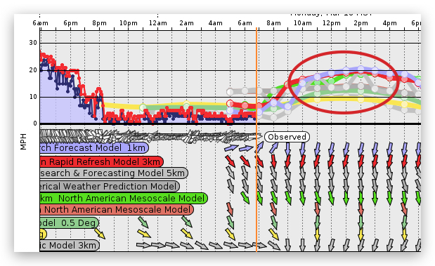
Fprecast Decoder: Monday, March 11, 2024 The large-scale winds fade away today as the North Pacific High moves over the Sea of Cortez and the low-pressure south of Cabo disappears killing the wind most of the Sea of Cortez. Indeed if you look at all the global low-resolution models they are forecasting sub-teens for Baja’s…

Forecast Decoder by Mike Godsey: Yesterday, Matts’s forecast, somewhat cryptically, talked about an overly-friendly North Pacific High. Remember the old cliche about “Too much of a good thing”? Normally having a smallish winter-sized 1-2000 mile-wide North Pacific High near Baja is good for the Sea of Cortez winter winds. But as spring approaches and the…

Today’s Forecast Jargon Decoder: The entire forecast for the current day can be found on iwindsurf.com or kitesurf.com. Decoder blogs are designed to help you visualize what the terms we use in the forecast. Today our long run of moderate El Norte wind continues today for the Rasta Beach, La Ventana and Los Barriles zone….
Todays Forecast Decoder: The entire forecast for the current day can be found on iwindsurf.com or kitesurf.com. wx.iwindsurf.com/proforecast/56 The nagging clouds disappear as the North Pacific High and the upper trough move eastward and stop steering clouds our way. Note how the models. had heavy clouds yesterday but much sparser clouds today and almost no…

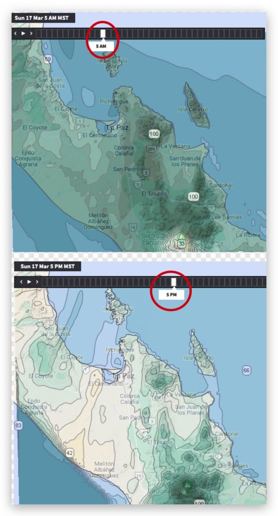
Back in beach Meteorology 101 you probably learned that wind is created as air moves from high-pressure towards low-pressure. Every sunny day at our beaches you can see and feel this happen as the Coastal Valleys heat and mild winds ramp up. But these local scale winds are much weaker than the strong winds created…
