Mike Godsey
Reading Matt Sounders forecast for solid NNE wind yesterday I was very skeptical. From my house, I was looking at lots of wind-killing clouds and a glassy Sea of Cortez.
But, like magic, the clouds parted and a delightful combo of mild “El Norte” winds and robust Local Sea Breezes sent hundreds of wings, kites and even a few windsurfers skimming across the water.
Looking at today’s sky above and the sparser clouds it is far easier to forecast clearing. But how did Matt make that great forecast yesterday when things looked so dismal at dawn?
If you have watched a time-lapse video of clouds you are struck by how fast they change. So making a forecast for clearing 6 hours in advance seems impossible.
But our tools keep improving and we get cloud forecasts correct more frequently.
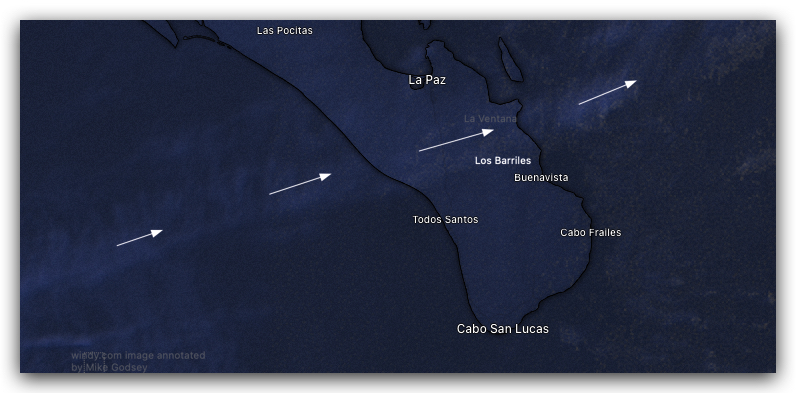
In Baja Sur the most useful tool is satellite imagery animation. When I animate this image I can see that the clouds streaming from the WSW are pretty sparse and with midday heating,
they are likely to become thinner.
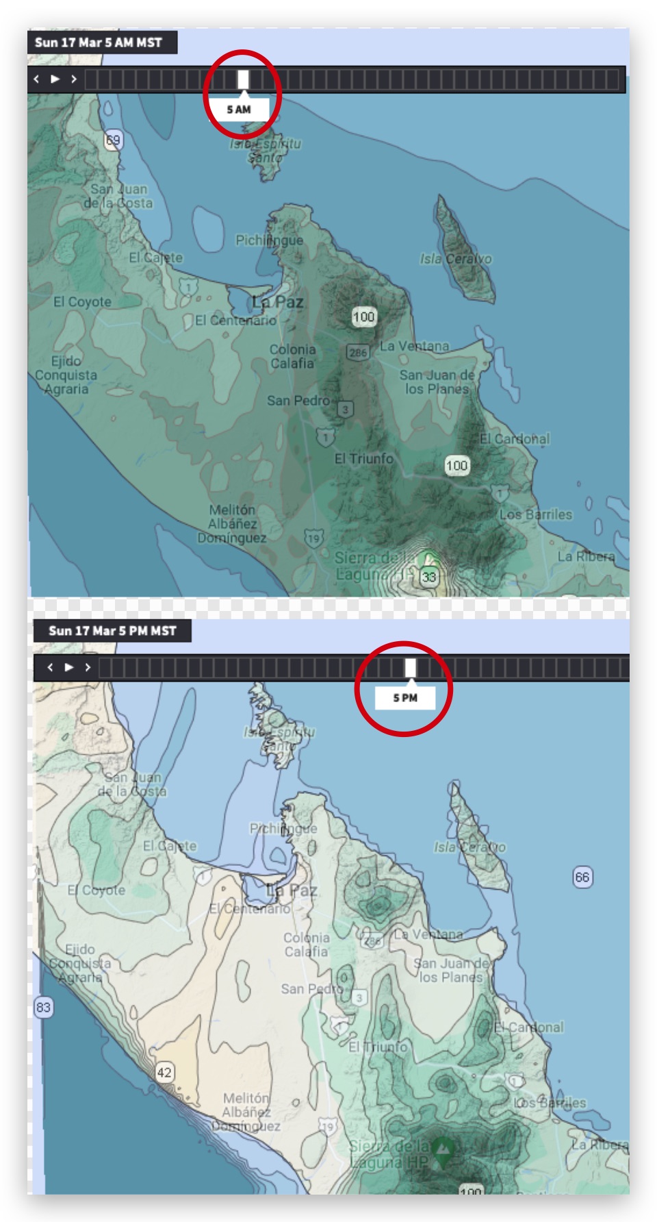
The newer tool, produced by the Weatherflow.com wizards at our Denver, Colorado, USA office often gives us a super high resolution 1km model view of the likely humidity and indirectly low clouds over Baja’s East Cape.
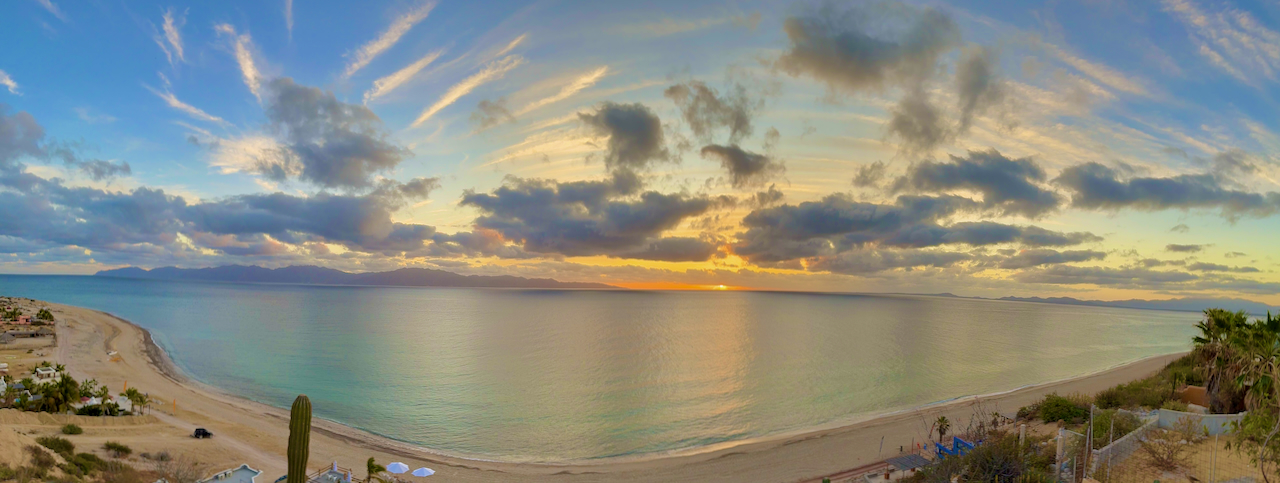
Notice all the dark areas in the first 5 AM model image. Note how it roughly compares to the sunrise photo above.
Now look at the almost clear skies in the 5 PM model image. Lets hope my forecast and the model output are right!