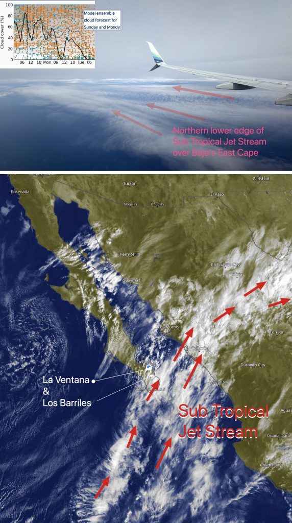
1- The dreaded Sub-Tropical Jet Stream is still streaming from the SW with 80% and decreasing cloud coverage and scattered sprinkles.2- These clouds will thin randomly, so Coastal Valley heating and thermal winds will not be reliable.3- A huge North Pacific High lords over the Pacific, and it is pushing high-pressure toward the 4-Corners region,…
Monday Jan 19: Forecast hinges on Coastal Valleys clouds this afternoon. With clearing mid to weak upper-teens outside strongest Los Barriles south. Wind Recipe:1- A tropical disturbance with rain and lightning is about 500 miles south of Cabo, so expect periods of patchy high and medium-level clouds.2- If these clouds linger over our Coastal Valleys,…
When Maria woke before sunrise, she reached for her phone and saw an alert from her Tempest weather station. Overnight, the temperature had dropped a startling 22 degrees. Yesterday afternoon, she had been sitting on the porch in short sleeves; now, as she stepped outside, her breath fogged the air. Curious, she opened the Tempest…
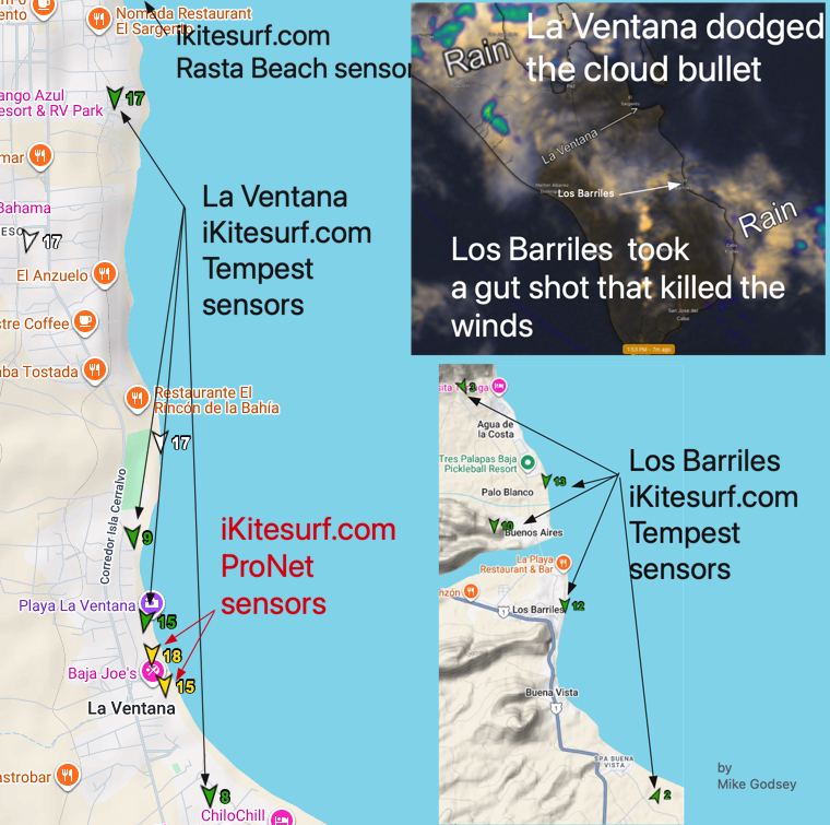
Take a look at our ikitesurf.com sensors below of Los Barriles and La Ventana. There is a shocking difference. That day our major wind machines, the North Pacific High and the 4-Corners region were weak and distant and did not contribute to our wind. When that happens, most of our wind is produced by heating…
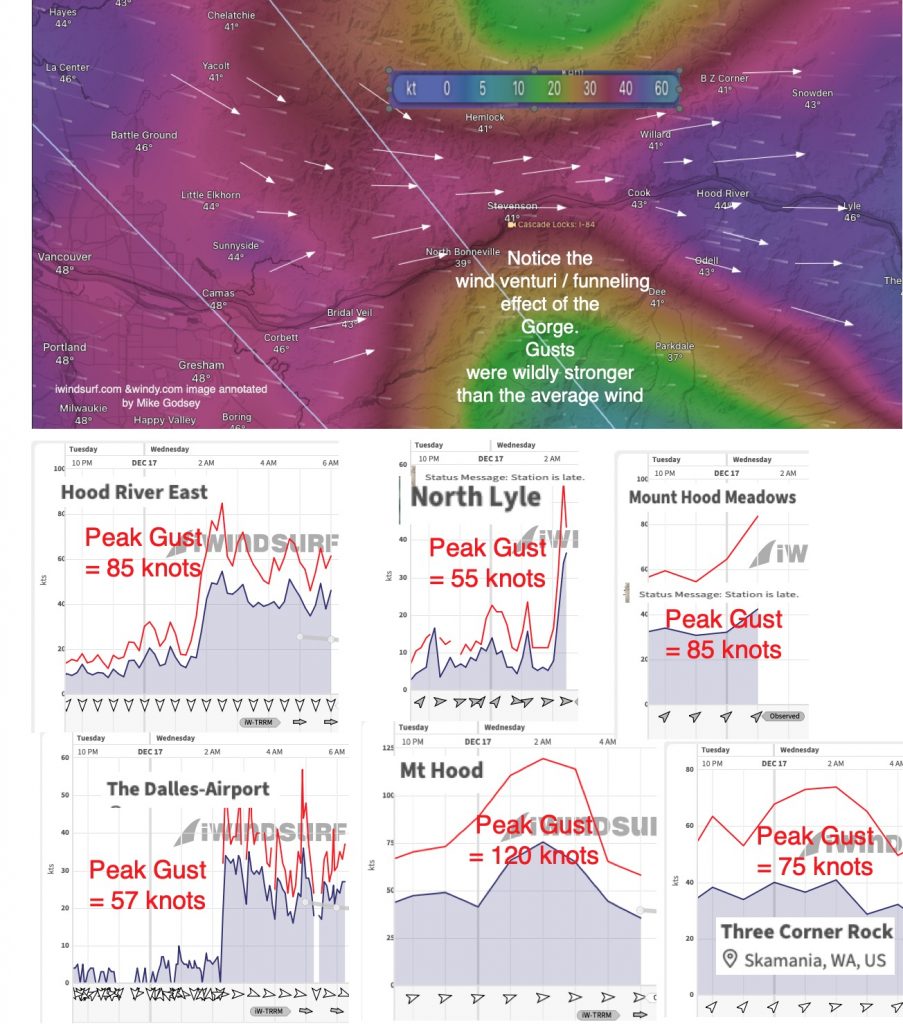
Did you sleep through it? The Gorge makes more than pretty pictures. It also makes wild weather. Last night, a windy cold front passed, and the combo of Adams, Hood, and the Gorge acted as a wind funnel, making for gusts near 60 near the water and gusts over 100 in the mountains. Here is…
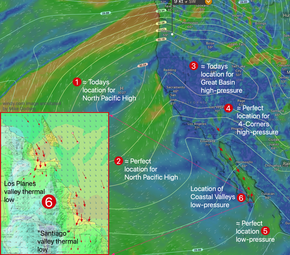
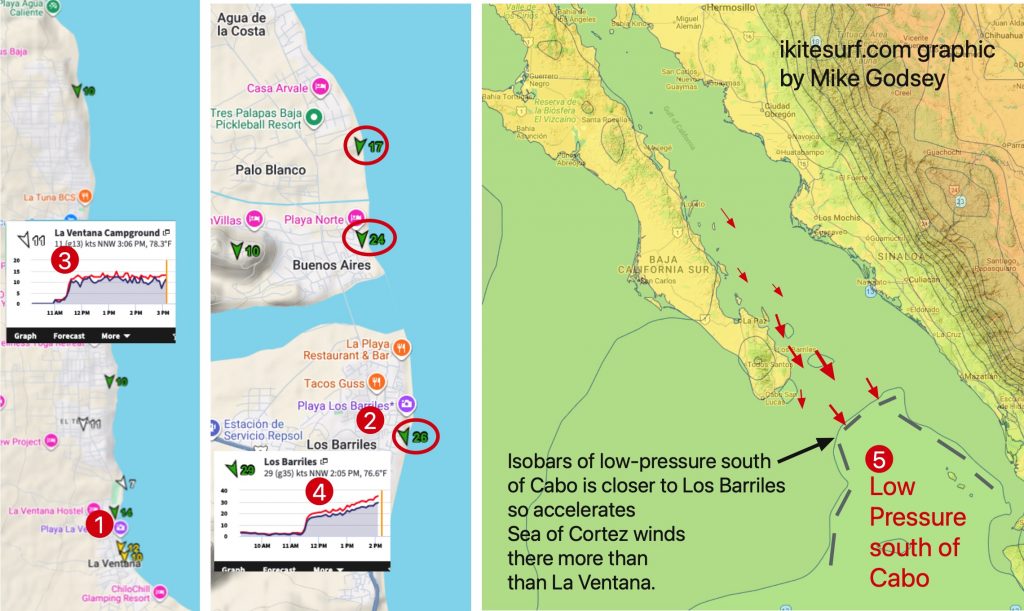
1- The North Pacific High and high-pressure in the 4-Corners are north of their perfect locations again today so mid-teens El Norte winds. 2- Those mid-teen winds are accelerated to mid to upper-teens by low-pressure south of Cabo in a near perfect location. 3- Blue sky allows the Los Planes and Santiago Valleys to heat…
We watched a rigging frenzy today just north of Rasta Beach near El Sargento. The winds had gone from calm and cloudy to northerly upper-teens minutes. Since I had forecast such a wind spike, I was apprehensive, ESPECIALLY since the winds at our house were blowing WEST despite the northerly surface winds. Some wingers like…

Saturday’s Wind Recipe: 1- Pt. Reyes SE 28g33 and fog blasting by the North Tower! That tells us that Big Eddy and southerly coast winds will rule all day! 2-The eddy started as a Gulf of Alaska storm/cold front pushed high-pressure into the Pacific Northwest. 3- This caused low-pressure to bulge over the coast from…
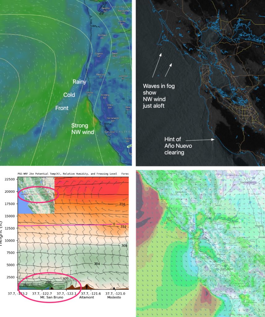
Sunday’s Wind Jargon Decoder: 1- A distant cold front bringing rain to the Gorge is compacting the NW ocean winds along our coast. 2- The dawn view from space shows NW ripples in the fog just offshore confirming that NW winds ≈ 1000 feet aloft will add a strong gust factor to the launch sites…