Wind Recipe: Note: Good chance late afternoon fog shuts down Crissy.
1- Weak elongated counter-clockwise eddy and its southerly coast winds expanded overnight less than expected, with southerly coast winds from Pismo to near Pt. Area.
2- The eddy spins all day as it gains southerly support from a low-pressure that extends up to ≈ 18,000 feet aloft (500 MB).
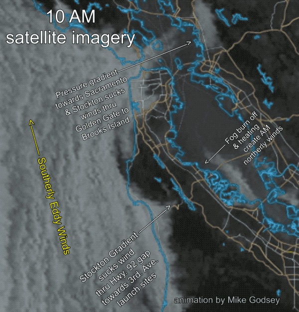
3- The satellite imagery above confirms that the strongest Central Valley
pressure gradient is towards Sacramento sucking low to mid 20’s winds from Anita Rock to North Tower and mid Slot to Larkspur/Clark’s Brickyards, Benicia to Sherman Island.
4- Upper-teens to low 20’s Brooks Island and weaker Shimada Park to near Pt. Isabel.
5- Weak, unreliable winds for the Peninsula except Oyster and Flying Tigers/Haskins and possibly Candlestick.
6- Weak southerly winds for entire coast except for Pacifica that reaches the mid to faint upper-teens.