Back in beach Meteorology 101 you probably learned that wind is created as air moves from high-pressure towards low-pressure. Every sunny day at our beaches you can see and feel this happen as the Coastal Valleys heat and mild winds ramp up. But these local scale winds are much weaker than the strong winds created by larger scale pressure gradients. And those high and low pressure areas are created by events far away from Baja’s East Cape.
In this first animation note with isobar lines that show surface high and low pressures. Notice the surface North Pacific High west of Baja.
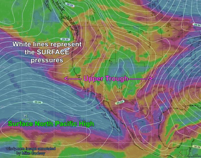
The blue and red colored wind running parallel to the California coast then dipping southward into the middle of the USA represent the modeled upper level winds at ≈ 18,000 feet aloft (500 MB).
A southward extending wave of upper level like this is called an upper trough. This last week or so this upper trough has brought a large mass of cold, dense air from the Arctic plunging most of North America’s temperatures below average.
This cold air mass is typically associated with high pressure systems, which limit clouds allowing temperatures to dip further.
So what does all of this have to do with Baja’s East Cape winds where the temperatures are only a bit cooler than normal?
Those same upper trough winds at ≈ 18,000 feet aloft are sweeping clouds from a Pacific storm over Baja which shade our Coastal Valleys spoiling any local pressure gradient.
But as you can see in the image the upper level winds are also shoving the surface North Pacific High towards Baja which is creating strong NW winds on the Pacific side of Baja Norte.
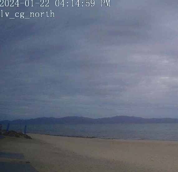
So why don’t these winds reach Rasta Beach, La Ventana and Los Barriles?
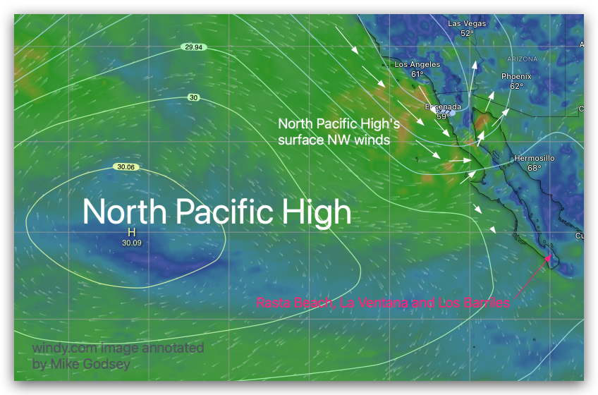
Look very carefully at the isobars over the Southern California Deserts and Arizona.
These lines represent a low-pressure area which is sucking up the North Pacific High’s surface NW winds before they can blow down the Sea of Cortez. This surface low-pressure area is created by the area where divergence in the upper level winds begin to turn from NW to West.
Now look just south of Cabo. Notice there are no isobars in that area. This means there is no low-pressure south of Cabo to suck any of that northerly wind to our beaches.
Tomorrow that upper trough moves eastward allowing the North Pacific High to move closer to the Sea of Cortez. At the same time the NPH extend a high-pressure ridge towards the 4-Corners region which will enhance our winds for almost a week!
Long-term trends: While a single cold event like this and the often extreme summer heat events can’t be directly attributed to climate change, extreme weather events are generally predicted by all the climate models to become more frequent and intense with global warming.
Which, of course, does not make common sense!
This is due to Arctic amplification. From Alaska to Canada to Scandinavia to Russia the Arctic is warming at a much faster rate than the rest of the planet, a phenomenon known as Arctic amplification. This can lead to a weakening of the jet stream and more frequent intrusions of cold air masses into lower latitudes. Conversely, in the summer it can lead to more frequent movements of hot air masses into higher latitudes hence more frequent heat waves. None of this makes sense unless you understand and follow the changing snake like pathway of the upper level winds.