Today’s Forecast
Jargon Decoder:
The entire forecast for the current day can be found on iwindsurf.com or kitesurf.com.
Decoder blogs are designed to help you visualize what the terms we use in the forecast.
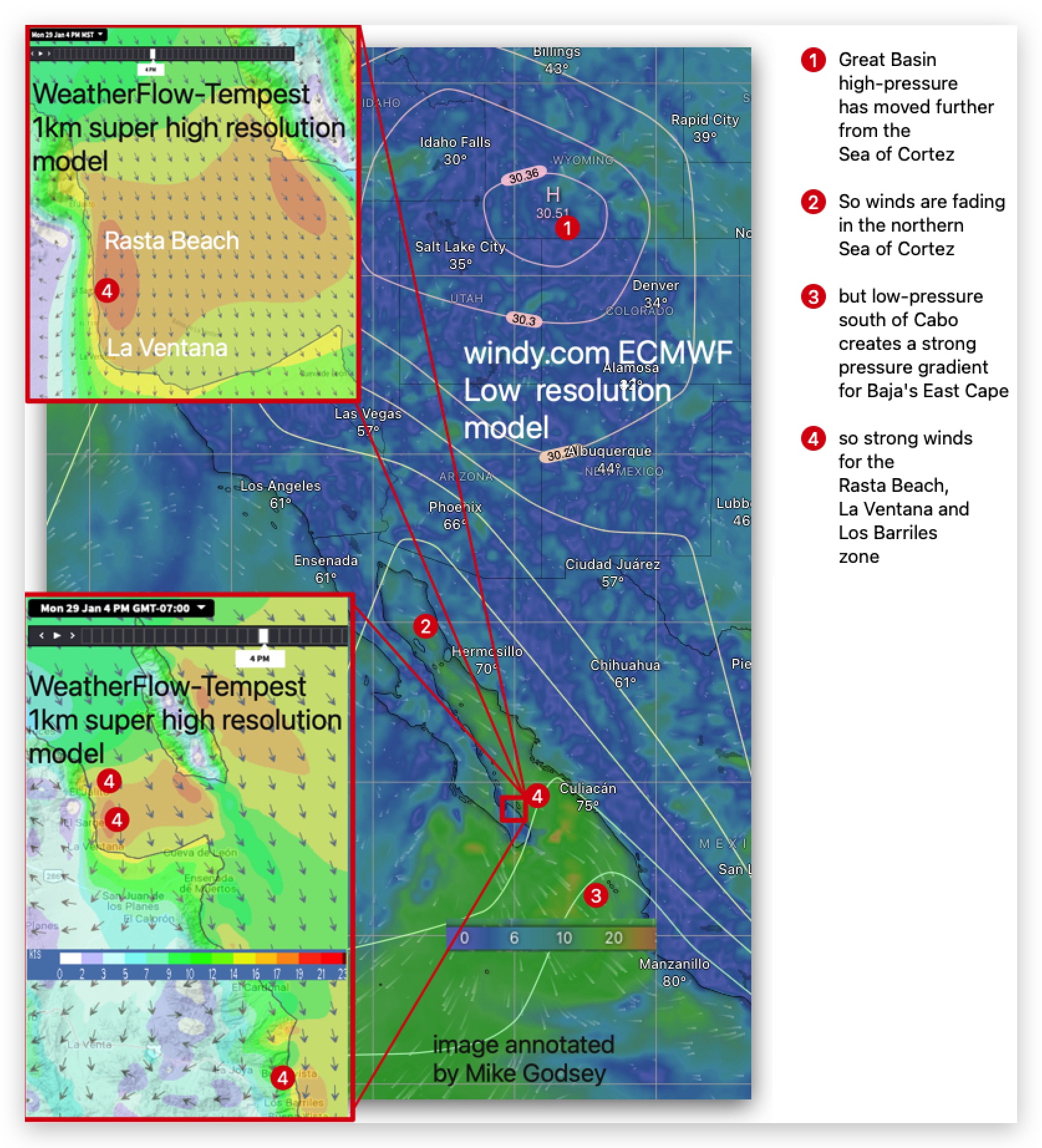
Today our long run of moderate El Norte wind continues today for the Rasta Beach, La Ventana and Los
Barriles zone.
The Great Basin high-pressure is
beginning to move eastward.
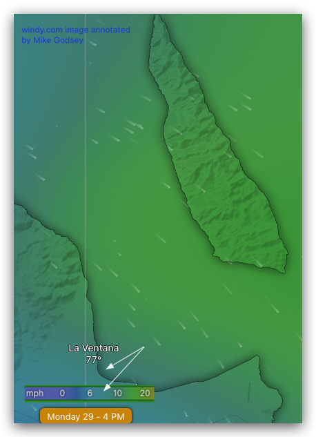
As you can see in the
second image this causes the winds in the northern half of the Sea of Cortez to fade.
But a strong low-pressure south of Cabo keeps our wind going until Wednesday.
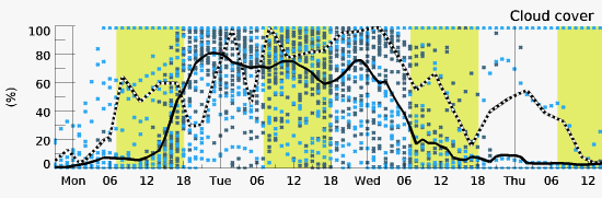
However the multi-model graph in the first images suggests increasing clouds that may make the beach winds unsteady in the mid to late afternoon.