Mike Godsey Hi Guys, I have spent hundreds of hours studying this issue by driving around the Peninsula especially the Half Moon Bay area. It is frustrating for me not to have a simple solution. Basic information: Unlike most Bay launch sites, the 3rd Ave. area is fed wind from 2 different gap areas in…

Mike Godsey Today we see a NW-WNW pattern with strong gusty winds focused on the coast, Anita Rock to Palo Alto and Tomales to Rod and Gun to Benicia. This blog helps you turn the forecast words into weather images. pattern is created by: 1. The center of the North Pacific High moves closer to…

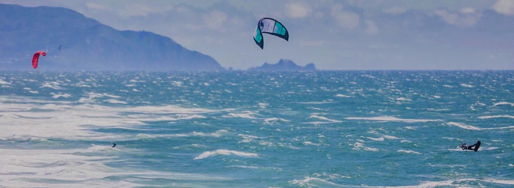
Mike Godsey These photos from the Ocean Beach King of the Cove event on April 26, 2024, tell the wind story. But if you need convincing that this was an epic day, look at the powerful winds at almost every WeatherFlow-Tempest shoreline sensor in the San Francisco Bay Area. The Red circles show sites with…

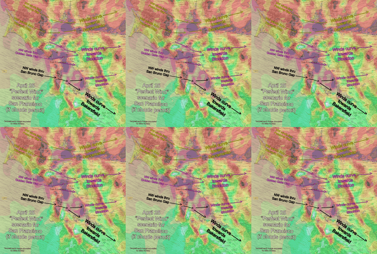
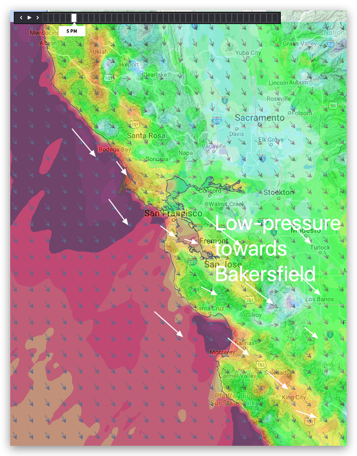
Mike Godsey Forecast Jargon Decoder, April 26, 2024 Powerful GUSTY EARLY winds hit Bay from Ocean Beach to Benicia and Sherman Island and Crissy to Palo Alto. The “Perfect Wind” scenario yesterday replays today BUT with a much stronger gradient towards Bakersfield! Whitecaps at Anita Rock at dawn foretell the AM story up and down…

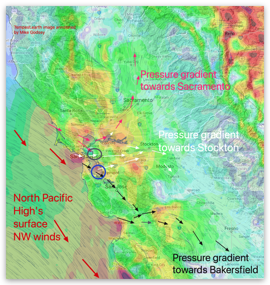
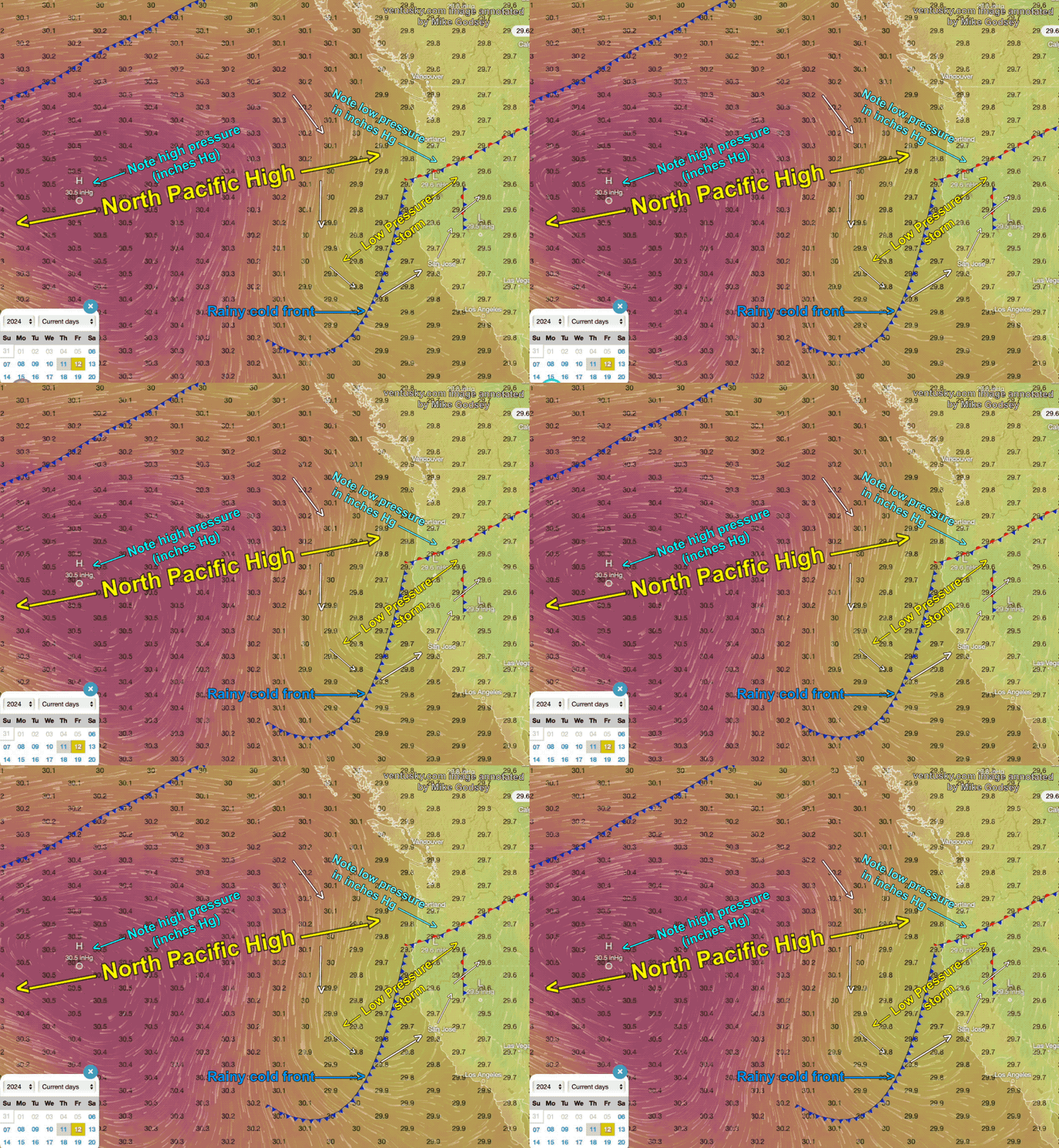
Max pressure gradient split between Sacramento, Stockton and towards Bakersfield so NW ocean winds accelerate to almost every site that CLEARS. Mike Godsey Forecast Jargon Decoder, April 25, 2024 The eddy and its southerly winds are history as low to mid-20’s winds develop due to: 1. a 3000-mile wide dome of high-pressure, the North Pacific…

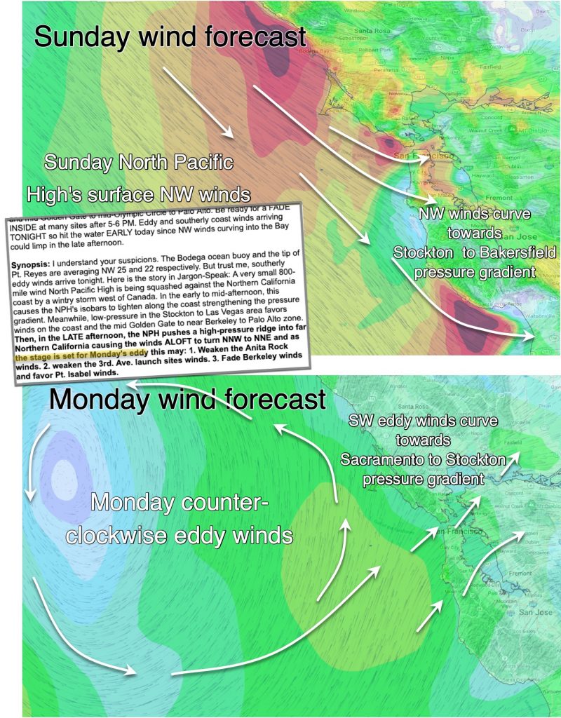
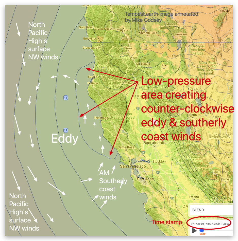
Forecast Jargon Decoder: Mon, Apr 22 2024 Wind forecast For Monday: Synopsis: The North Pacific High’s surface NW winds move further from shore as low-pressure moves over the coast in the AM, and a counter-clockwise eddy develops encouraged by the low-pressure and NNE winds aloft. The eddy never dies even as the low-pressure retreats back…

by Mike Godsey Forecast Jargon Decoder: Friday April 16 Synoposis: The US ship Bell Shimada 50 miles west of the Golden Gate is reporting 1-knot west wind which tells that the North Pacific High’s surface NW winds are far from shore while the coast sensors are showing southerly eddy winds from Monterey to Mendocino. Still, I expect the…

Mike Godsey “There is no North Pacific High this spring” (heard on the beach at Crissy Field) Are you are an avid West Coast surfer, kiteboarder, windsurfer, winger or sailor or just love to watch huge surf? Then you love the NW clearing winds and waves from the North Pacific High that commonly follow a…

by Mike Godsey Forecast Jargon Decoder: April 7, 2024 Strong coast winds and GUSTY LATE winds Crissy Beach to Alameda to Peninsula launch sites. Weaker WNW for Benicia, Pt. Isabel, Race Track and Berkeley. Update: Getting skeptical about the strong wind forecast inside the Bay given the current weak NE winds? I am keeping to the…

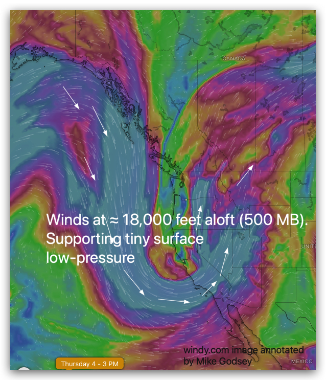
by Mike Godsey Forecast Jargon Docoder: Thursday, April 4, 2024 A 2800-mile-wide North Pacific High spans the waters from the Gulf of Alaska to near the tip of Baja so very strong NNW ocean winds are blasting past of the Farallon Islands (18 miles west Gate). Unfortunately, a tiny 150-mile-wide wide low-pressure area loiters all…


