by Mike Godsey
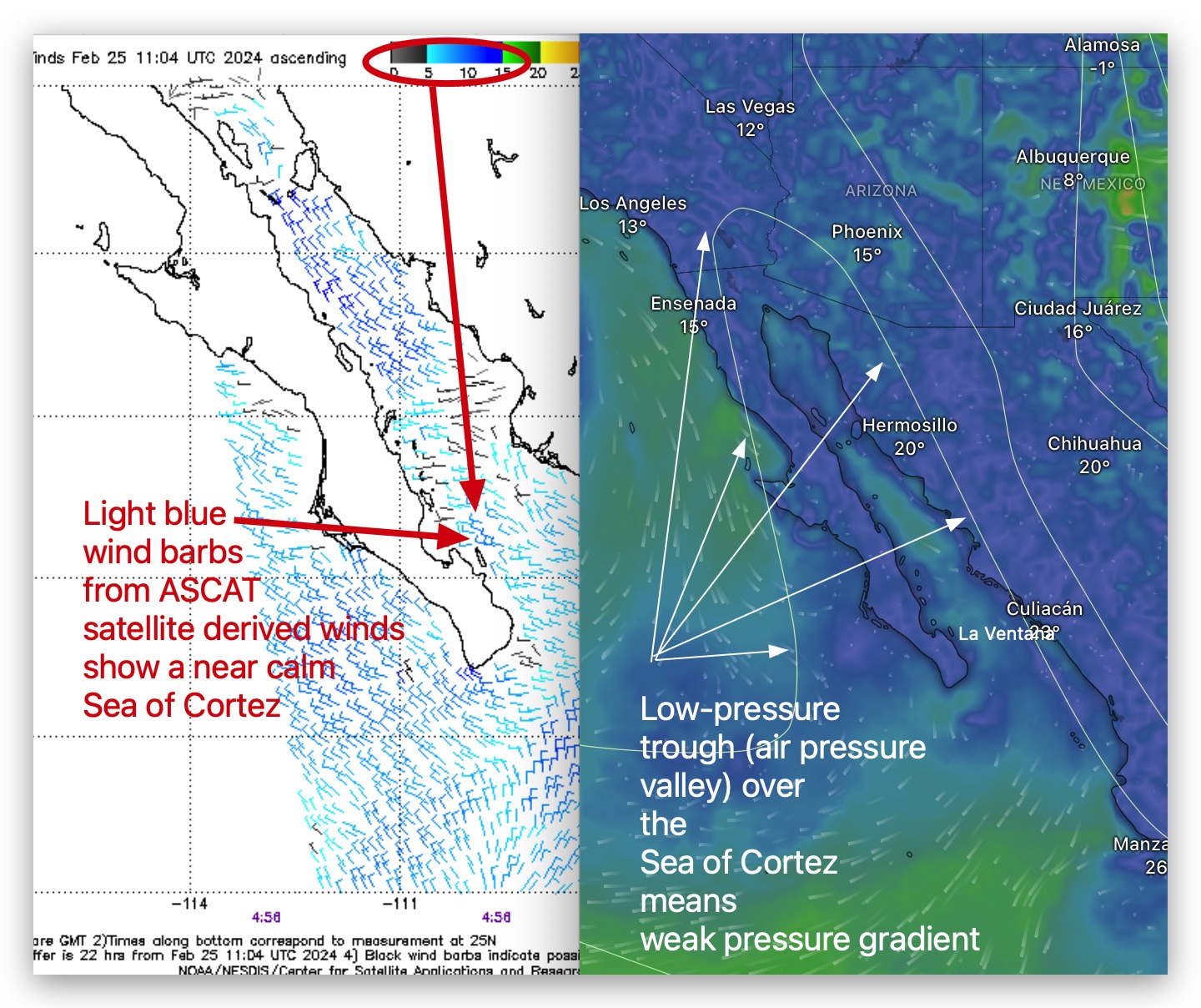
Notice the low-pressure trough in the right side of the image. With low-pressure over almost all of the Sea of Cortez and no low-pressure south of Cabo the large scale pressure gradient is almost nil.
This seems confirmed when you look at the satellite-derived winds of the ASCAT
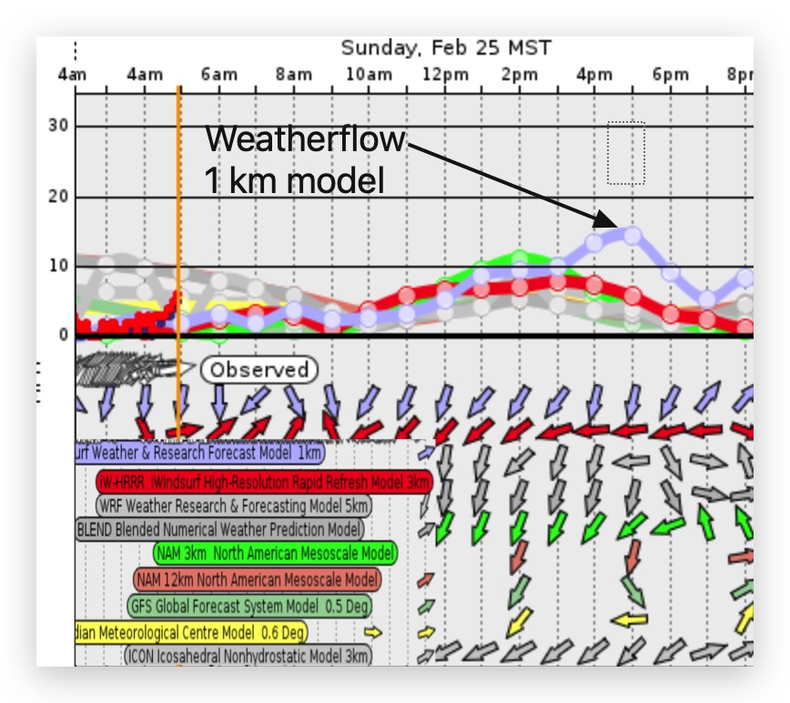
The next graphic shows that ALL of the lower-resolution models only forecast faint winds. So, overall you would guess that that Baja’s East Cape would only see the faintest wind today.
And, you and those models would be right for most of the day. However, take a look at the blue line in the model graphs in the blog representing the Weatherflow super high resolution 1 m model. It suggests that there is a chance that solid Coastal Valley heating will create foil range low to mid-teens winds VERY LATE in the afternoon.