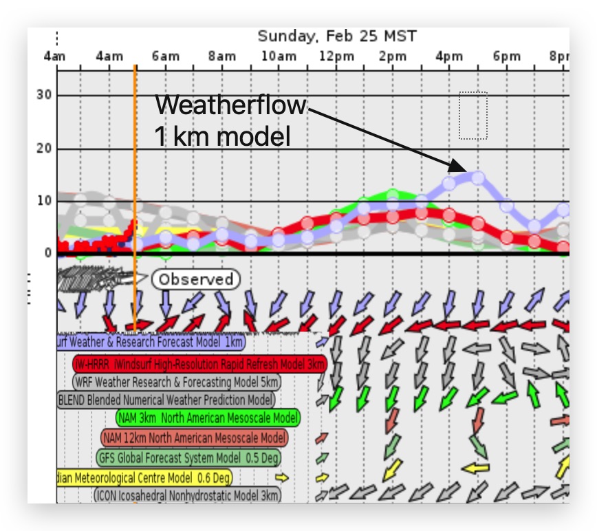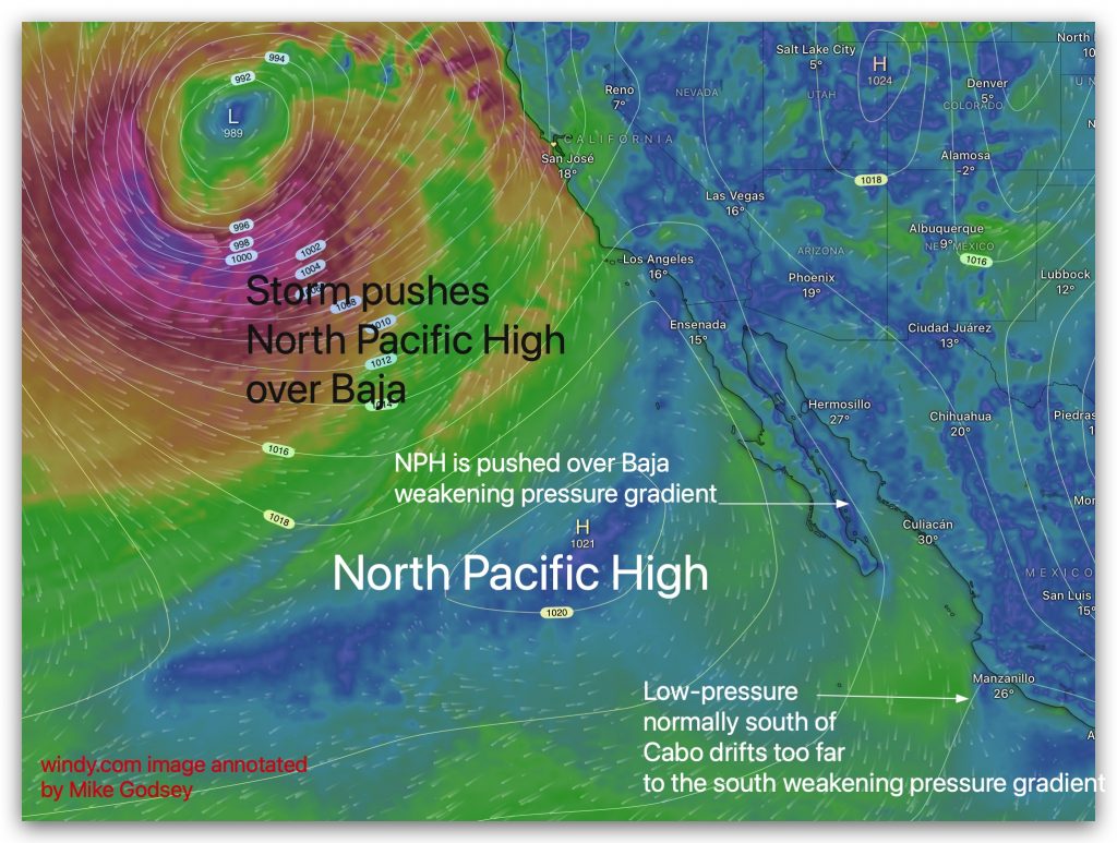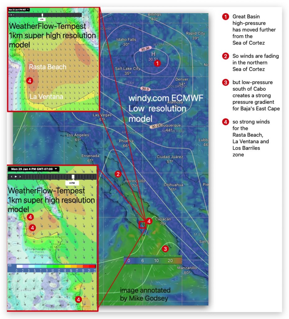
by Mike Godsey Notice the low-pressure trough in the right side of the image. With low-pressure over almost all of the Sea of Cortez and no low-pressure south of Cabo the large scale pressure gradient is almost nil. This seems confirmed when you look at the satellite-derived winds of the ASCAT The next graphic shows…

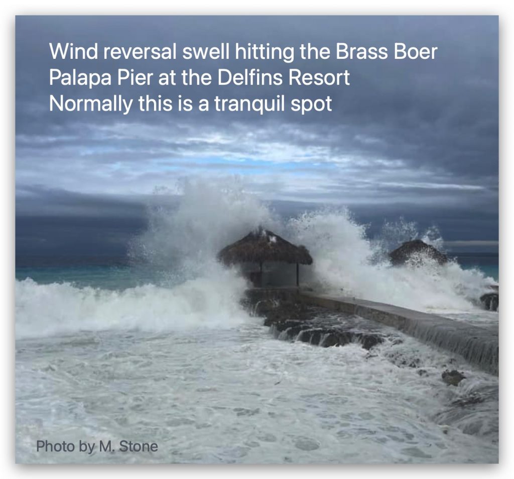
Mike Godsey “A mighty tremor roused us from sleep at 3 pm in the SandDollar Condos. The ground vibrated beneath us, as colossal waves crashed against the shore. It was unmistakable – the reversal had finally come. Feb. 5, 2024” For starters I should mention that mild “Wind Reversals” can be a blessing since, as…

Mild Local Sea Breezes in the low to mid-teens focus in the La Ventana area and weaker and/or less reliable for Los Barriles and Rasta Beach. Most of our wind today comes from blue sky heating in dead-end Los Planes Valley creating a modest local pressure gradient. Rasta Beach, further away from the valley often…

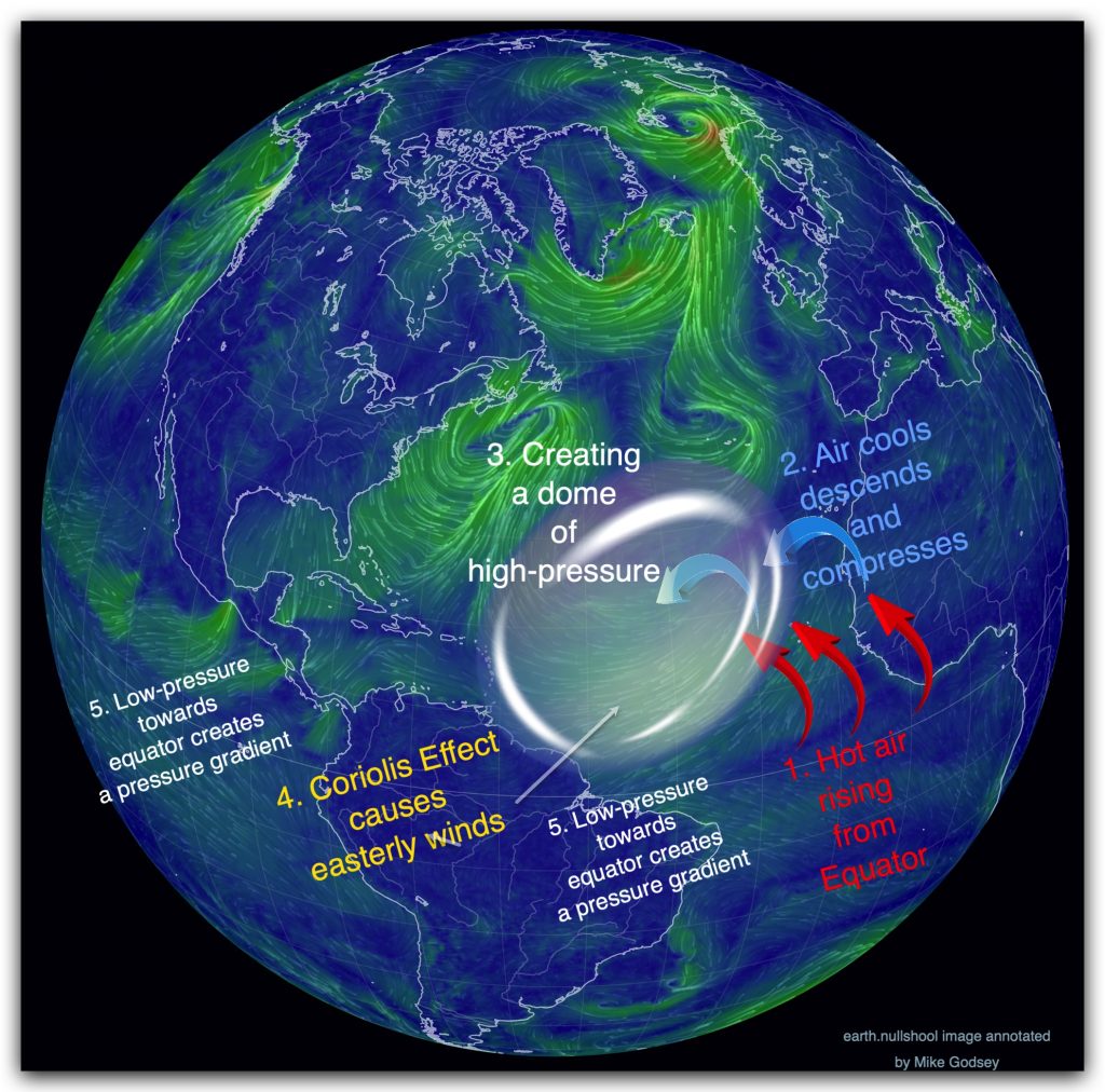
In 1492, Christopher Columbus, driven by his ambition to chart a westward route to Asia, set sail from the Canary Islands with three ships. Relying on the steady easterly trade winds of the North Atlantic high-pressure system, his crew made landfall on October 12th on an island in the Bahamas. Though Columbus believed he had…

Several WeatherFlow-Tempest zoomable Model forecasts for the Caribbean for today can be found here: This first blog will cover some of the basic factors causing the Caribbean Trade winds. In future blogs I will be using the island of Bonaire to illustrate Caribbean wind patterns. Photo by Mike Godsey Today is a somewhat atypical winter day in the…

Today’s Forecast Jargon Decoder: The entire forecast for the current day can be found on iwindsurf.com or kitesurf.com. Decoder blogs are designed to help you visualize what the terms we use in the forecast. Today our long run of moderate El Norte wind continues today for the Rasta Beach, La Ventana and Los Barriles zone….

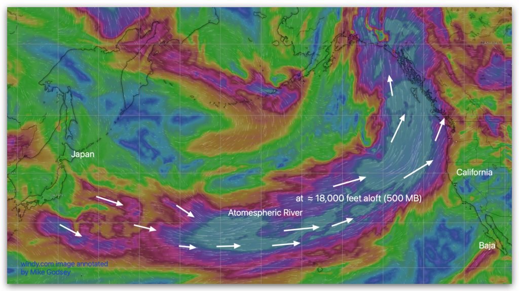
Up at ≈ 18,000 feet aloft (500 MB) a humongous atmospheric river stretches over 10,000 miles from Egypt to near Canada today. You can see this in this modeled imagery of the winds s at ≈ 18,000 feet aloft (500 MB). As this narrow band of strong winds travels across the warm Pacific it picks…
Todays Forecast Decoder: The entire forecast for the current day can be found on iwindsurf.com or kitesurf.com. wx.iwindsurf.com/proforecast/56 The nagging clouds disappear as the North Pacific High and the upper trough move eastward and stop steering clouds our way. Note how the models. had heavy clouds yesterday but much sparser clouds today and almost no…

Back in beach Meteorology 101 you probably learned that wind is created as air moves from high-pressure towards low-pressure. Every sunny day at our beaches you can see and feel this happen as the Coastal Valleys heat and mild winds ramp up. But these local scale winds are much weaker than the strong winds created…

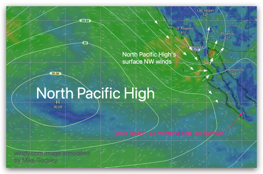
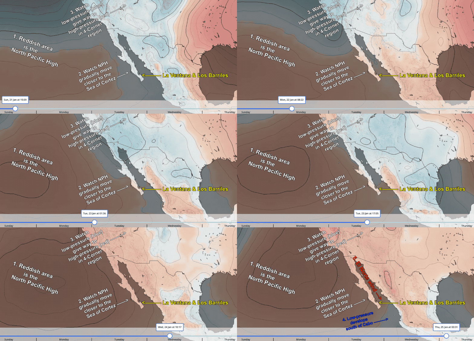
Forecast Decoder: The North Pacific High is slowly gathering its strength west of Baja and the Pacific side sees mid-teens NW wind today. A bit of that wind reaches the Sea of Cortez as NNW wind that barely reaches the sand. The model output suggests cloud coverage all day but in the satellite imagery, I…
