Several WeatherFlow-Tempest zoomable Model forecasts for the Caribbean for today can be found here:
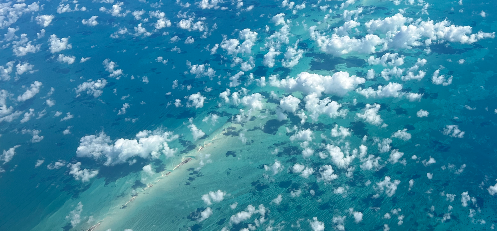
This first blog will cover some of the basic factors causing the Caribbean Trade winds. In future blogs I will be using the island of Bonaire to illustrate Caribbean wind patterns. Photo by Mike Godsey
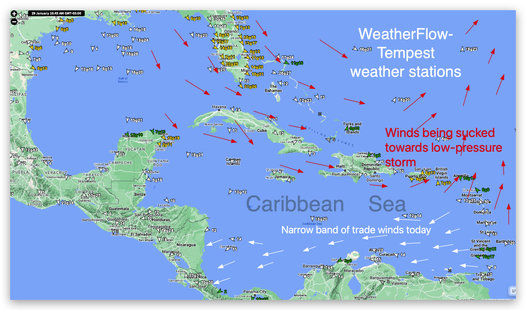
Today is a somewhat atypical winter day in the Caribbean wind wise.
In this first graphic notice the narrow band of white arrows and our WeatherFlow-Tempest weather stations real-time wind velocities.
Our WeatherFlow-Tempest sensors in this area show easterly Trade Winds.
If you would like your area covered in future blogs or if you have questions mail me at mgodseywf at g mail .com
But sensors just north of that zone the trades winds give way to winds from the NNW to SSW. This is due to the presence of a deep low-pressure storm system east of the USA hence the trade winds belt is narrow today.
But all this gives you a hint why the ABC islands including Bonaire have such reliable winter Trade Winds since storms to the north are common in winter.
This Blog series will focus will be on these easterly Trade winds.
One major factor in the Caribbean Trade winds is the North Atlantic High-pressure system also known as the Bermuda High or the Azores/Bermuda High . This high-pressure system is infamous for its role in steering hurricanes across the Atlantic towards the Caribbean and the USA. However, its role in creating the Trade Winds is much more benign.
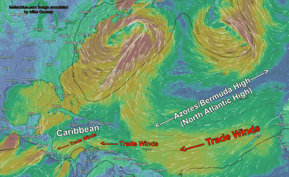
In this animation you can see the North Atlantic high-pressure as an oval area with winds spiraling outwards from it in a clockwise fashion. The winds on the southern flank of the North Atlantic high-pressure are extremely reliable winds so in the days of sailing ships carrying trade cargo or slaves from Africa would ride these winds to the new world. Hence the moniker “Trade Winds”
The bulk of the winds you will experience on a Caribbean vacation come from this North Atlantic high-pressure.
Our main topic today is how the North Atlantic high-pressure is created. Here are the basic steps.
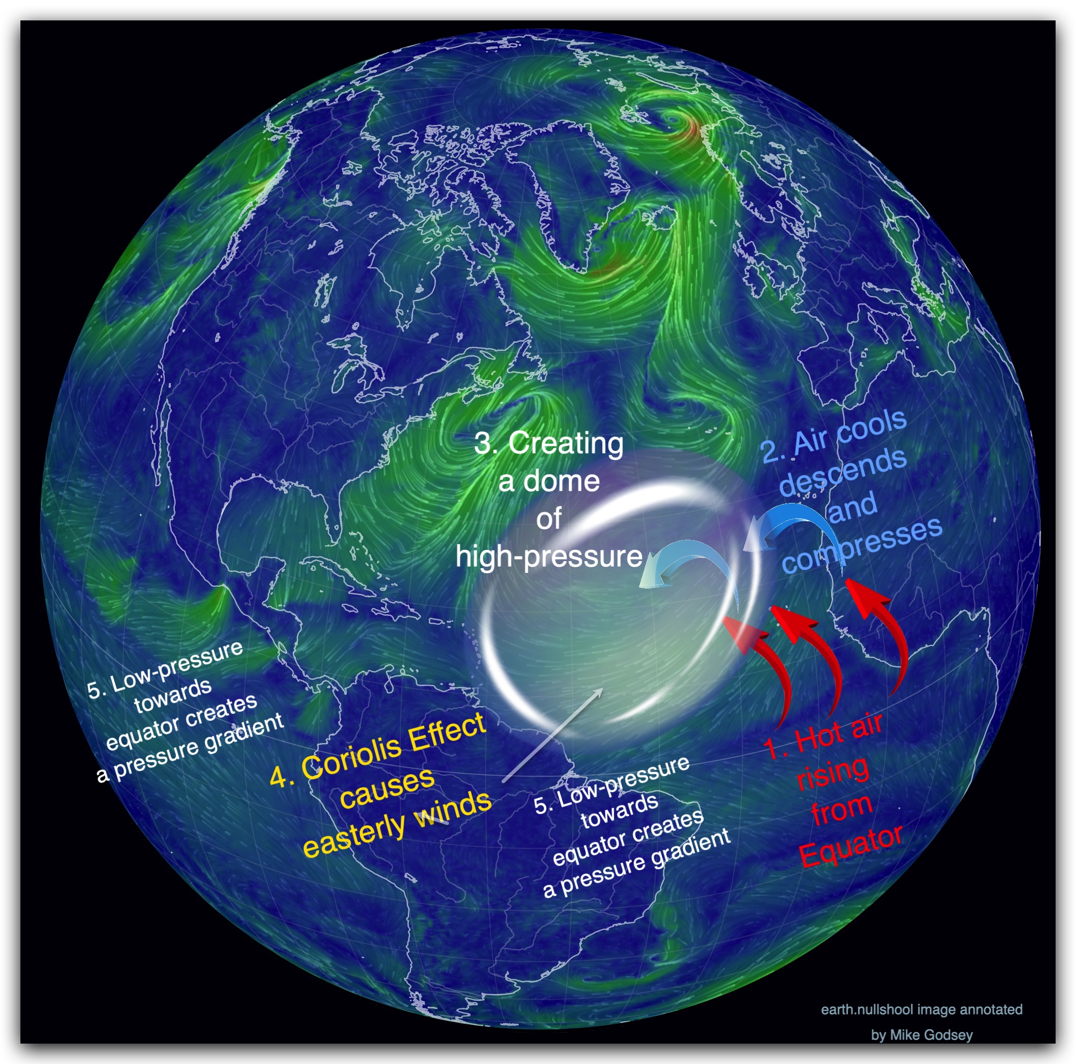
1. Hot air rises: Our story begins with the Sun, relentlessly pouring energy onto the tropical regions around the equator. This intense heating warms the air, causing it to rise and expand, creating an area of low pressure at the equator.
2. Cool Air descends: As the air rises, it cools and eventually sinks to the surface around 30 degrees north and south of the equator. This sinking air creates areas of high pressure known as the subtropical highs.
The North Atlantic High is one such prominent high-pressure system. If you live on the USA’s west coast you may have heard of the North Pacific High that delivers Trade Winds to Hawaii and northerly wind to the west coast of the USA.
3. Descending air reaches surface creating high-pressure: As air descends into these high-pressure areas a dome of high-pressure is formed.
Now, if you are a Flat Earther and believe the world is a stationery flat plane then this high-pressure air would flow straight out from the center of the high-pressure in all directions. But since the world is a globe and spins something curious happens.
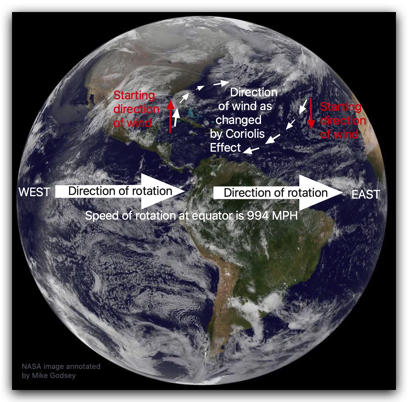
4. The Coriolis Effect adds a sting: The Earth’s rotation adds a crucial twist to the story. As the rising
air from the equator travels towards the poles, it gets deflected by the Coriolis effect.
This deflection makes the winds aloft blow eastward in both hemispheres (to the right in the Northern Hemisphere). It also causes the winds curve as they spiral outwards from the high-pressure area.
So on the northern edge of the North Atlantic high-pressure there are NW winds and on the southern edge, near the Caribbean, there are easterly winds.
5. Pressure Gradient accelerates winds: As air spirals out of the southern border of the North Atlantic
High it accelerates towards the low pressure at the equator following the pressure gradient, driving the trade winds westward across the Atlantic Ocean and over the Caribbean Sea.
So from this simplified explanation we will delve deep into Caribbean winds.
Future blogs in this series will talk about:
- Seasonal variations in the Trade Winds
- The first humans to use the Caribbean Trade Winds.
- The Trade Winds and island climates
- Island topography and Trade Wind strength
- Ocean currents and topography
- Local currents and wind direction and strength.
- Street clouds and Trade winds.
- Hurricane paths and the Caribbean trade winds
- Gulf of Tehuantepec gale force winds and the Caribbean Trade Winds
- Why the trade winds often blow all night.
- Why Bonaire is a windsurfing, kiteboarding and winging mecca.
- Why Lac Bay on and Atlantis Beach on Bonaire are special.
- What shapes the Bonaire water currents that impact SCUBA divers.
- Where does all that air from the Trade Winds go?
Recent Blogs:
- Different clouds this morning in the Pac NW
- Why is Rufus so Fickle?
- Elementor #34618
- Crazy wind switch at Sherman Island
- What is Zonal Flow?