Up at ≈ 18,000 feet aloft (500 MB) a
humongous atmospheric river stretches over 10,000 miles from Egypt to near Canada today.
You can see this in this modeled imagery of the winds s at ≈ 18,000 feet aloft (500 MB). As this narrow band of strong winds travels across the warm Pacific it picks up vast amounts of water vapor. When it encounters cold air from more northerly storm systems this water vapor condenses into rain droplets that produce heavy rain at the surface.
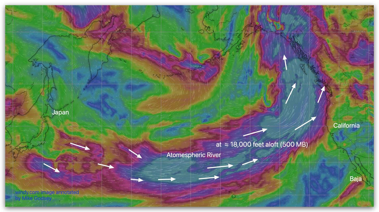
Likewise, when the surface winds below these upper level winds hit the Coast Range and inland mountains the water vapor condenses forming rain and at higher elevations, snow.
Why should wind addicts on Baja’s East Cape care about this distant event? The rainy storm systems associated with this event begin to sloooowly shove our 4-Corners region wind machine eastward so our El Norte winds fade Tuesday and especially Wednesday.