The La Ventana & Los Barriles launch site wind forecast for the current day can be found on iwindsurf.com or kitesurf.com. The wind pattern starts changing today. Unless the change is slower than expected we only see mild winds that hit the foil range. This imagery shows the topics discussed in todays forecast. Note: Our ikitesurf.com…
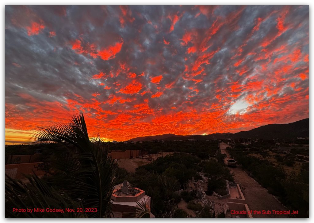
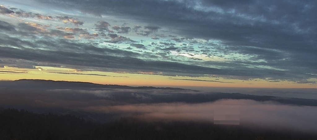
The tiny village of La Ventana is known for its amazing Sea of Cortez sunrises framed between Isla Ceralvo and Punta Arena. But usually, the sunsets behind the mountains pale in comparison. But last night this “evil beauty” sunset appeared. The winter weather in southern Baja is supposed to be endless blue skies and calm…
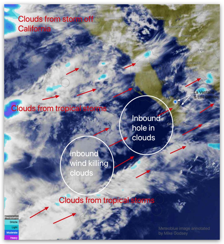
The La Ventana & Los Barriles launch site wind forecast for the current day can be found on iwindsurf.com or kitesurf.com. Let’s talk clouds. If you are in the La Ventana area, first notice the thin line of puffy LOW clouds streaming over Isla Ceralvo (AKA Isla Jacques Cousteau). These clouds are good news since…
The entire forecast for the current day can be found on iwindsurf.com or kitesurf.com. Unless one of the inbound cloud masses blocks valley heating, we see solid winds strongest at the La Ventana campground and Los Barriles. There is high-pressure in the 4-Corners region of the USA, but the overall pressure gradient near the Sea…
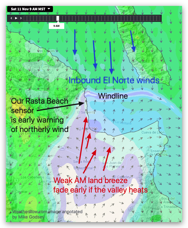
Forecasts are great but it is always nice to have empirical confirmation of when the forecast winds will begin to build at the beaches. That is one reason we installed one of our Tempest sensors at the Kitesurfing Planet shop and restaurant at Rasta Beach north El Sargento. In this first image you can see…
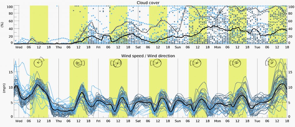
Watch the ebb or flow of ephemeral fog at the Golden Gate or the rapid movements of puffball cumulus clouds during a summer day, and you quickly realize that forecasting cloud coverage is often a crap shoot. Clouds form and evaporate with random temperature changes, elevation changes, relative humidity, vertical movement, aerosols. Etc. But supercomputer…

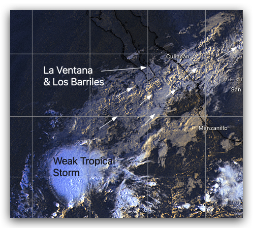
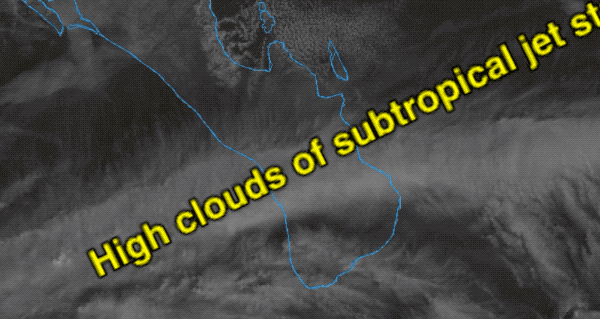
As you can see in the blog imagery, a weak tropical storm about 700 miles SW of Cabo Wabo is pumping clouds into a weak sub-tropical jetstream, which is sending clouds over a glassy Sea of Cortez. The Multimodel Ensemble Forecast (geekspeak for the consensus of 13 models) suggests about 50% coverage today, which jibes…
If you are an ikitesurf.com or iwindsurf.com subscriber, you can use this link for the actual launch sites forecast: San Francisco Bay Area 3x daily forecast. Note: The phrases in bold below are in the forecast imagery. The bands of clouds overhead will thicken as a rainy cold front 200 miles west of the Golden Gate moves…
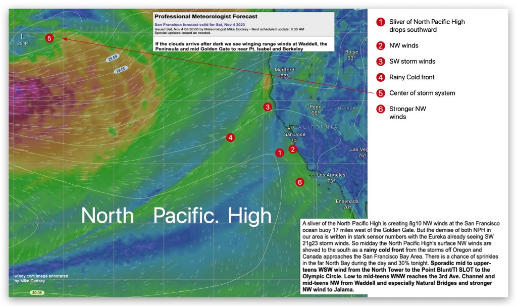
If you are an ikitesurf.com or iwindsurf.com subscriber, you can use this link for the actual launch sites forecast: San Francisco Bay Area 3x daily forecast. Today, a sliver of the North Pacific High is creating 8g10 NW winds at the San Francisco ocean buoy 17 miles west of the Golden Gate. But the demise…
The 2023 El Niño emerged in June 2023 and is expected to persist through the winter of 2023-2024 and there is a 75-85% chance that it will peak as a strong El Niño event this winter. Remember, the impact of El Niño on our winter wind will be episodic. There will be many periods when…