Southern California and San Francisco wingers, kiters and windsurfers know the spring time drill.
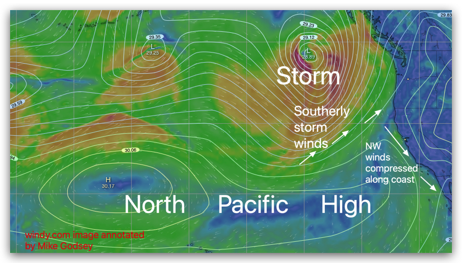
As storms rainy southerly winds depart we see strong NW wind from the North Pacific High.
Of course it is fall now but nothing is suprising
weatherwise these days.
But what is really different is that todays NW winds for the Bay Area and Southern California occur BEFORE the storm.
Even stranger is that rather than having a storm yesterday we had a heat wave and very light wind.
These images blog show how
these pre-storm NW winds develop.
In the first image find the huge North Pacific High and note that it has a weak ridge extending near California. By itself this would only make low-teens winds.
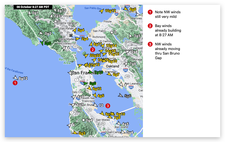
But looking at the San Francisco winds around 8:30 AM notice we are seeing winds gusting into the upper-teensor higher at few sites.
While the San Francisco ocean buoy is only reading 8g12!
How can such weak NW ocean wind produce such strong wind inside the Bay so early?
Look at this third image note the low-pressure over the Sierra and part of the Central Valley.
Yesterday that low-pressure was over San Francisco and even the ocean making for a weak pressure gradient over the Bay.
Now with that pressure gradient over the Central Valley it is creating winds inside the Bay even in the early morning.
Lets look at this pressure gradient more closely and notice
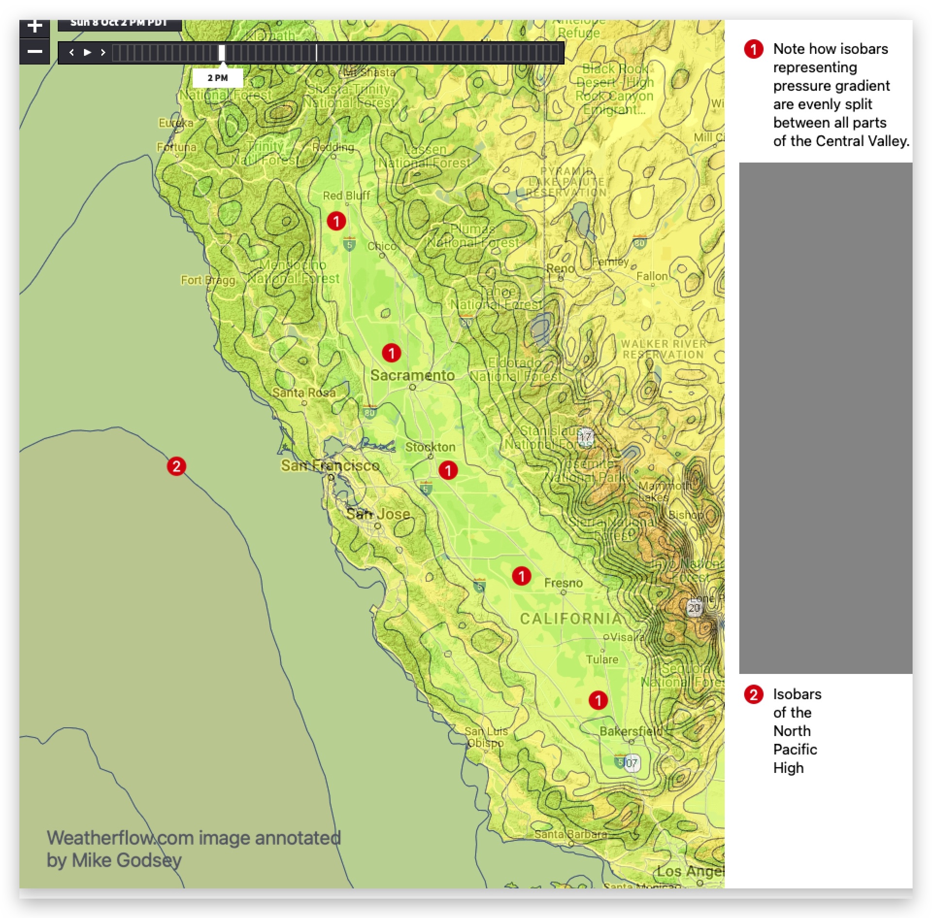
the distribution of the isobars.
Notice how the low-pressure extends from Redding to Sacramento, Stockton and towards Bakersfield.
This means this afternoon as the gradient pulls the mild NW wind into the Bay the wind curves towards that wide spread pressure gradient.

This means almost every launch site in the Bay Area. And if you are a yachtsman you can sail almost everywhere in San Francisco Bay and find solid wind.
But there is more to this story.
Those NW ocean winds will be ramping up this afternoon.
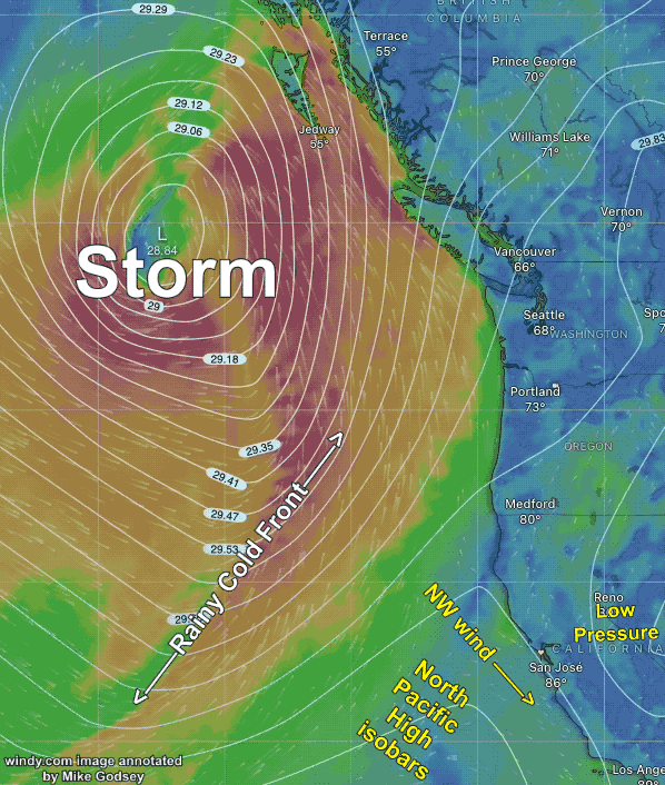
Going back to the animation image notice the rainy cold front.
As it moves towards the California coast it compacts the NW ocean winds increasing their velocity.
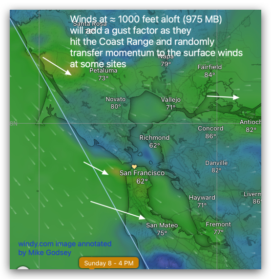
Plus, as this last image shows, it also pushes the NW winds ≈ 1000 feet aloft (975 MB) over parts of the Bay Area adding a up and down factor.