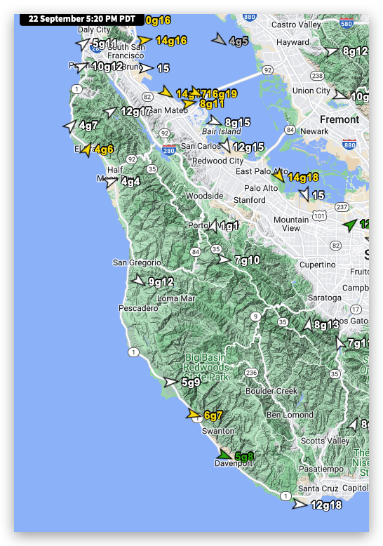
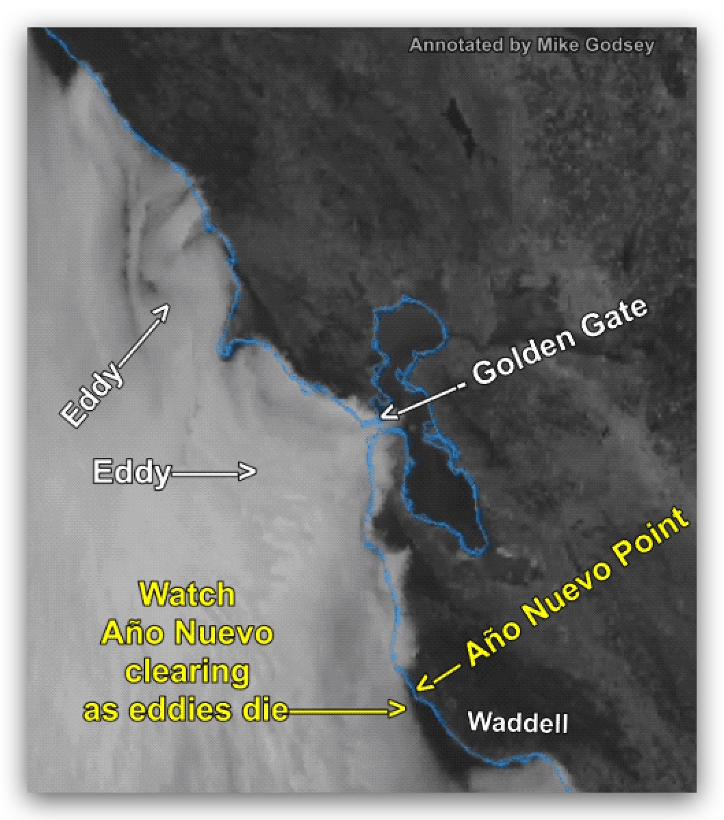
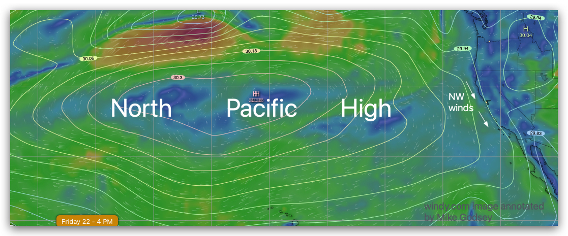
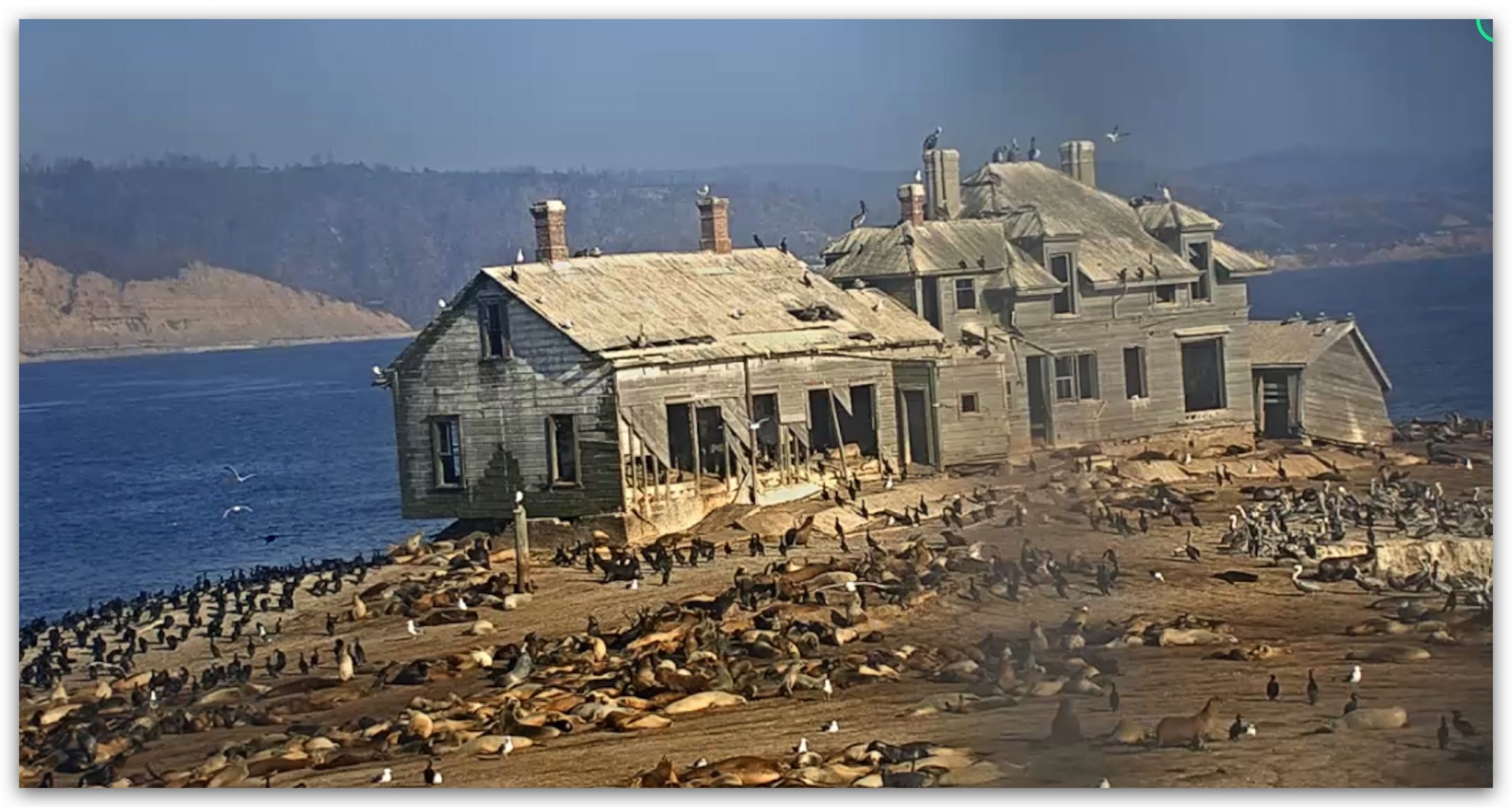
For a month Northern California has had atypical eddy or low-pressure southerly weak winds and a foggy coast. Yesterday, Sept 22, a bit of NW winds created Año Nuevo clearing as you can see in this cam image from yesterday. This abandoned house is actually on Año Nuevo Island just yards from the point. Año Nuevo Park is the point just north of Waddell (yellow sensor reading 6g7) where Highway 1 briefly moves inland along the coast and where the sensor reading is 5g9. When there is Año Nuevo clearing and strong enough NW winds, we get a phenomenon called supercritical flow, which jacks up the beach winds in the zone downwind of a point. Yesterday, the NW winds were too weak to cause this phenomenon. That is why the winds are stronger at Natural Bridges than Waddell as the pressure gradient towards Pacheco Pass and Stockton work their magic.This is what Año Nuevo clearing looks like in the satellite imagery.So, where did this bit of NW winds come from? Notice the huge North Pacific High that spans the Pacific. Note how tight its isobars are near Hawaii so there were strong trade winds there yesterday. Then check out how far apart the North Pacific High’s isobars were near San Francisco. This and a weak pressure gradient towards Stockton created those mild NW winds at Waddell. Today, Sept. 23 a huge storm will push the North Pacific High southward and the next several days will see rain, especially from the North Bay to Oregon. Then get ready for NW clearing winds on the California coast midweek as some of the might of that huge North Pacific High impacts our coast.