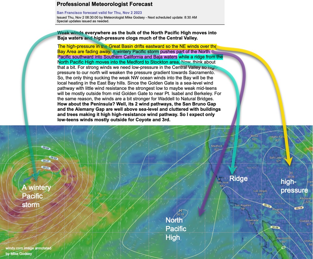
It is hard to describe complex weather patterns without using some jargon. Here is a jargon Decoder for today’s forecast. While it does not explain everything it at least gives you a visual of what these parts of the wind machine look like today. Weak winds everywhere as the bulk of the North Pacific High…
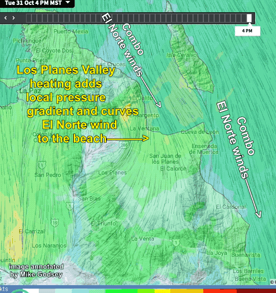
Have you ever wondered why Baja’s Sea of Cortez only has weak southerly winds in the Summer while the rest of North America is having its peak kiting, winging and windsurfing season? And why does the Sea of Cortez have its strongest winds in the winter when the rest of North America only has sporadic…
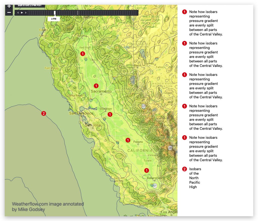
Today, both Southern California and the San Francisco Bay Area had sites with unusually strong winds for mid-October. This was due to part of the North Pacific High being unusually far north for this time of year. Plus early season wintery storms have been pushing a ridge from the NPH close to the California coast….
Southern California and San Francisco wingers, kiters and windsurfers know the spring time drill. As storms rainy southerly winds depart we see strong NW wind from the North Pacific High. Of course it is fall now but nothing is suprising weatherwise these days. But what is really different is that todays NW winds for the…
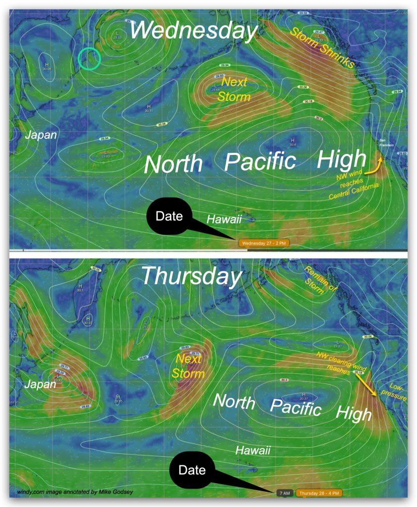
So you all know the spring ti me routine. In April through mid-May many storms are followed by clearing and then NW winds. These fabled NW winds clearing winds are accelerated by low-pressure that develops inland in the wake of a passing storm. As Global Weirding progresses we are sometimes seeing NW clearing winds at…
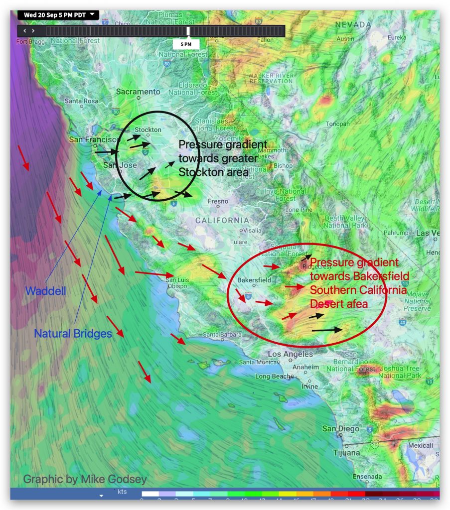
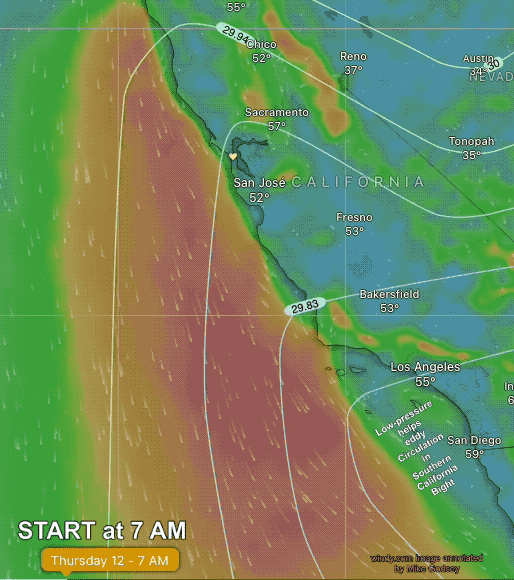
From xxxxxxxxxxxx@sbcglobal.net “Mike said the gradient to Stockton would affect Natural Bridges and then the gradient to Bakersfield would affect Waddell. How is that? I would think either gradient would affect either one almost equally.“ Hi XXXXXXX, Thanks for the Feedback! As you can imagine, condensing complex wind flow patterns into mere words in a forecast…

Sure it was Sept. 2 which is around when the San Francisco, Southern California and Gorge winds BEGIN to fade but we rarely see zero to faint winds for the entire West Coast this early in the fall. Take a look at these forecasts! Reading the forecasts you notice 2 things in common. They all…
My 7:30 AM forecast had good winds forecast for Pt. Isabel and good but WEST winds in the 3rd Ave. Channel and crappy winds for the 3rd. Ave. launch site winds. And there was a decent chance of brief Anita Rock winds close to Crissy Field. Then, around 11 AM, I issued this update because…