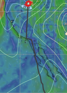
Hurricane Hilary had a very atypical trajectory and strength as it neared Baja Norte and Southern California waters.
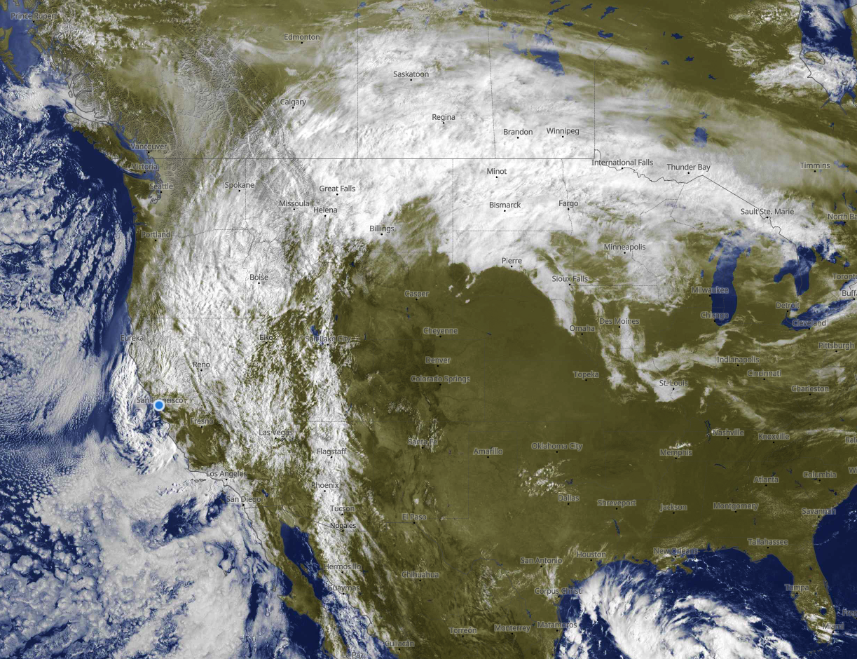
And today, August 21, moisture from Hilary is high in the atmosphere spreading clouds over large parts of California, Oregon, Washington, Idaho, Montana, North Dakota, South Dakota, Minnesota, Wisconsin and Michigan.
Hilary’s rain set all-time records for many locations and caused widespread flooding.
So the obvious question is…what led this Cat. 4 hurricane and its remains to take such an uncommon trajectory?
This blog covers some major factors involved in creating Hilary and its pathway. It is important to note that these are just some of the factors that may have contributed to the steering of Hurricane Hilary over California.
The exact role of each factor is still being investigated by meteorologists.
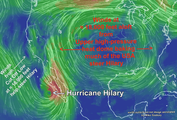
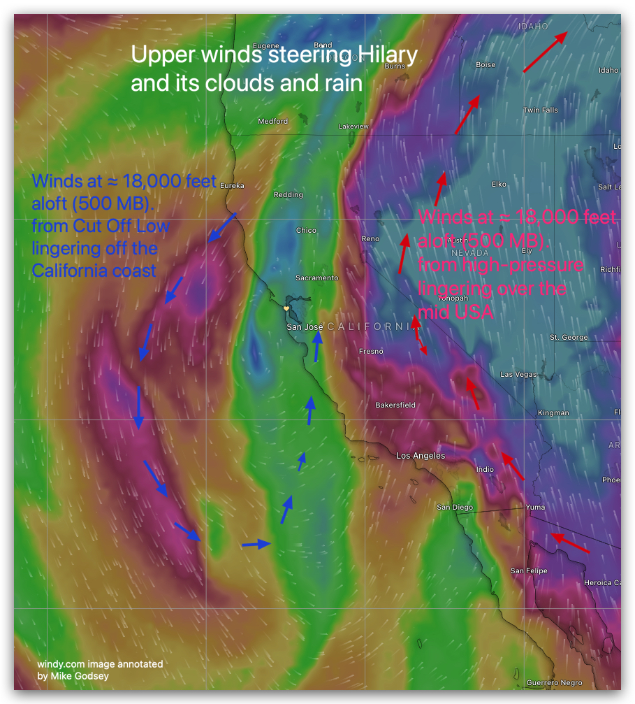
Upper high-pressure & southerly winds: There has been a lingering upper high pressure over the central United States with its clockwise strong southerly flow at ≈ 18,000 feet aloft (500 MB) over the California/Nevada border as Hilary moved up the coast of Baja.
In the case of Hurricane Hilary, this southerly flow helped to steer the storm over California.
In the first image, you can see this upper high-pressure over the USA. Notice its southerly winds over the California/Nevada border.
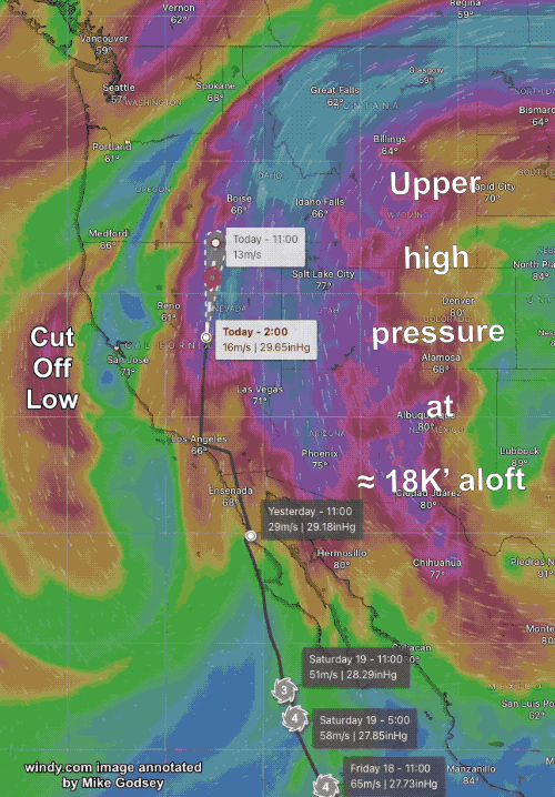
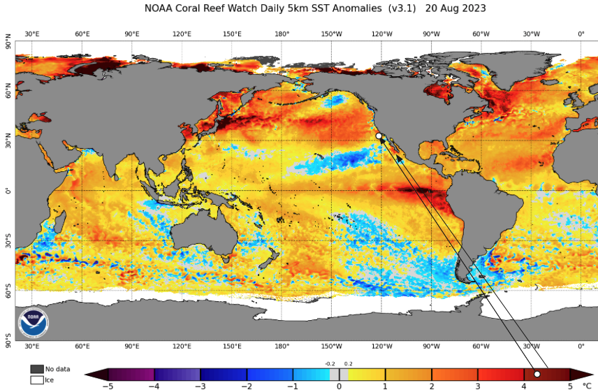
Upper low-pressure & southerly winds: A Cut Off Low, also at about 500 MB, has been lingering off the west coast of California for over a week.
The second image shows the position of the Cut Off Low today, August 21.
During the last week, the Cut Off Low has enhanced the San Francisco Bay Area marine layer depth at the surface while its counter-clockwise southerly flow has sometimes fueled a surface eddy near San Francisco. This upper low may have
provided moisture and kept air rising in the storm’s core, helping strengthen Hilary. What seems clear is the Cut Off Lows southerly winds at ≈ 18,000 feet helped steer Hilary northward on its course over California.
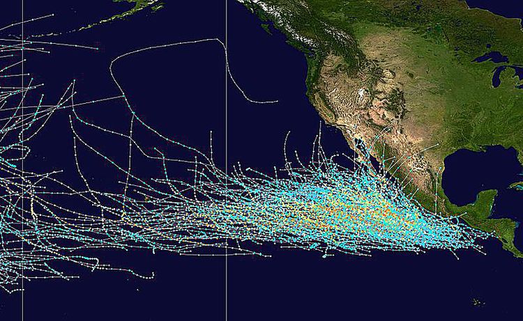
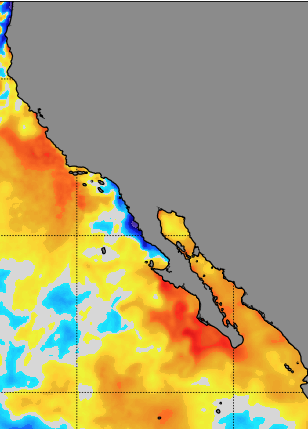
Warm ocean waters: The ocean waters off the coast of California are typically cooler than the waters in the Gulf of Mexico, where most hurricanes form.
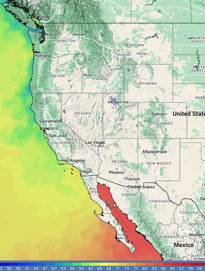
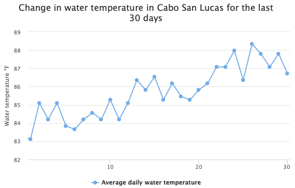
However, the ocean waters off the Baja Norte and Baja Sur coast were unusually warm this summer, with the waters near Cabo San Lucas reaching 88 degrees.
Likewise, the waters off California were unusually warm this year, which provided the energy that Hurricane Hilary needed to maintain its strength.
El Niño is a climate pattern that causes the tropical Pacific Ocean to warm up. This warming of the ocean waters can lead to more intense storms,
including hurricanes. Hurricane Hilary formed in the Eastern Pacific Ocean, which is typically more active
during El Niño years. The storm also formed over very warm water temperatures, which helped it to intensify.
Atmospheric subsidence: Atmospheric subsidence is a downward flow of air that can help to weaken storms. In the case of Hurricane Hilary, atmospheric subsidence was not as strong as usual this year, which allowed the storm to maintain its strength.
Climate change: Although you can not prove a causal link between specific weather events and Climate Change, you can determine if the likelihood of previously improbable weather events is increasing and correlated with climate variables known to be changing.
The Earth’s atmosphere is warming, leading to warmer ocean temperatures.
This warming of the ocean waters is a known factor making it easier for hurricanes to form and intensify.
The trajectory of Hilary and its strength as it neared California was a very improbable event.
But such an improbable event did occur in 1939 with far more tragic results. So it is hard to draw a clear causal link just from Hilary. But as such improbable events become more common, the link looks more likely.