Have you noticed that the wind and weather patterns seem to be getting more extreme?
This Sunday, August 20, most models are forecasting weather events that are quite unusual.
How unusual?
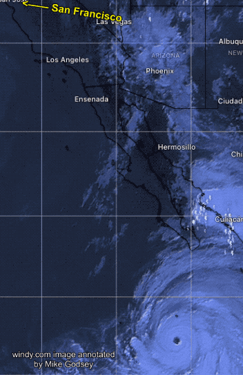
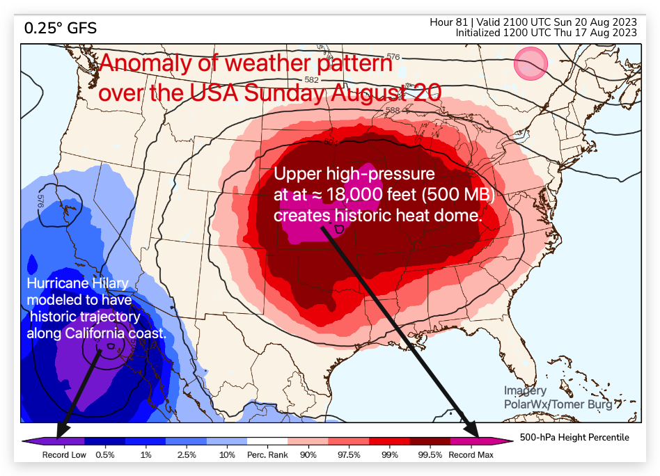
Well, compared to historical data, the modeled trajectory of hurricane Hilary’s remains, as it dies, carries it right up the California coast past Southern California, which would be a record low-pressure anomaly event.
And if the remains of Hilary follow the modeled trajectory just inland from San Francisco it would be ≈ a 1- 2.5% low-pressure anomaly.
All this could bring heavy rain to parts of Southern California and thunderstorms to the Bay Area. With the dry conditions in California, lightning and wildfires are a real issue with this event.
This type of event has not happened to California for 84 years when the remains of a hurricane, nicknamed El Cordonazo or The Lash of St. Francis, hit the greater Long Beach in September 1939,
drenching the region and knocking out power. The storm killed over 45 people on land and more at sea.
Meanwhile, much of the eastern USA sees a huge heat dome modeled as a 99.5% to record anomaly high-pressure heat dome.
Of course, all this could just be a coincidence.
Or perhaps coincidences are becoming more common, or maybe some of us are getting better at ignoring them.