In many places in the San Francisco Bay Area, wind forecasting is difficult. But the most frustrating place for meteorologists and customers is the winds between the San Mateo Bridge channel and the shoreline near the 3rd. Ave. shoreline.
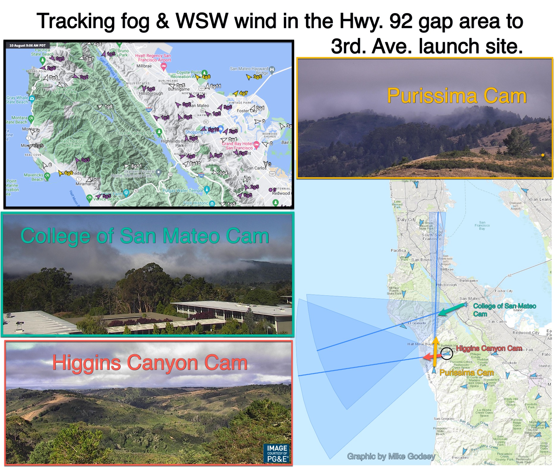
Windsurfers, kiters, wingers and kayakers call this area the zone between the 3rd. Ave. launch sites and the 3rd. Ave. Channel. This blog shows some of the tools we use in trying to forecast the launch sites winds in this zone.
This entire zone has strong winds when the ocean winds are NW and the max pressure gradient to the Central Valley is towards Bakersfield via the San Luis Reservoir’s Pacheco Pass. This pattern is most common in the late spring to early summer and causes the ocean winds to accelerate through the San Bruno Gap and over the zone between the 3rd. Ave. launch sites and the 3rd. Ave. Channel.
Unfortunately, as the northern Central Valley heats up, the max pressure gradient is often towards Sacramento and or Stockton. This pressure gradient does 3 things:
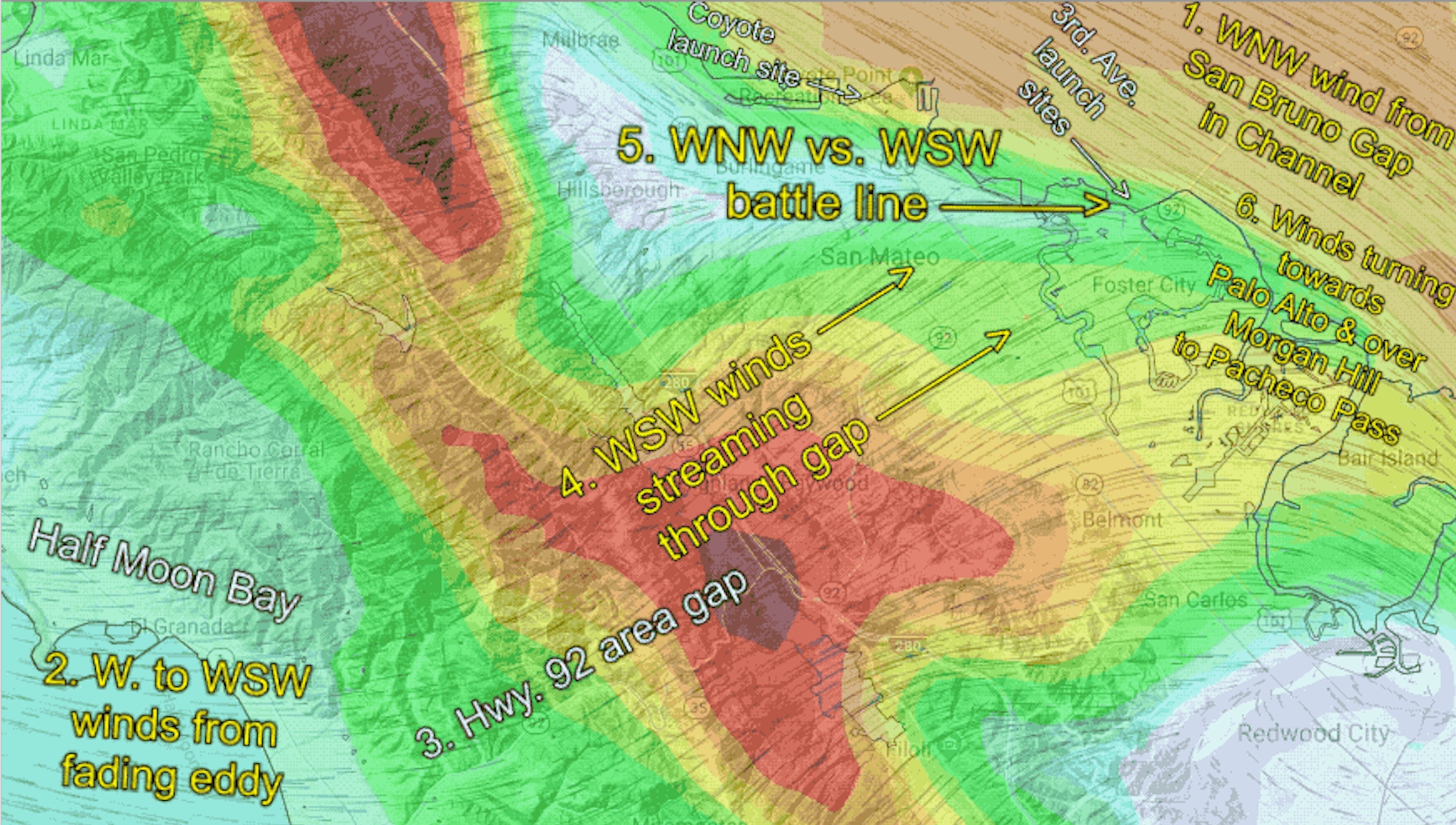
- It sucks the wind coming through the San Bruno Gap so it curves away from the 3rd. Ave. launch sites and more towards Hayward. This means the 3rd. Ave. channel has strong wind, but the launch site winds are weaker or less reliable.
- The pressure gradient towards Sacramento and Stockton also sucks fog and wind from Half Moon Bay, so there is WSW flow from the Hwy. 92 gap area to near the 3rd. Ave. launch sites.
- This creates a battleline between the WNW wind from the San Bruno Gap and the WSW from the WSW flow from the Hwy. 92 gap area. And this battleline moves back and forth during the afternoon as variables like the marine layer depth and southerly eddy flow fluctuate.
This graphic shows some of the tools Weatherflow forecasters use to make sense of all these changing variables and issue a useful forecast.