The San Francisco Bay Area winds are much more complex than Southern California or The Gorge. In the Gorge, the ocean winds sweep through a single gap in the Coast Range, following a single pressure gradient to the Columbia Basin. While Southern California ocean winds mostly blow along the coast or sweep over flat coastal plains towards an inland pressure gradient.
The San Francisco winds have to curve through over a dozen coastal gaps in the Coast Range and then follow circuitous pathways through several gaps in the East Bay hills.
Worse, there is not a single pressure gradient attracting these winds.
The pressure gradient towards Sacramento curves some the ocean wind towards the North Tower to Point Blunt to Pt. Isabel.
The gradient towards Stockton curves some part of that wind towards Treasure Island, Berkeley, Alameda and Candlestick.
While the gradient towards Bakersfield sucks winds towards the Crissy beach, 3rd. Ave. launch sites, and Palo Alto.
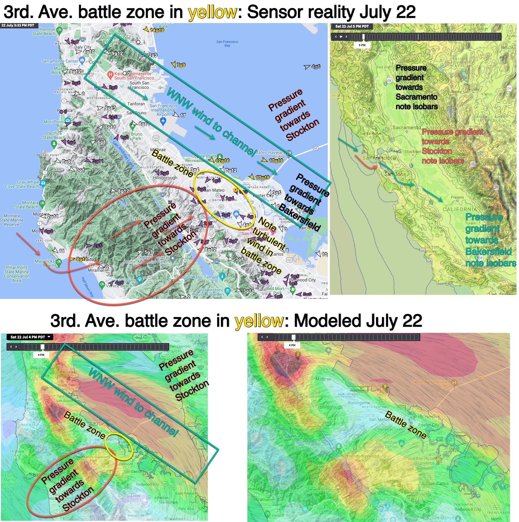
But in reality, all of these pressure gradients are working together, literally pulling the wind different directions so the flow often splits as it flows towards different gaps and towards multiple pressure gradients.
Crissy, Pt. Isabel and the 3rd. Ave. launch site winds often fall victim to this reality.
This visual blog tells part of this story for the 3rd. Ave. launch site winds.