If you are an ikitesurf.com or iwindsurf.com subscriber, you can use this link for the actual launch sites forecast: San Francisco Bay Area 3x daily forecast. Note: The phrases in bold below are in the forecast imagery. The bands of clouds overhead will thicken as a rainy cold front 200 miles west of the Golden Gate moves…
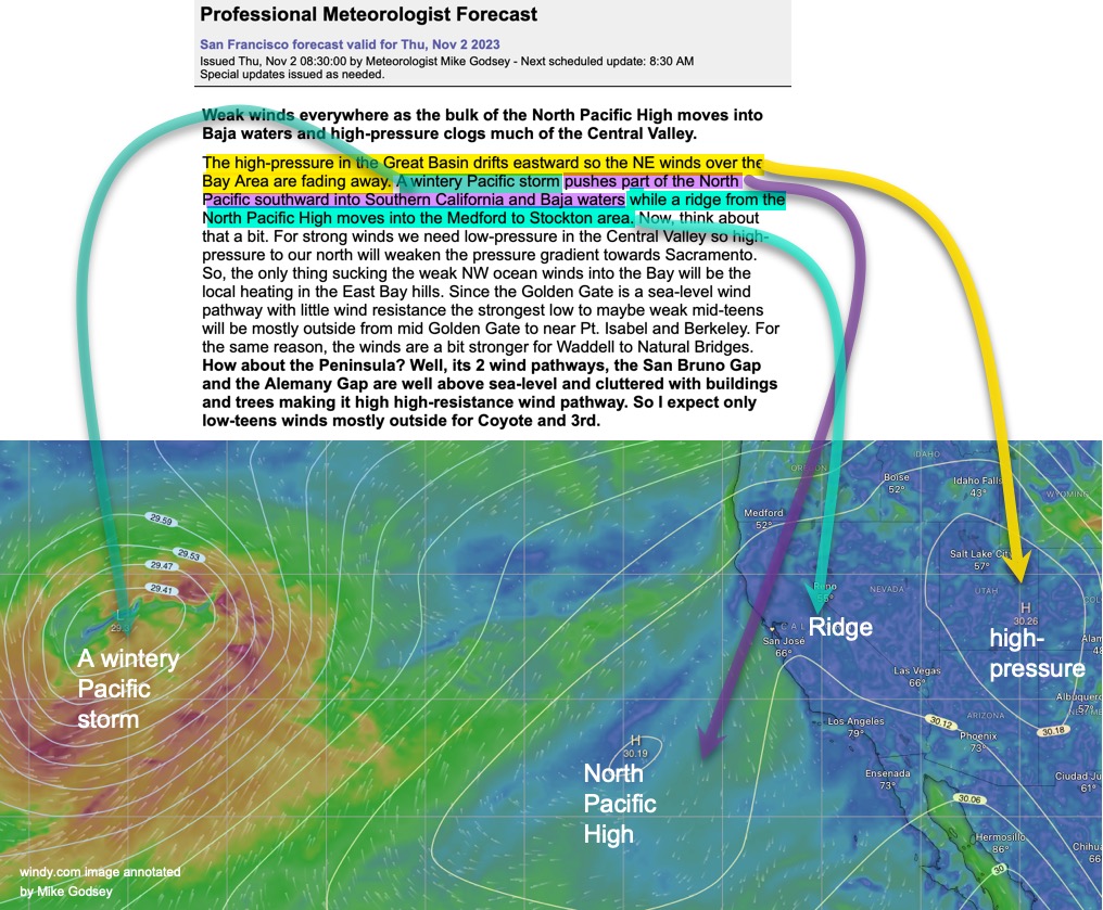
It is hard to describe complex weather patterns without using some jargon. Here is a jargon Decoder for today’s forecast. While it does not explain everything it at least gives you a visual of what these parts of the wind machine look like today. Weak winds everywhere as the bulk of the North Pacific High…
Hurricane Hilary had a very atypical trajectory and strength as it neared Baja Norte and Southern California waters. And today, August 21, moisture from Hilary is high in the atmosphere spreading clouds over large parts of California, Oregon, Washington, Idaho, Montana, North Dakota, South Dakota, Minnesota, Wisconsin and Michigan. Hilary’s rain set all-time records for…
Forecasting wind for the San Francisco Bay Area is extremely tricky compared to the Southern California, Baja or The Gorge. All those sites usually have inbound wind coming from the coast heading inland and typically from one direction. The Bay Area can have NW or W or SW or SSW ocean winds. Plus it has…
The North Pacific High was very active in Baja waters this spring but has provided scant strong NW winds for the Northern California coast this spring in March. This week a rapidly enlarging North Pacific High has formed north of Hawaii and will bring strong NW winds to the San Francisco Bay Area and the…
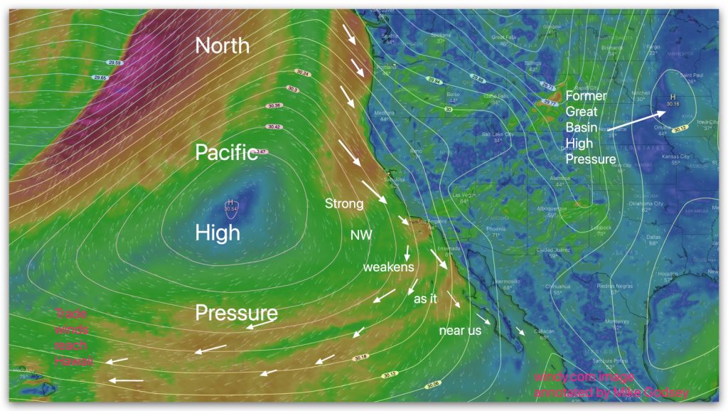
The image below shows the area from Hawaii to Alaska to Baja to Iowa. Today the huge North Pacific High you see in the Pacific only delivers mild NNW winds to Baja’s East Cape. But over the next several days part of that high-pressure buds off and forms a larger high pressure over the Great…
Despite the forecast for solid winds at La Ventana and somewhat lesser winds for El Sargento and Los Barriles the winds looked a bit iffy mid morning. Clouds clogged the coastal valleys and the winds plateaued in the mid to upper-teens. Then as you see in this satellite imagery the clouds cleared the Los Planes…
Tuesday, January 17, 2023 Later today the North Pacific High’s moves a finger of high pressure over wind machine’s trigger then fires off Wednesday shooting northerly wind our way for days and days. In meteorological terms, the NPH is pushing a finger of high pressure toward the Great Basin today. Then tomorrow that bit of…
We have had a long spell of mild wind days with a varying combo of wind from a weak North Pacific High west of Baja + local sea breezes. Tomorrow high pressure builds in then Great Basin and we see stronger El Norte winds from that high pressure + NNW winds from the North Pacific…
Notice the huge mass of clouds carried by the Sub-Tropical Jetstream from a disturbance to the SW over Baja Sur. This mass of clouds has been lingering north of Baja’s East Cape the last few days but overnight lunged over us. If those clouds linger we will have weak unreliable wind. However, watching the satellite…