It is hard to describe complex weather patterns without using some jargon. Here is a jargon Decoder for today’s forecast. While it does not explain everything it at least gives you a visual of what these parts of the wind machine look like today.
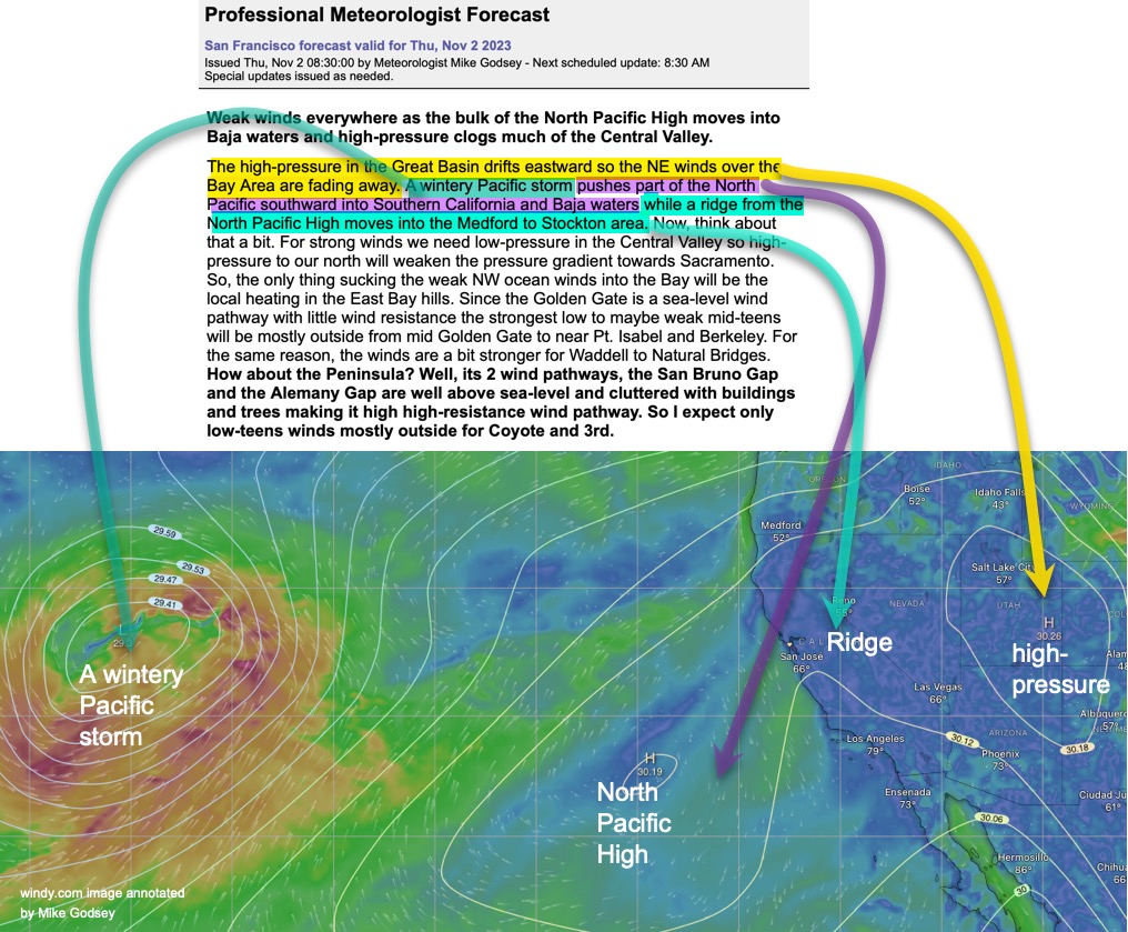
Weak winds everywhere as the bulk of the North Pacific High moves into Baja waters and high-pressure clogs much of the Central Valley.
The high-pressure in the Great Basin drifts eastward so the NE winds over the Bay Area are fading away. A wintery Pacific storm pushes part of the North Pacific southward into Southern California and Baja waters while a ridge from the North Pacific High moves into the Medford to Stockton area. Now, think about that a bit.
For strong winds we need low-pressure in the Central Valley so high-pressure to our north will weaken the pressure gradient towards Sacramento. So, the only thing sucking the weak NW ocean winds into the Bay will be the local heating in the East Bay hills. Since the Golden Gate is a sea-level wind pathway with little wind resistance the strongest low to maybe weak mid-teens will be mostly outside from mid Golden Gate to near Pt. Isabel and Berkeley. For the same reason, the winds are a bit stronger for Waddell to Natural Bridges. How about the Peninsula? Well, its 2 wind pathways, the San Bruno Gap and the Alemany Gap are well above sea-level and cluttered with buildings and trees making it high high-resistance wind pathway. So I expect only low-teens winds mostly outside for Coyote and 3rd.