Yesterday the North Pacific High’s surface NW ocean winds were exceptionally weak yet my forecast was for strong upper-teens to low 20’s winds for almost every water location in the San Francisco Bay Area. There are 2 keys to Bay Area summer winds. The first is the many gaps in the Coast Range and East…
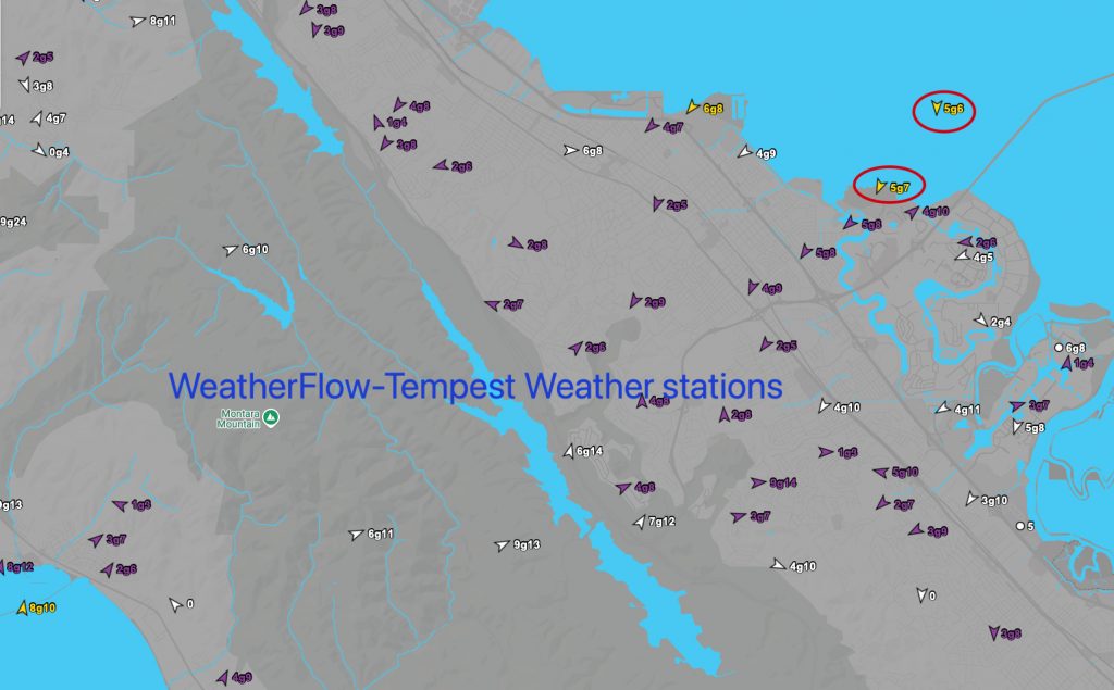
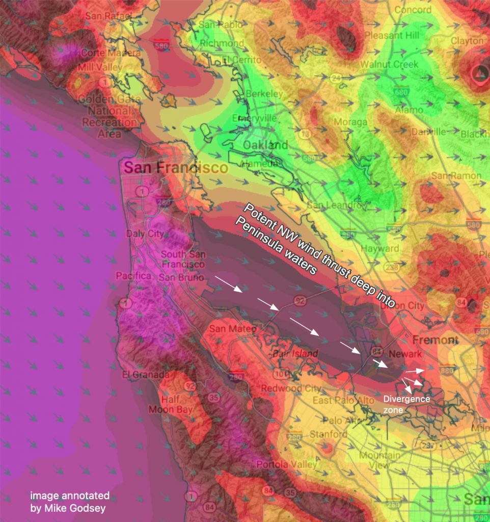
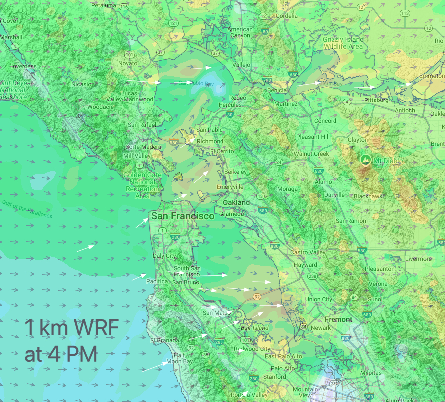
Now at 11:30 AM: There are white caps outside of Anita Rock and below the San Rafel/Richmond Bridge. Most of the Bay Area has cleared. Our fleet of ≈30 Tempest sensors between 3rd. Ave. and Half Moon Bay are showing NE winds and that usually means WSW PM winds from the Hwy. 92 gap area…
Thursday’s Eddy Wind Recipe: It you are new to the San Francisco Bay Area summer winds you are befuddled right now. For weeks we have had NW ocean winds curving in to most sites. But the handwriting was on the wall with 3rd. Ave. often plagued by W to WSW winds at the launch sites…
Saturday’s Wind Recipe: First Major Eddy of the season starts Monday! Sherman Expression Session FORECAST: Upper-teens to low 20’s+ Up and down blasts stronger due to winds aloft and proximity of heat bubble. The NPH delivers very strong NW wind to our ocean buoys and scours out clouds fast: Bodega buoy 23g31, S.F. buoy 20g23…But…
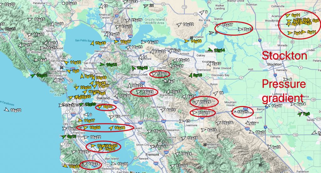
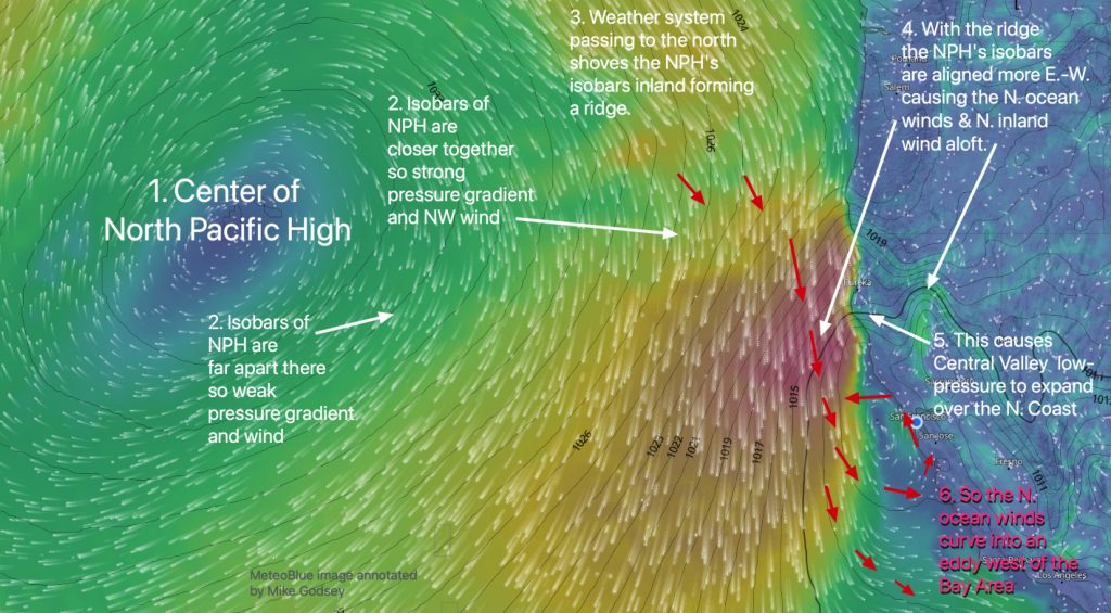
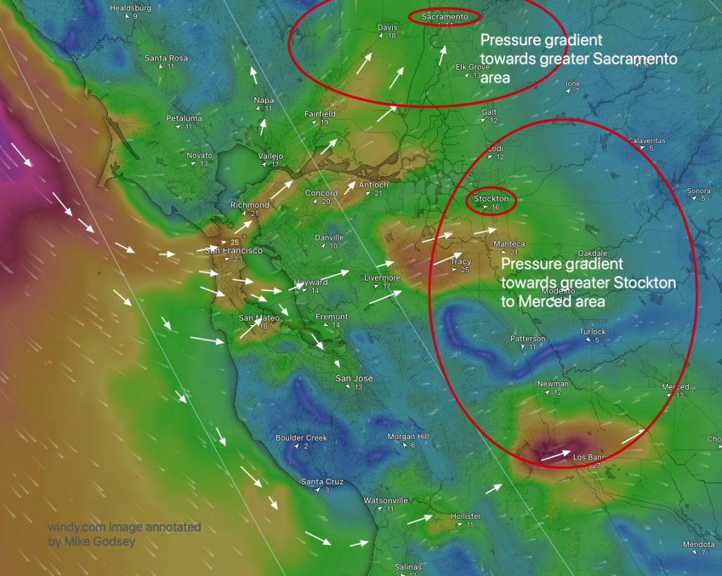
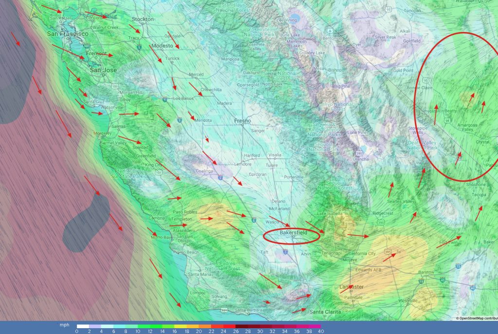
Friday’s Wind Recipe by Mike Godsey: 1, The Bodega ocean buoy NW 25g31 as a 3500-mile wide NPH anchors NW wind and chilly upwelling along our coast. 2, A sensor near the Altamont Pass is reporting 21g31 supporting the evidence that the pressure gradient focuses Stockton > Bakersfield which favors coast winds and sites from…
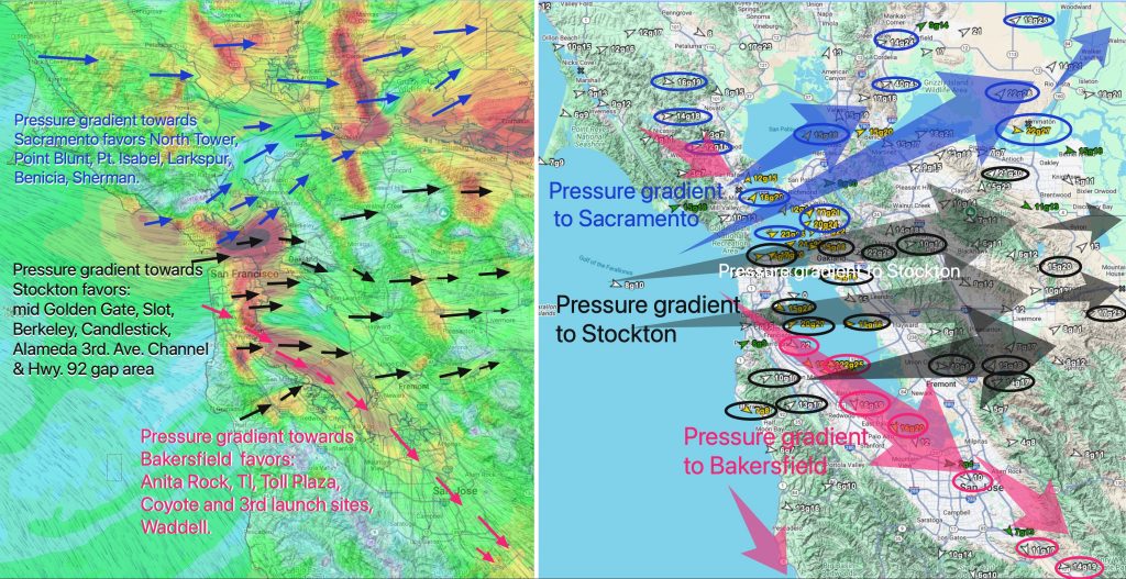
2100 mile-wide North Pacific High is compacted against the California coast by a rainy Gulf of Alaska storm Strong pressure gradient towards Stockton helps Candlestick and Alameda. A massive gradient towards Bakersfield and the Great Basin accelerates wind down the coast. The same gradient sucks winds over the launch sites from Anita Rock to 3rd…
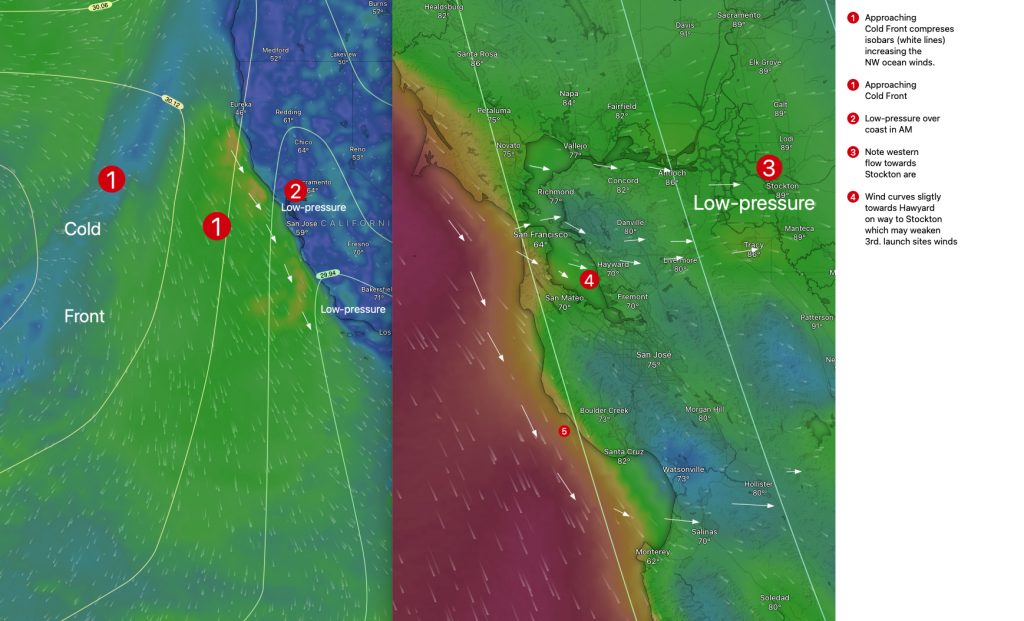
Human Forecast for May 3, 2025 Very EARLY Gusty winds for the entire coast and Bay including Ocean Beach for the “King of the Cove” Saturday! Note: The San Francisco Department of Emergency Management has issued a HIGH WIND ADVISORY for blowing objects. Now at 11:30 AM: With parts of the Bay and Central Valley still blanketed…
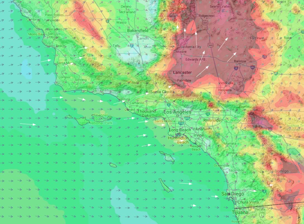
Mild on Central Coast but windy for Lopez and strong for Isabella. Entire Southern California sees moderate winds. Central Coast A tiny storm system off San Francisco diverts the North Pacific High’s surface NW winds around the Central California coast so the coast sees mild W to WSW wind. However, a strong pressure gradient towards the…
Wind Recipe: 1. A tiny storm system due west of S.F. blocks most of the North Pacific High’s surface NW winds. 2. Scattered high clouds mean the Central Valley gradient is very mild. 3. The storm provides a weak serving of WSW wind that might serve the wind-starved just outside of Anita Rock and Pt….