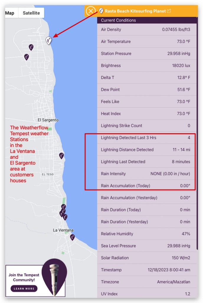
West Coast Wind Blog: Lightening today, The expanding Tempest weather station in La Ventana
The La Ventana & Los Barriles launch site wind forecast for the current day can be found on iwindsurf.com or kitesurf.com.

The La Ventana & Los Barriles launch site wind forecast for the current day can be found on iwindsurf.com or kitesurf.com.
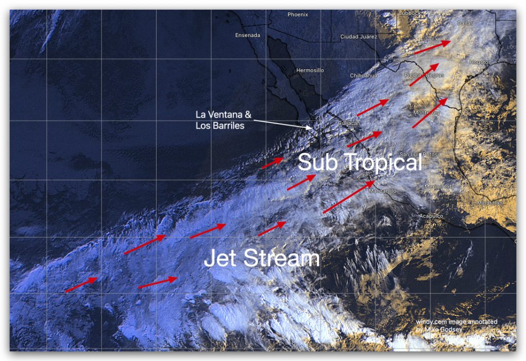
The La Ventana, El Sargento & Los Barriles launch site forecast for the current day can be found on iwindsurf.com or kitesurf.com. Forecast Jargon Decoder, Dec. 13, 2023 Today’s forecast: In this second image, notice the dreaded 3500-mile-long Sub Tropical Jet Stream cloud mass streaming from the SW over Baja’s East Cape. At dawn today,…
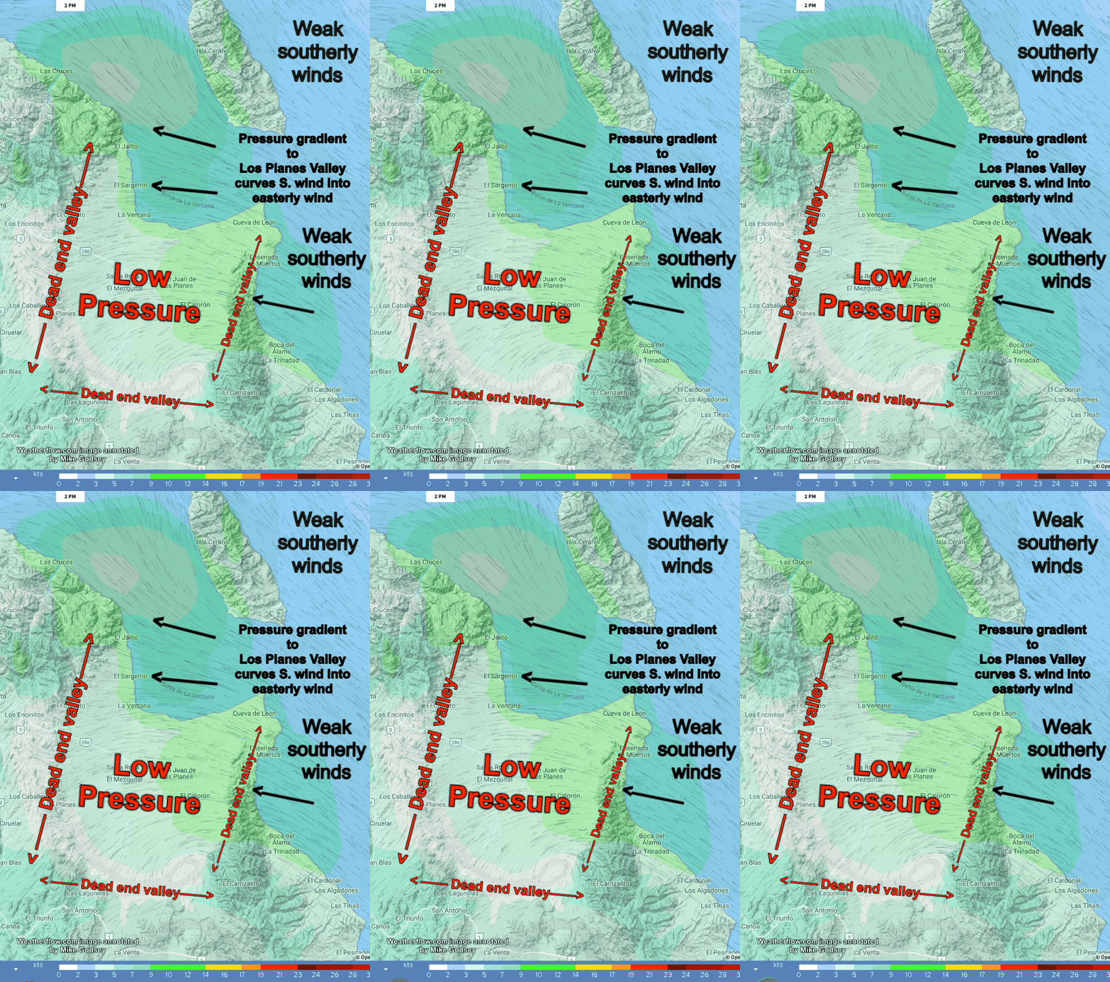
The La Ventana & Los Barriles launch site wind forecast for the current day can be found on iwindsurf.com or kitesurf.com. Forecast: Muy tranquilo. Good Fishing then good Paragliding and decent foiling with big wings and skill for Rasta Beach. Note: During mild EASTERLY WINDS, the best paragliding is in the area in the Rasta Beach…
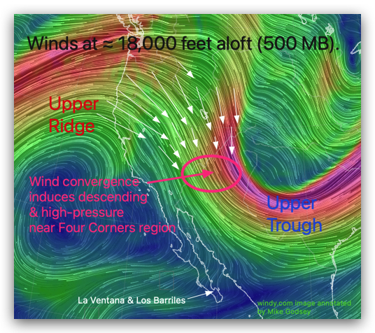
The Southern California and Central California launch site wind forecast for the current day can be found on iwindsurf.com or kitesurf.com. We all know how Santa Ana winds localize and how they feel but what causes these winds? Generally, these winds are caused by a surface high-pressure area in the Great Basin. But what causes this high-pressure…
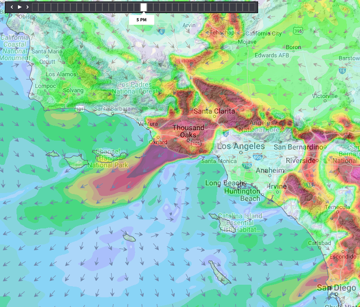
The Southern California and Central California launch site wind forecast for the current day can be found on iwindsurf.com or kitesurf.com. Notice the tiny 400-mile wide remanent of the North Pacific High centered 100 miles West of San Francisco that is shrinking fast. Note how most of its mass isbeing absorbed into a huge growing 1200-mile-wide high-pressure…
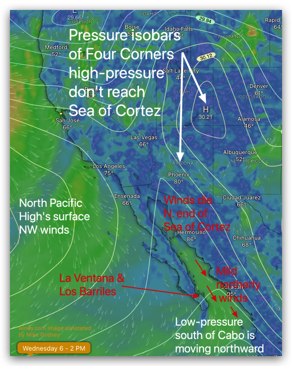
The La Ventana & Los Barriles launch site wind forecast for the current day can be found on iwindsurf.com or kitesurf.com. First notice how our high-pressure wind machine is still anchored over the Four Corners. But notice how its pressure gradient isobar lines do not even reach the Sea of Cortez much less La Ventana….
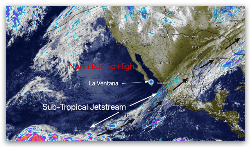
Since this is an El Niño year the wind-killing Sub-Tropical Jetstream is much more likely to come over Baja’s East Cape and kill the winds. So far we have been lucky but today the Sub-Tropical Jetstream is close enough that I thought you would like to see the wind-killing bullet that missed us. Take a…
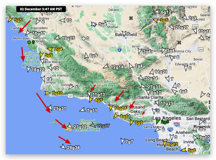
Overnight the 1000 mile wide North Pacific High has pushed a huge ridge of high-pressure inland which is morphing into a separate high-pressure over the southern Great Basin/Four Corners. This tends to turn our ocean winds a less favorable NNW direction and create NE winds over the interior at the surface and just aloft. This…
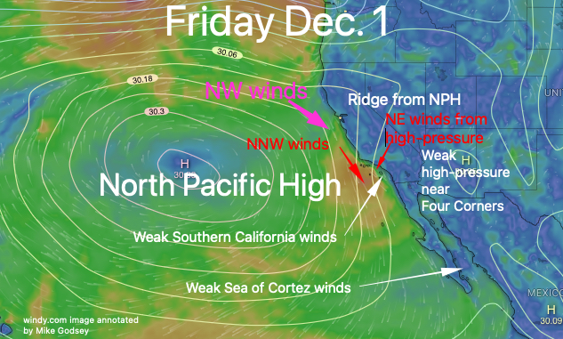
The 1000 mile wide North Pacific High is still, weirdly in an early summer location so why is the Santa Maria Ocean buoy blowing NNW rather than NW. And why are NE winds starting to pick up on the Southern California coast? In this first image you can see part of NPH moving inland into…
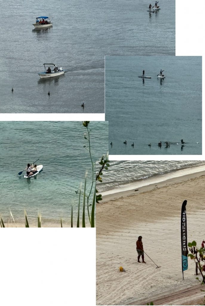
The La Ventana & Los Barriles launch site wind forecast for the current day can be found on iwindsurf.com or kitesurf.com. IF we get a hole in the clouds… chance of mid to late afternoon mid-teens NORTHERLY WINDS wind reaches Rasta Beach then La Ventana but not Los Barriles. Note: Another Canadian is preparing our way…