The La Ventana & Los Barriles launch site wind forecast for the current day can be found on iwindsurf.com or kitesurf.com.
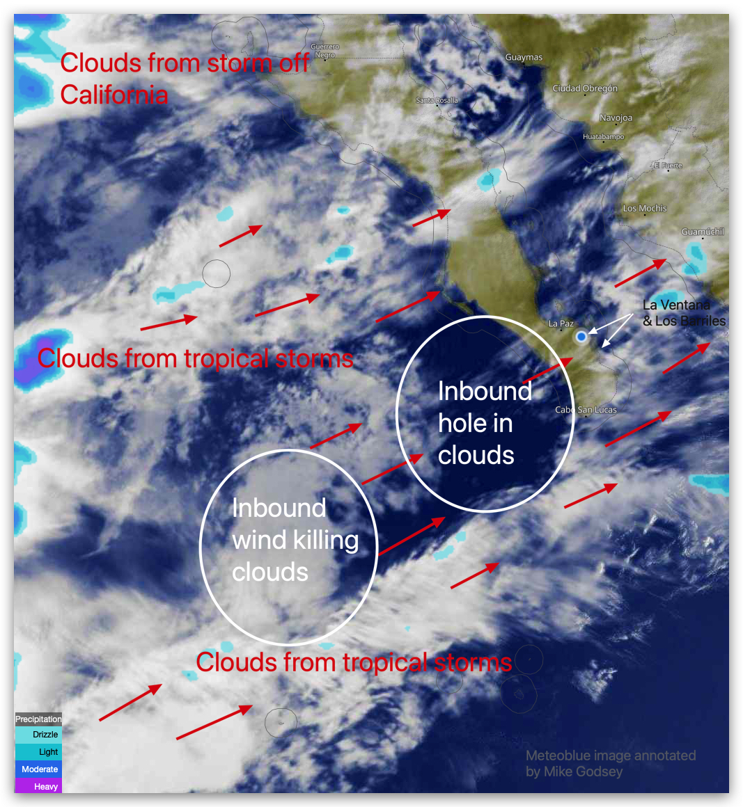
Let’s talk clouds. If you are in the La Ventana area, first notice the thin line of puffy LOW clouds streaming over Isla Ceralvo (AKA Isla Jacques Cousteau).
These clouds are good news since they confirm the satellite ASCAT that El Norte winds are blowing outside.
Now, we must figure out how to get those winds to the beach!
Next, check out the swirly mess of high clouds over us. These clouds are partially from a complex of small tropical storms to our SW and vanguard clouds from a winter storm 600 miles west of California.
All this sounds pretty dismal since we need blue sky heating in the Coastal Valleys to get those El Norte winds to the beach, which combines with the local sea breezes.
But look at the satellite imagery in my blog. Notice that there is a large blue hole in the inbound clouds.
I am going to wager that the “Hole in One” may settle just inland of us this afternoon. Hence, my optimistic forecast.