The 2023 El Niño emerged in June 2023 and is expected to persist through the winter of 2023-2024 and there is a 75-85% chance that it will peak as a strong El Niño event this winter.
Remember, the impact of El Niño on our winter wind will be episodic. There will be many periods when the winds will be excellent. Part 2 blog, soon to be posted( will help you discern when good winds are more likely.
A strong El Niño can impact your Baja wind vacation in 3 ways.
- Sometimes, clouds stream by far aloft will shade the valleys which weakens the local pressure gradient that creates Local Sea Breezes.
- The resulting weaker pressure gradient makes it more difficult for the large-scale northerly (El Norte) winds to curve into the beaches reliably.
- There can be smaller swell and shorter period swell than normal years since the North wind fetch over the Sea of Cortez is often shorter.
- The El Norte winds are more likely to be confined to the southern half of Baja and may be weaker than normal.
- Rainy storms are more likely to hit Southern California and Baja Norte, causing major driving problems due to flooded Vados and collapsed bridges. And there is a greater, but still small, chance of sprinkles in the La Ventana area.
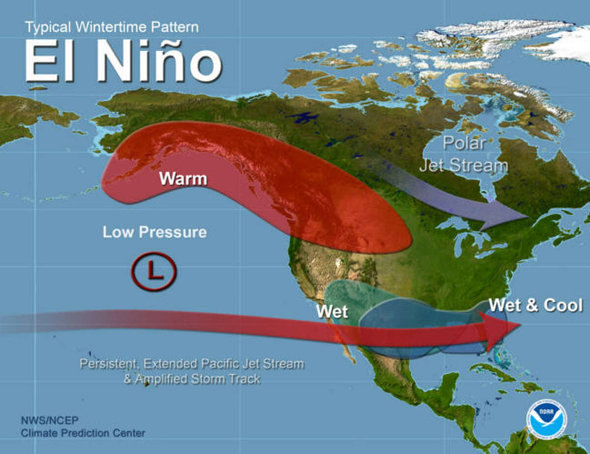
All this happens because during a strong El Niño the subtropical jet stream over the Baja California Peninsula shifts southward and eastward. This is represented in this NOAA graphic by the red arrow showing the winds ≈ 18,000 feet aloft (500 MB) and higher.
This means the jet stream is likelier to steer storms and precipitation into the northern Baja California Peninsula or even over Baja Sur, resulting in wetter conditions than usual.
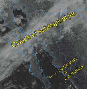
You can see this in this satellite animation I made during the last El Niño. In this case, the clouds are mostly over Baja Norte, but it also means that the Great Basin and/or 4 Corners high-pressure that are vital in making strong El Norte winds do not bring much wind to Baja Norte while Baja’s East Cape has weaker winds than normal.
This also means that the northerly winds wind is not blowing down the full length of the Sea of Cortez, so the swell will be smaller for La Ventana and Los Barriles with a shorter fetch. This means those huge smooth swells will be less frequent outside and the surf over the sand bars may be smaller.
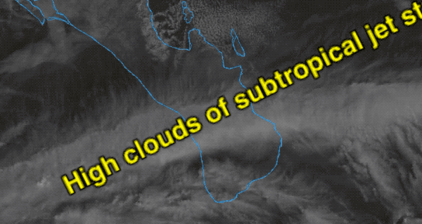
This second animation shows the subtropical jet stream flowing right over La Ventana and Los Barriles. The resulting cloud coverage will weaken the Local Sea Breezes and the weaker local pressure gradient may stop the large scale El Norte winds from curving into the beaches.
However, this is when we get those spectular sunrises.
If you are driving to or from the US border, follow the weather carefully since storms that would normally hit Northern California may hit Southern California and Baja Norte. Flash floods can wipe out bridges and fill Vados, especially in the Cativina Area. Time your driving between storms.
It is important to note that the impacts of El Niño on the Baja California Peninsula can vary from year to year. The strength of the El Niño event can also affect the magnitude and pattern of the impacts.