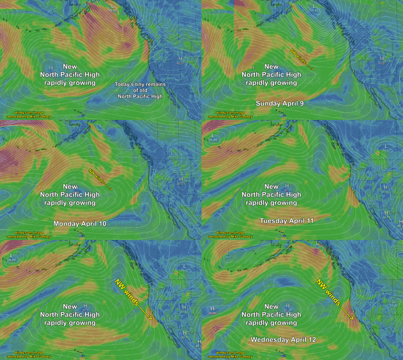
The North Pacific High was very active in Baja waters this spring but has provided scant strong NW winds for the Northern California coast this spring in March. This week a rapidly enlarging North Pacific High has formed north of Hawaii and will bring strong NW winds to the San Francisco Bay Area and the…
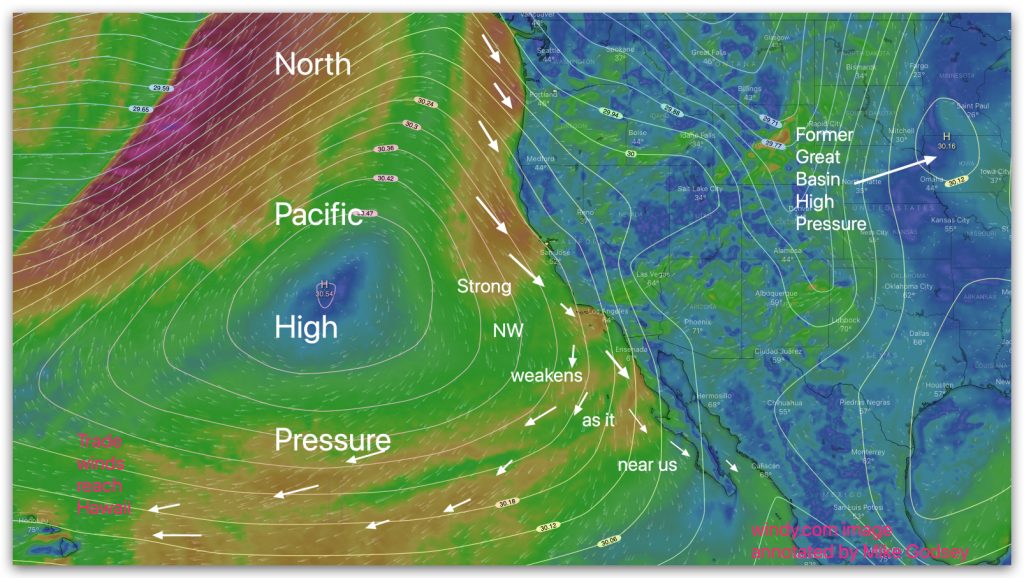
The image below shows the area from Hawaii to Alaska to Baja to Iowa. Today the huge North Pacific High you see in the Pacific only delivers mild NNW winds to Baja’s East Cape. But over the next several days part of that high-pressure buds off and forms a larger high pressure over the Great…
Despite the forecast for solid winds at La Ventana and somewhat lesser winds for El Sargento and Los Barriles the winds looked a bit iffy mid morning. Clouds clogged the coastal valleys and the winds plateaued in the mid to upper-teens. Then as you see in this satellite imagery the clouds cleared the Los Planes…
Tuesday, January 17, 2023 Later today the North Pacific High’s moves a finger of high pressure over wind machine’s trigger then fires off Wednesday shooting northerly wind our way for days and days. In meteorological terms, the NPH is pushing a finger of high pressure toward the Great Basin today. Then tomorrow that bit of…
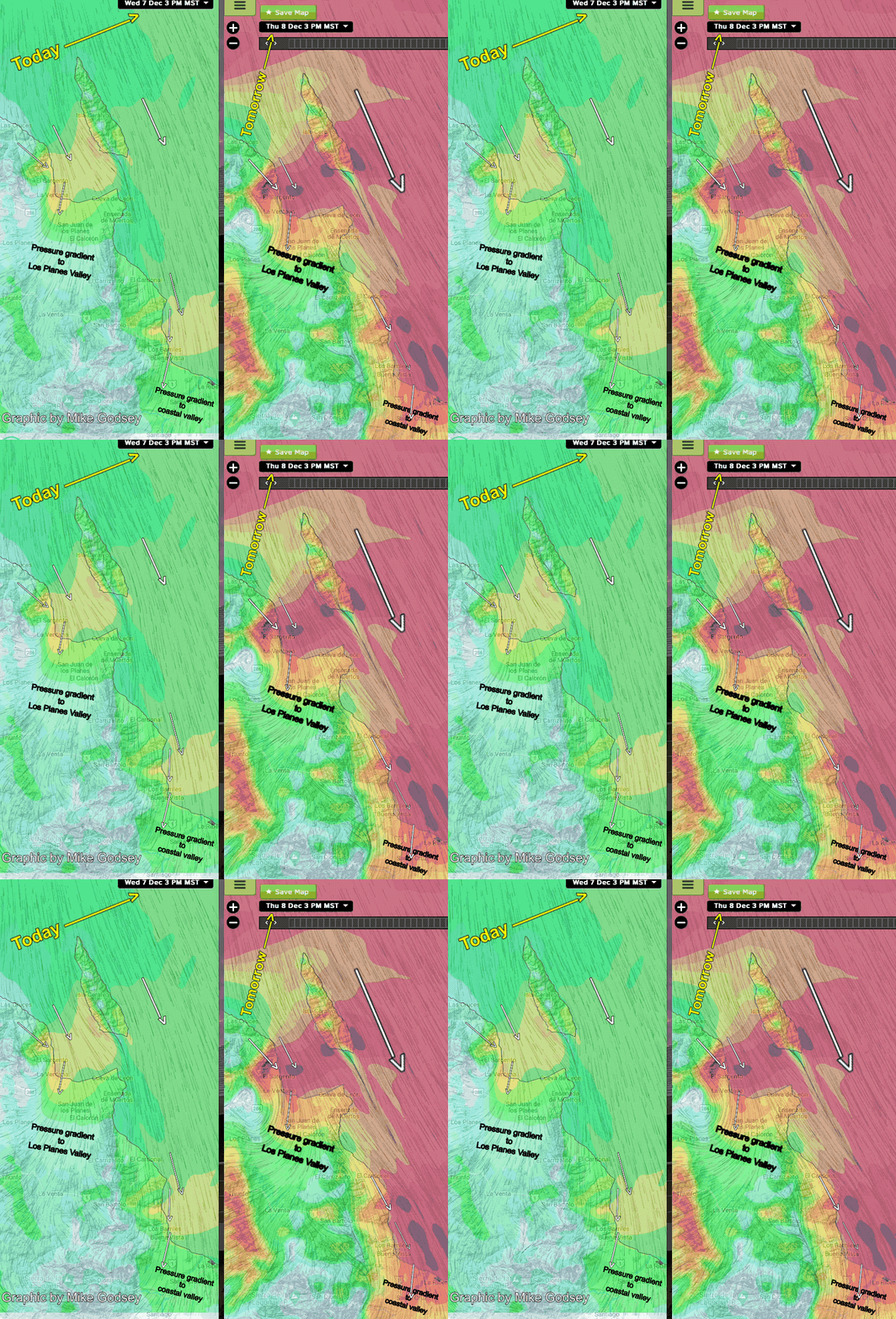
We have had a long spell of mild wind days with a varying combo of wind from a weak North Pacific High west of Baja + local sea breezes. Tomorrow high pressure builds in then Great Basin and we see stronger El Norte winds from that high pressure + NNW winds from the North Pacific…
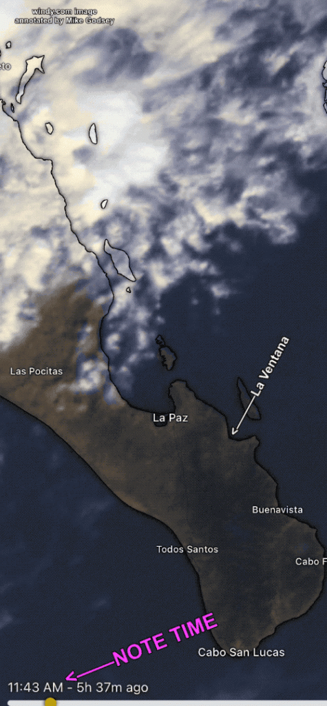
Notice the huge mass of clouds carried by the Sub-Tropical Jetstream from a disturbance to the SW over Baja Sur. This mass of clouds has been lingering north of Baja’s East Cape the last few days but overnight lunged over us. If those clouds linger we will have weak unreliable wind. However, watching the satellite…
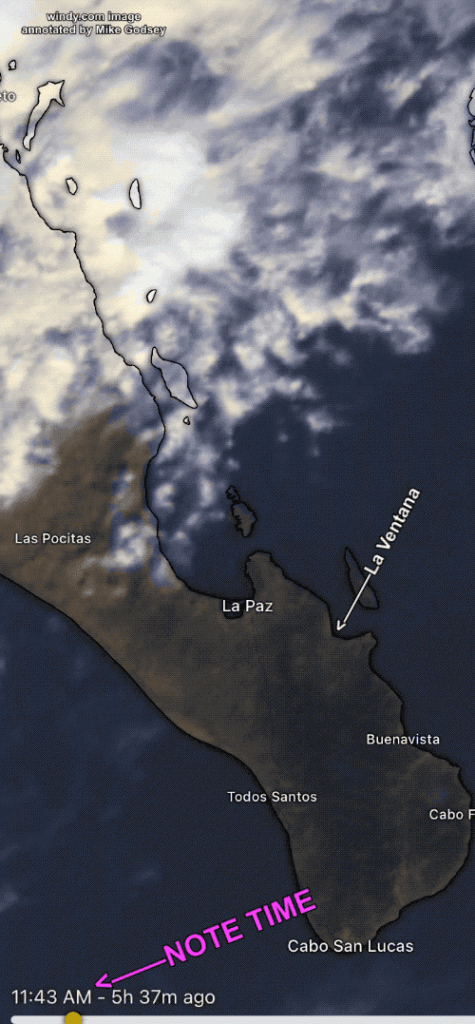
Yesterday saw an abrupt drop of the wind velocity at some La Ventana sensors around 2:30 PM. This fade nicely illustrates the importance of heat in the Los Planes Valley. Below is my forecast for yesterday which mentions the possibility of this happening. This satellite imagery shows the massive clouds to our north and the…
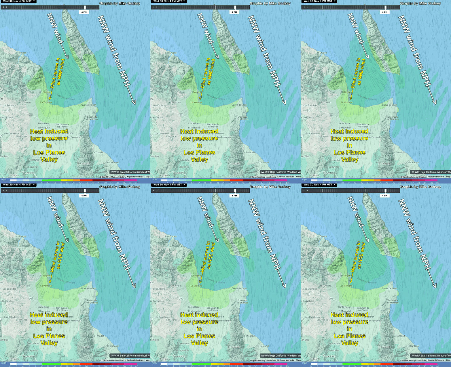
If the multimodel ensemble forecast for spare clouds today, Wednesday, Nov. 30, is correct we should see good heating in the Los Planes Valley inland of La Ventana. This heating is critical to get the winds to the beach since most of our large scale breeeze today is NNW wind from the North Pacific High…
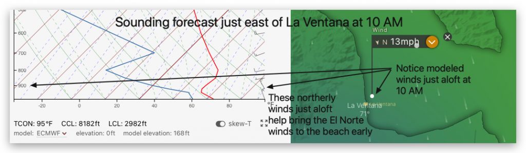
The banner above shows what the winds looked like at the La Ventana campground at 9:45 AM Thanksgiving Day. Note the building white caps. What causes the winds to start out so early and how did the forecast predict this in advance? Well, forecasting strong El Norte winds was easy. This next image shows the…
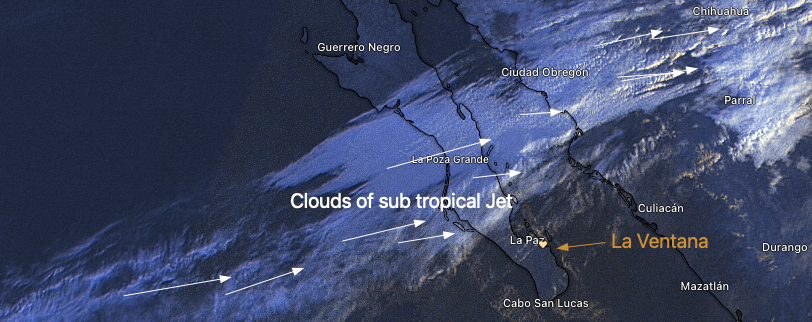
Baja’s East Cape forecast for La Ventana, Los Barriles and El Sargento: Looking at this amazing 7:15 AM satellite imagery you can see a solid mass of clouds from the subtropical jet stream is over the Sea of Cortez for Mulege to just north of La Paz. The edge of this cloud mass has a…