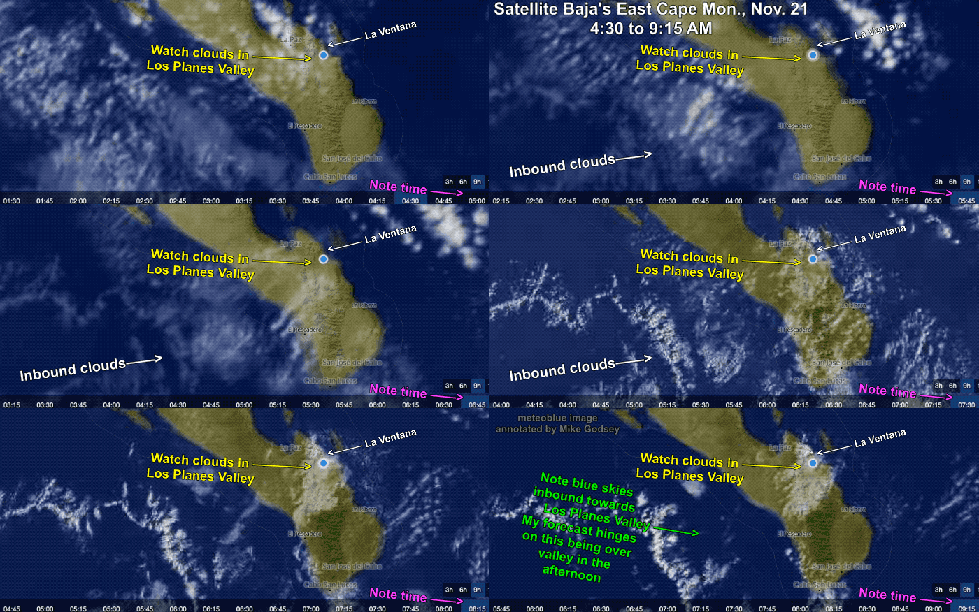
In Part 1 of this blog, we saw how lingering surface high pressure over the Great Basin kept the El Norte winds blowing for days rather than the typical 2-3 days. In Part 2 we saw how an upper ridge can anchor that surface high pressure in place while increasing its strength. Now Part 3…
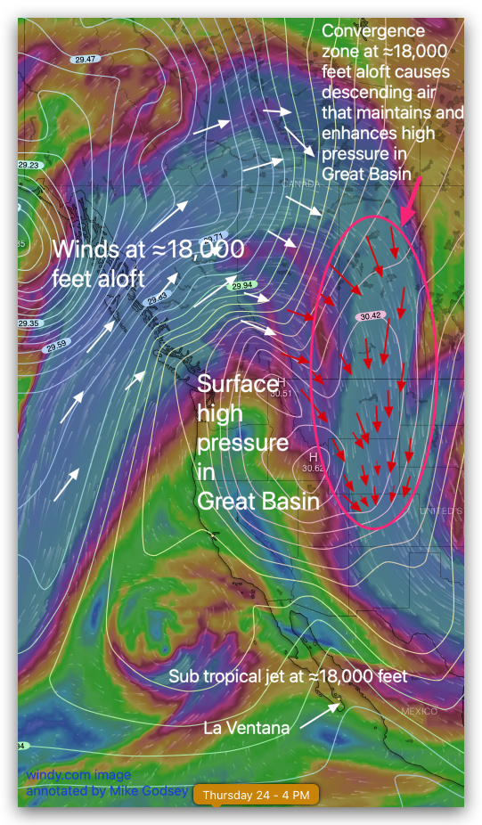
In Part 1 of this 3 part blog we saw how lingering high pressure over the Great Basin kept the El Norte winds blowing for days rather than the typical 2-3 days. But the question remains… why did that high pressure linger so long and stay so strong. Part 2 of this blog answers that…
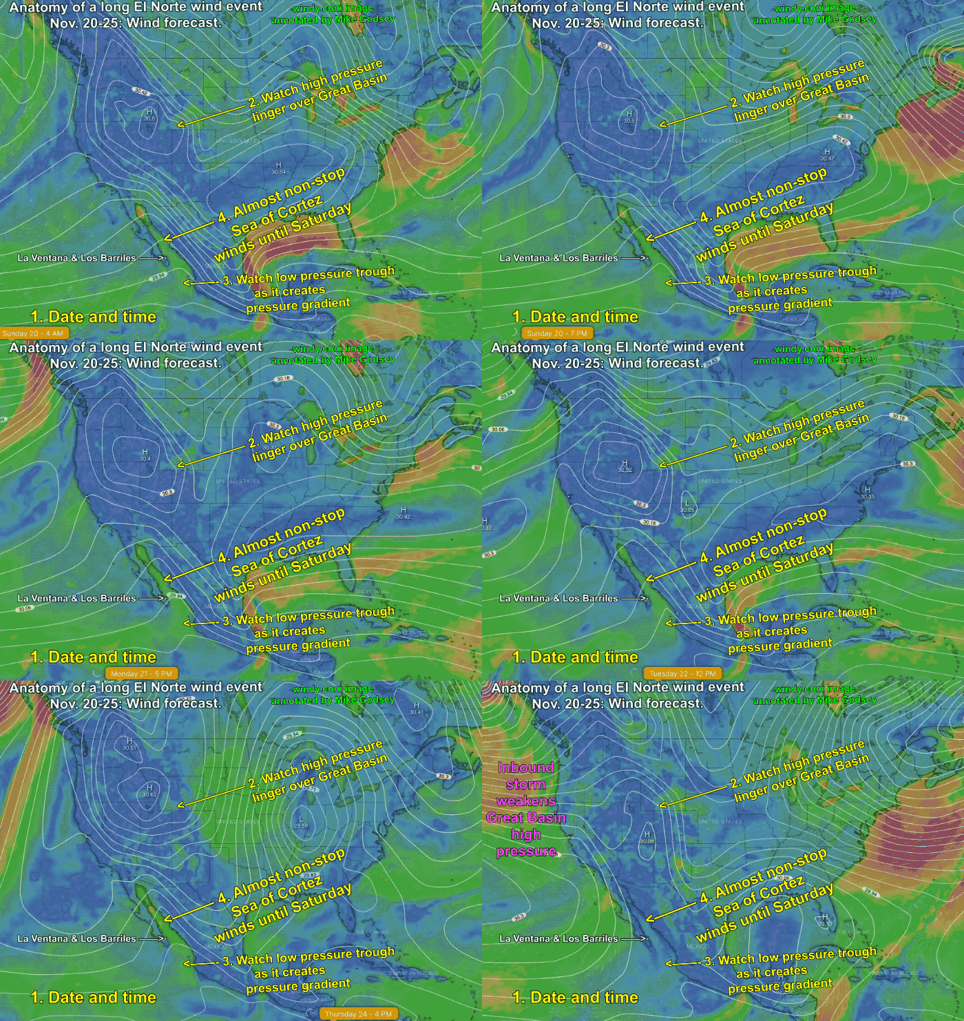
If Matt and my forecasts are right we are in for a long spell of moderate El Norte winds coming down Sea of Cortez from the Great Basin. The 3 part blog looks at the 3 major causes of this event from Nov. 20 to around Nov. 25. Typically El Norte wind events last 2-3…
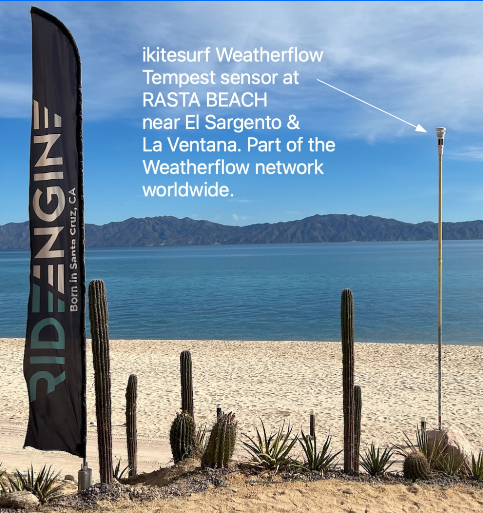
There is now a Weatherflow Tempest weather station at Rasta Beach about 1 km north of El Sargento. This sensor at hosted by the great folks at Kitesurfing Planet. Be sure to check out all their rental gear and the amazing beach side restaurant. The sensor is at the back of the beach so it…
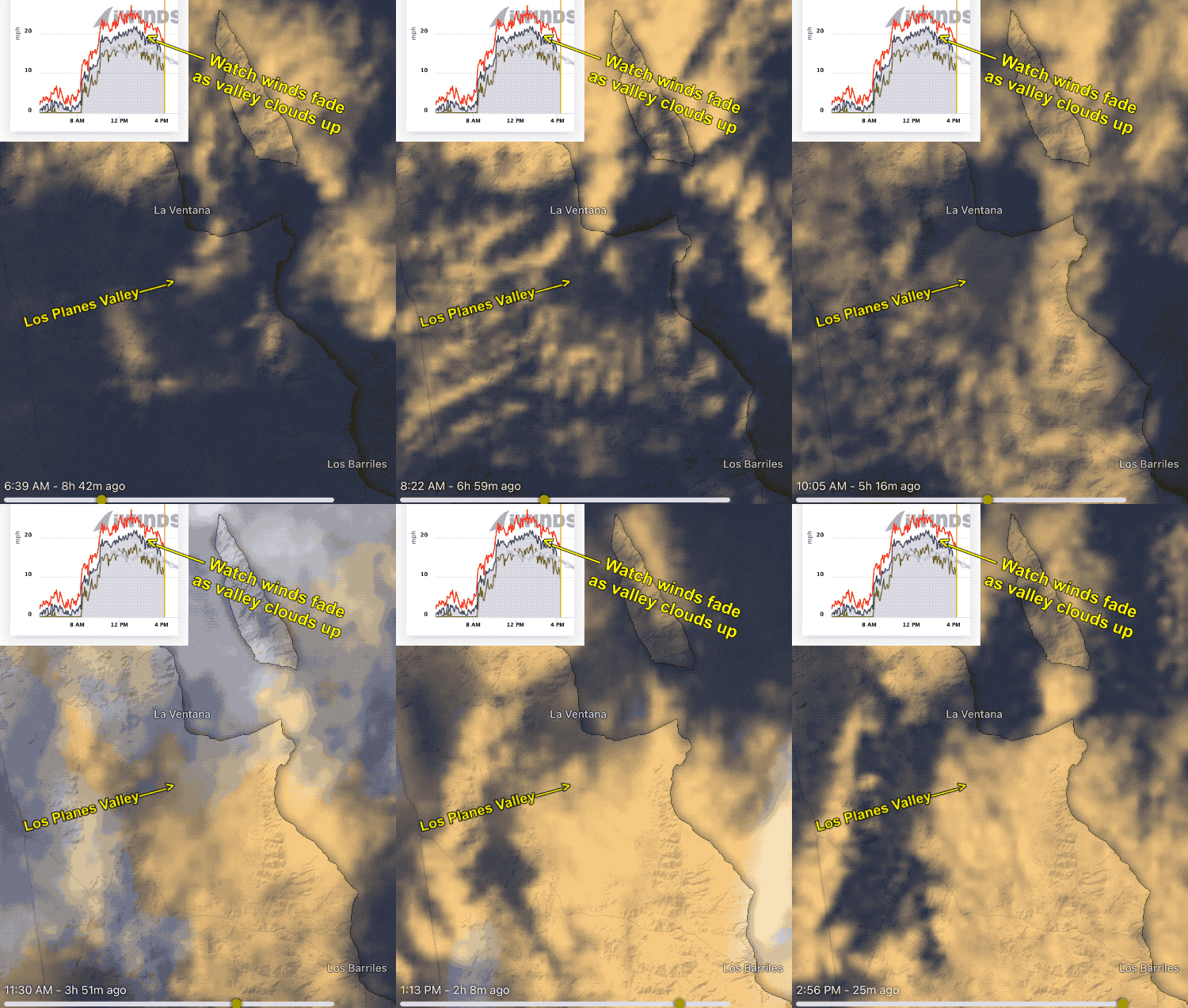
My forecast yesterday, Tuesday, Nov. 15 was for early winds but with clouds as an issue. Both of those forecasts came true but with a twist. The entire Los Planes Valley was clear mid-day to early afternoon so the winds were a bit stronger than forecast. But the cloud really danced around the valley all…
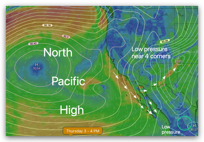
Today we are seeing a massive 4000-mile-wide North Pacific High repeating last winter’s pattern. On the right margin is the Southern California wind graphs from Ventura to San Diego’s Silver Strand. What caused these strong NW winds clearing winds in November? The first map image shows the North Pacific High which is located in a…
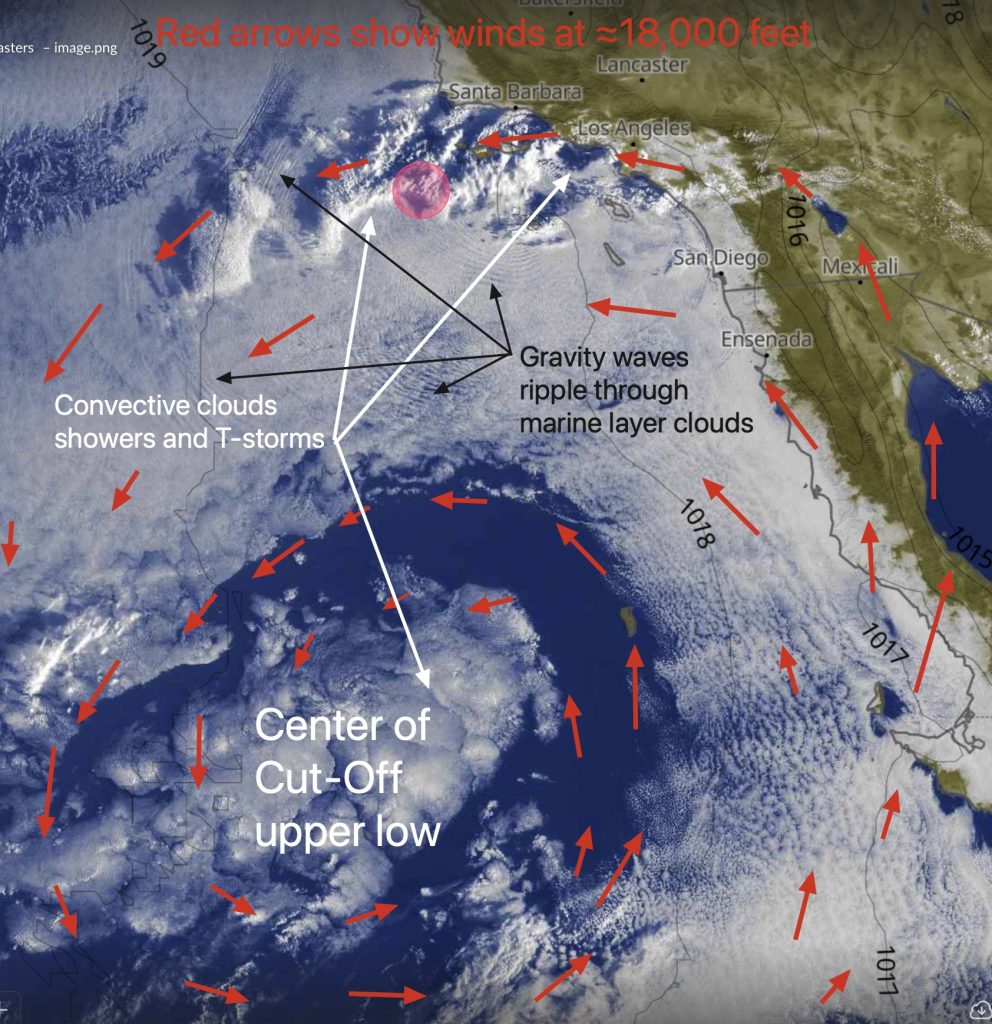
Much of early October saw the Weatherflow iwindsurf.com/ikitesurf.com forecasts barely changing from day to day for Southern California and the San Francisco Bay Area. During that time marine layer clouds clogged the Bay Area and the Southern California bight much like June Gloom. The cause of this stagnant weather pattern was the Rex Block discussed…
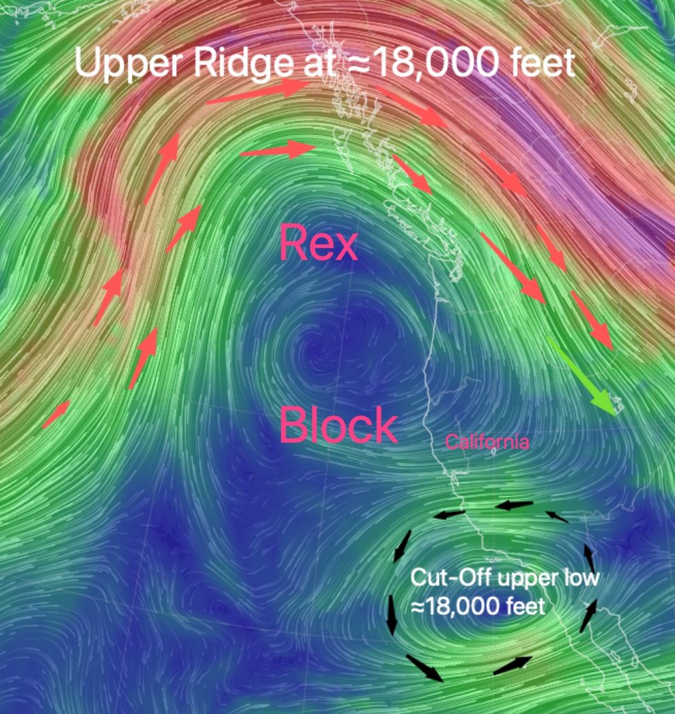
Have you noticed that our San Francisco Bay Area forecast text has barely changed recently? Almost every day there is mention of the Central Valley thermal low over the coast and a chance of an eddy and largely absent NW ocean winds. Before you attribute the repeated forecast text to forecaster laziness consider the Rex…
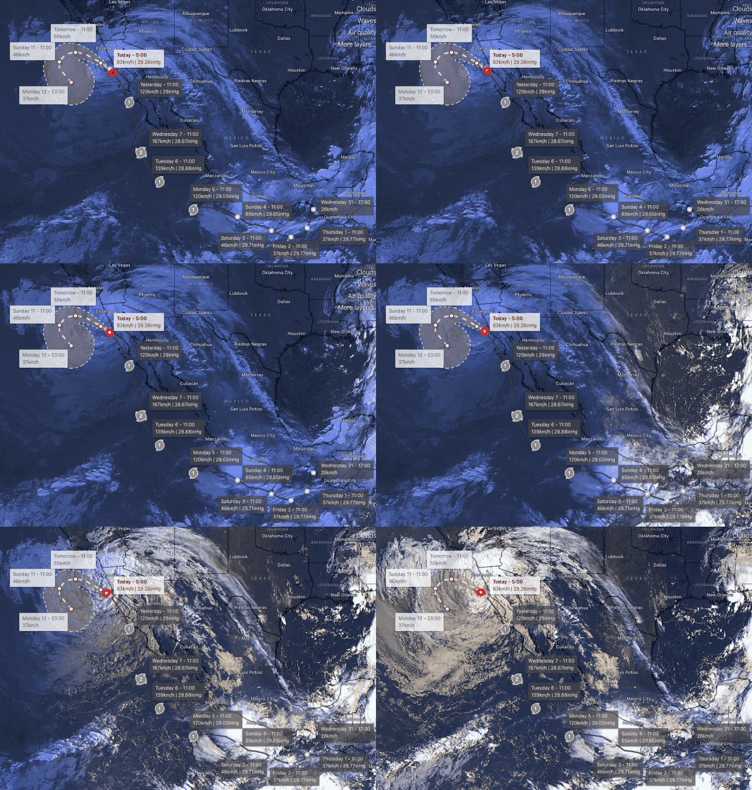
As you have probably noticed we have had some weird wind/weather patterns in recent years. But this week has been exceptional for weirdness. This graphic shows how anomalous a weather pattern is compared to historical norms. Lots of weirdness today. For you math wizards that means the major wind makers, Hurricane Kay and the North Pacific…
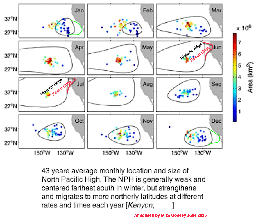
Several years ago I was at 3rd. Ave. on San Francisco’s Peninsula rigging when I heard a conversation that went something like this: “We just are not getting the usual NW winds this summer. The North Pacific High has disappeared” That season the San Francisco Bay Area had a summer cursed by frequent eddies off…