West Coast Wind Blog: Very early season storm followed spring type NW clearing winds
by Mike Godsey
by Mike Godsey
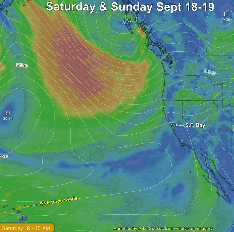
by Mike Godsey Recently the Weatherflow iwindsurf.com and ikitesurf.com forecasts and our internal Slack channel have seen a lot of chatter about the very weird weather pattern from today, Thursday, Sept 16 to Sunday, Sept 19. During that time period, we make a rapid transition from a… Southerly eddy winds on the Northern California coast….
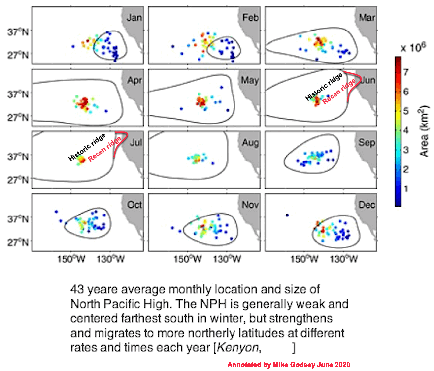
by Mike Godsey Have you noticed? The NW ocean winds are becoming more common this late summer into fall for Southern California and the San Francisco Bay Area? While the Columbia Rivers winds are a mere shadow of their summertime strength. So what causes these seasonal changes in the winds? The North Pacific High, a…
by Mike Godsey The first 2 sentences of Kerry’s 7:30 AM San Francisco Bay Area forecast for today, August 31, was good news for kiters and windsurfers from Larkspur to Sherman Island to Pt. Isabel to the Golden Gate. But to Tahoe firefighters and resident it described nightmare scenario. “Morning Update: An upper-level trough is deepening southward out…
by Mike Godsey There is a huge counter-clockwise spinning eddy along much of the California coast from Pt. Arena to Southern California waters today. The same North Pacific High ridge that is creating that eddy is also creating NNW winds in the Central Valley fanning the many fires in Northern California and also blowing smoke…
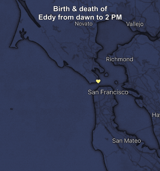
by Mike Godsey All you have to do is watch a dust devil or try to track a tornado and you figure out fast predicting the fate of a spinning body of air is very tricky. And such a prediction was my task today in forecasting the winds for the San Francisco Bay Area. If…
by Mike Godsey A customer asked: Lopez lake had one of its best days of the year with +20 from before 9am and still going at 6pm. Clearly it had a typical 30 degree thermal, like so many days lately, but what else made the difference? The fog pulled back many miles from the beach….
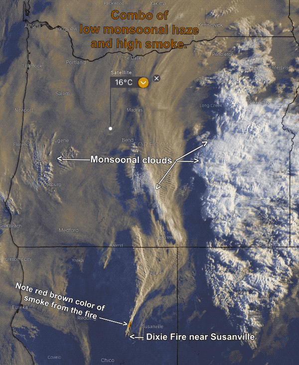
by Matt Souders & Mike Godsey At this point, you are probably wondering about the thick haze every morning that has plagued the Gorge and much of the Pacific Northwest. It barely has a hint of the typical brownish color of wildfire smoke nor does it have the smell of smoke. And unlike smoke, it…
by Mike Godsey Frequently I mention the winds at 1000 feet aloft (975 mb.) in my forecast which I am sure puzzles some of you. After all, your kite lines or mast extends mere feet into the atmosphere so why should you care about the winds 1000 feet aloft. Today it is very easy to…
by Mike Godsey, Ask any long-term windsurfer or kiter and they will tell you the Bay Area winds are changing. 3 basic wind patterns For many decades there were 3 basic wind patterns during the summer. The NW pattern with winds the North Pacific High being sucked through the W to NW facing gaps in…