Long long ago, before Call of the Wind and later windsurf, windsurfers in the know monitored Ken Poulton’s weather page for real time informaiton. Back then the key of information you could derive from his page was the current pressure reading for Sacramento in the Central Valley. We all knew that the stronger the SFO-Sacramento pressure…

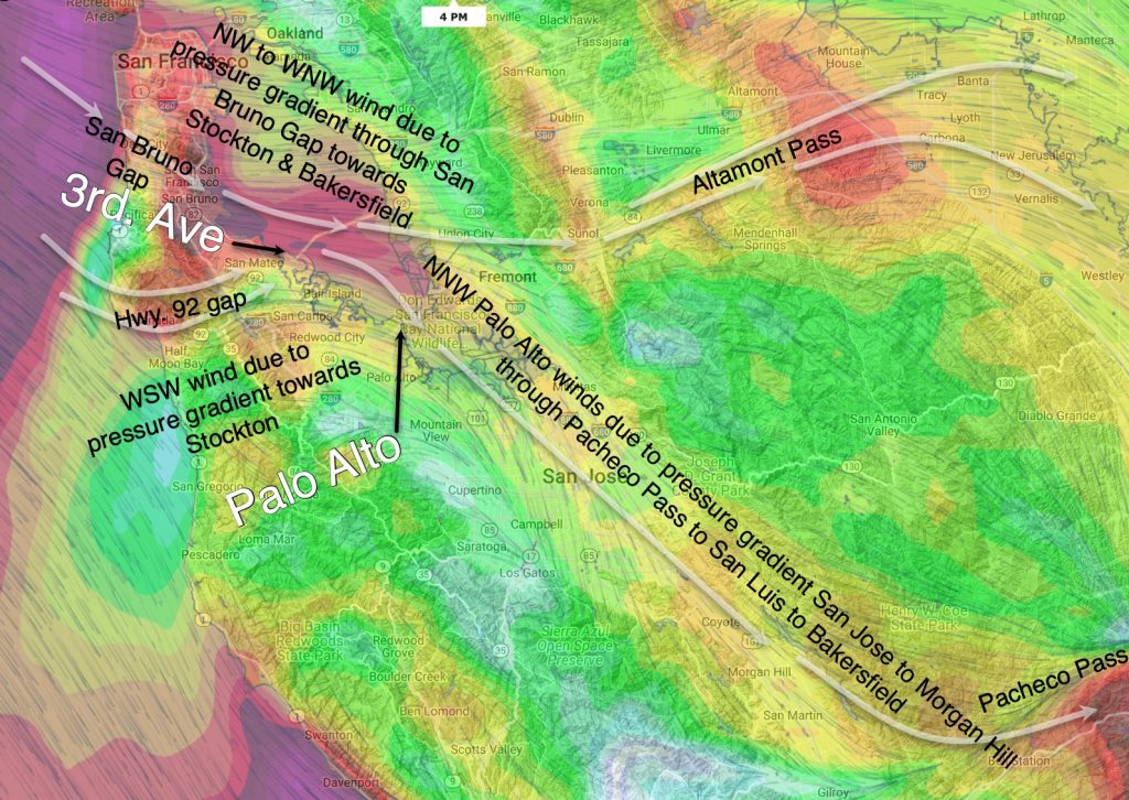
Customer, fxop asks: “Why is Palo Alto typically more northerly than other mid-peninsula sites? Hi fxop, I love low-hanging fruit type questions I can actually answer. See the graphic below where I have simplified the wind flow with white arrows (Unfortunately, the graphic below is for a more W not NW day so the depicted…

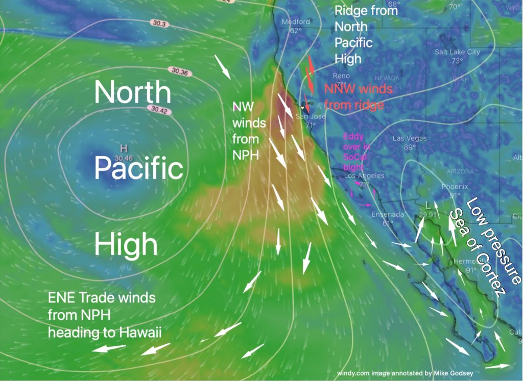
In this first image, you can see that the North Pacific High’s surface NW winds are roaring down the Northern California and Central California coasts this morning. But notice how all this wind bypasses Southern California waters and there are actually SE winds in the Southern California bight. Where is all this NW going? And why…

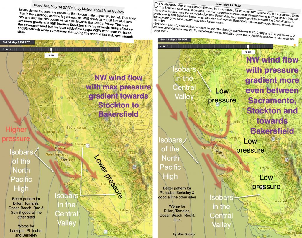
Hi Gang, The graphic below is for a blog I will do later next week. But it is more timely today as our pressure gradient pattern changes a bit. The key concept is that when the NW ocean wind reaches the coast it flows through gaps that are the easiest pathway towards the maximum pressure…

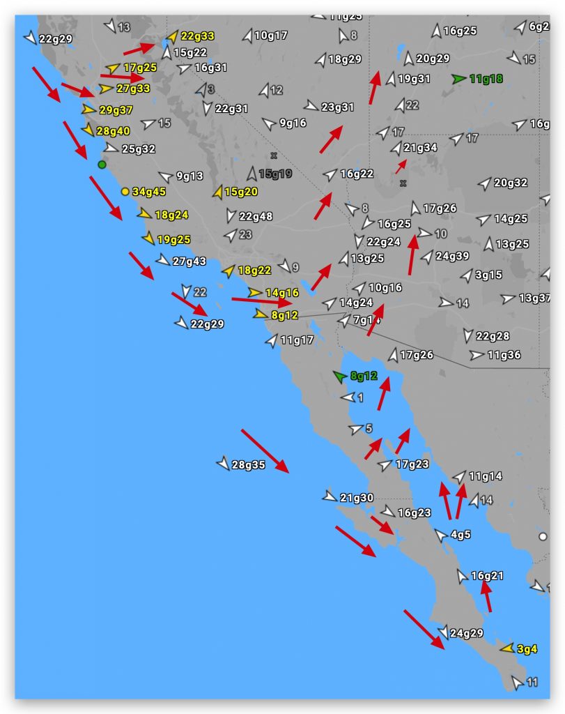
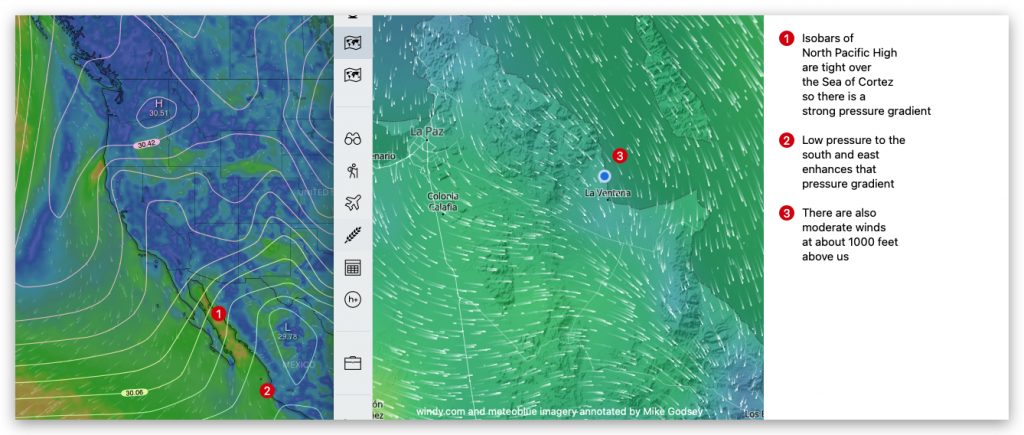
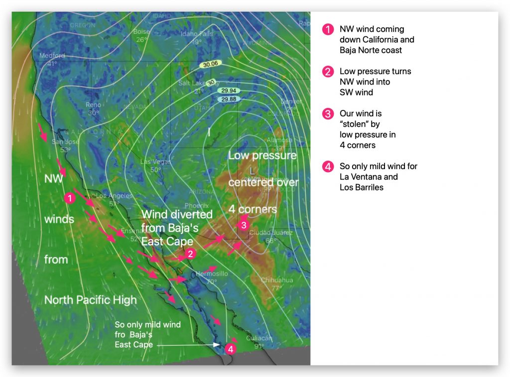
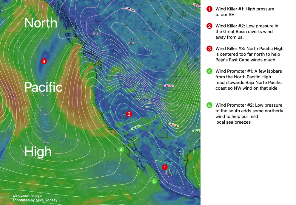
West Coast Wind Blog: by Mike Godsey: Baja daily human forecast Questions about the forecast: Mail me mgodseywf@gmail.com It was an interesting day on forecasting on the west coast. My California forecasts exceeded the strong winds I forecast but the winds which I said “SHOULD” reach Baja’s East Cape never even hit the…

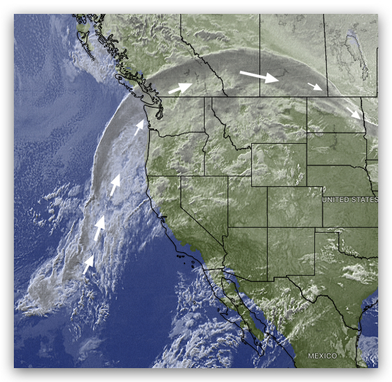
West Coast Wind Blog: by Mike Godsey: Baja daily human forecast Questions about the forecast: Mail me mgodseywf@gmail.com This satellite image from 7 AM this morning clearly shows the clouds being carried by the upper ridge that is drifting into Canada. Yesterday this ridge was over the northern USA where it has been…

West Coast Wind Blog: by Mike Godsey: Baja daily human forecast Questions about the forecast: Mail me mgodseywf@gmail.com Many thanks to the people who requested the continuation of the daily Baja blogs. Unfortunately, with the season slowly ramping down for most tourists, there were not enough requests to justify working on a blog…

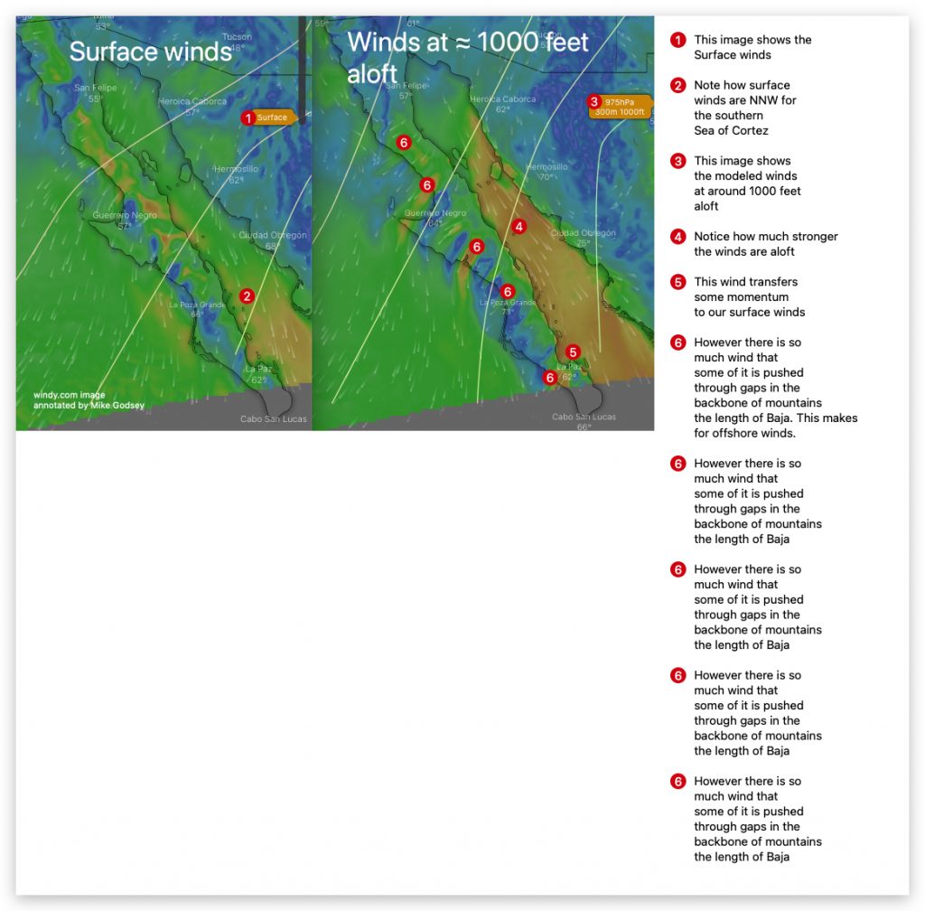
West Coast Wind Blog: by Mike Godsey: Baja daily human forecast Questions about the forecast: Mail me mgodseywf@gmail.com The peak of the Baja season is ending with fewer people coming down in March. Meanwhile, I am getting busy doing the Southern California & Central California coast forecasts and soon the San Francisco Bay…

West Coast Wind Blog: by Mike Godsey: Baja daily human forecast Questions about the forecast: Mail me mgodseywf@gmail.com The peak of the Baja season is ending with fewer people coming down in March. Meanwhile, I am getting busy doing the Southern California & Central California coast forecasts and soon the San Francisco Bay…

West Coast Wind Blog: by Mike Godsey: Baja daily human forecast Questions about the forecast: Mail me mgodseywf@gmail.com Nature always has killers. This porpoise near the Hot Springs had a fatal encounter with a shark. Likewise the fabled reliable wind of Baja’s East Cape often has wind killer lurking to the north and…


