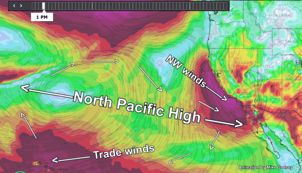
This winter we have seen the third year of a El Niño climate pattern. Indirectly this has often caused the average size and location of the North Pacific High to be atypical. Much of the winter the NPH has been larger, further northward and closer to Baja California than average. This first image shows the…
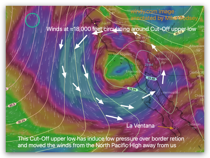
Today’s mild winds in the El Sargentoto Los Barriles corridor are due to a Cut-Off upper low in the upper-level winds that circulate around the world from mostly west to mostly east. Normally these winds loop North and south as they travel steering the surface weather systems and surface winds. Occasionally one of the southward-extending…
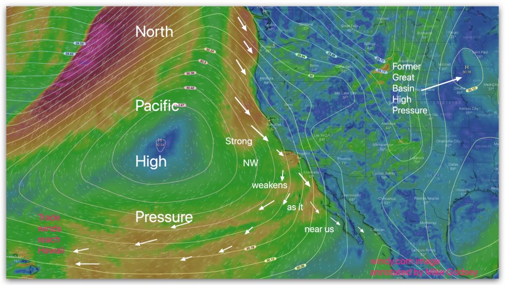
The image below shows the area from Hawaii to Alaska to Baja to Iowa. Today the huge North Pacific High you see in the Pacific only delivers mild NNW winds to Baja’s East Cape. But over the next several days part of that high-pressure buds off and forms a larger high pressure over the Great…
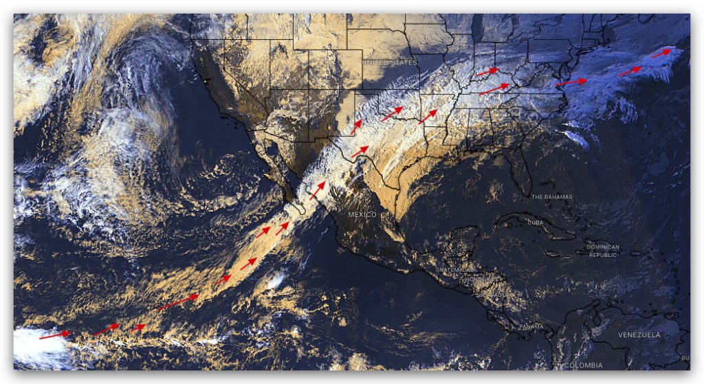
It was a dismal wet day for El Sargento, La Ventana and Los Barriles wind wise. This satellite imagery at 5:30 PM yesterday Jan. 31, 2023, shows that wind-killing cloud streamer of the subtropical jet stream.
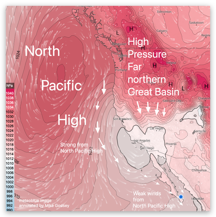
In the image below note the North Pacific centered off the Oregon, USA coast and extending into Baja waters. Also, notice how its winds are far from us. Meanwhile, Great Basin high pressure is centered over Columbia River Basin in the USA. Both are making lots of wind but that wind is about 1000 miles…
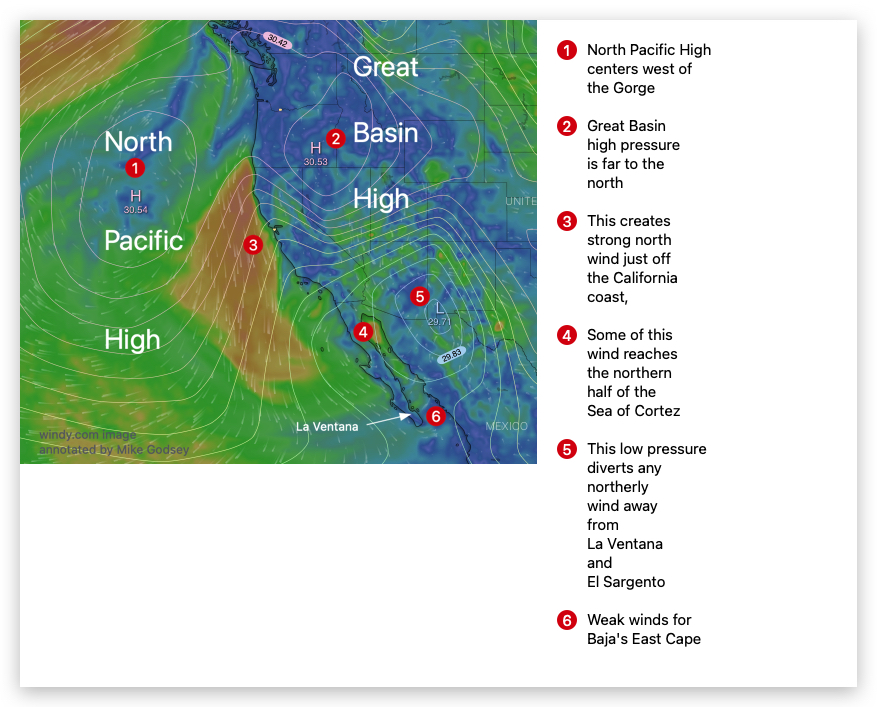
See the image below: Our large-scale (synoptic in geek talk) wind machines take a much-needed vacation today. 1. & 2: Both the North Pacific High and the Great Basin High Pressure drift towards the USA’s Pacific Northwest and send weak wind to La Ventana and Los Barriles. 3 & 4: They do send moderate winds…
This, like last year, has been a great season with mild to moderate wind days most of the time. But you will hear the old-timers, especially windsurfers, grumbling about the lack of big El Norte days that used to be the wind signature of La Ventana and Los Barriles in past decades. Several times each…
Despite the forecast for solid winds at La Ventana and somewhat lesser winds for El Sargento and Los Barriles the winds looked a bit iffy mid morning. Clouds clogged the coastal valleys and the winds plateaued in the mid to upper-teens. Then as you see in this satellite imagery the clouds cleared the Los Planes…
Tuesday, January 17, 2023 Later today the North Pacific High’s moves a finger of high pressure over wind machine’s trigger then fires off Wednesday shooting northerly wind our way for days and days. In meteorological terms, the NPH is pushing a finger of high pressure toward the Great Basin today. Then tomorrow that bit of…
Take a look at my banner photo from my house last year. Notice the near glassy waters near the beach much like today but with low swell. Now notice that dark line. That is called a local sea breeze front. It is the point there the warm air rising from the Los Planes Valley cools…