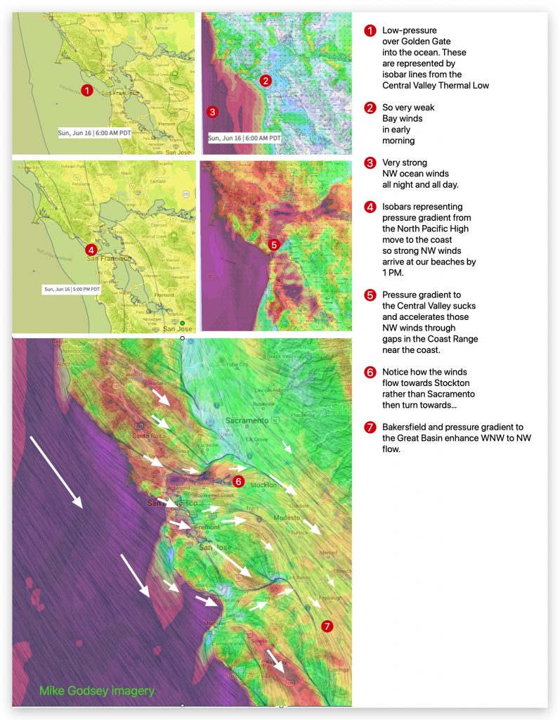
Forecast Jargon Decoder, June 16, 6:59, 2024 Do you find these Decoders useful? Let me know mgodseywf@gmail.com Limp low-pressure from the Central Valley has ballooned out from the Central California over the coast so we are seeing glassy waters below the Golden Gate to Anita Rock. So once again the Crissy wind sock appears in…

Forecast Jargon Decoder: June 13, 2024 Befuddled by all the meteorological jargon in the forecast? This blog gives you imagery of what the forecast is talking about. Let me know if you find this Decoder useful mail me: mgodseywf@gmail.com Very strong winds at most sites north of the Bay Bridge + Flying Tigers/Haskins. 3rd. Ave….

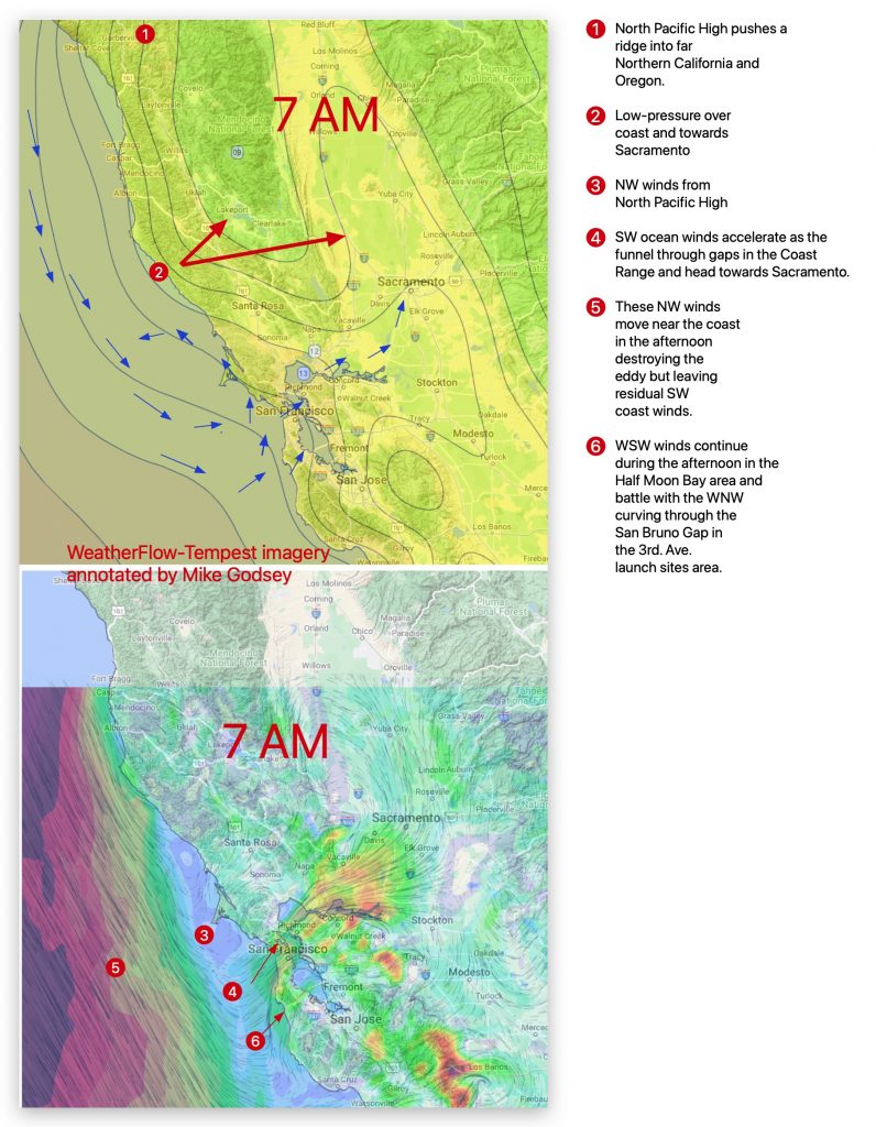
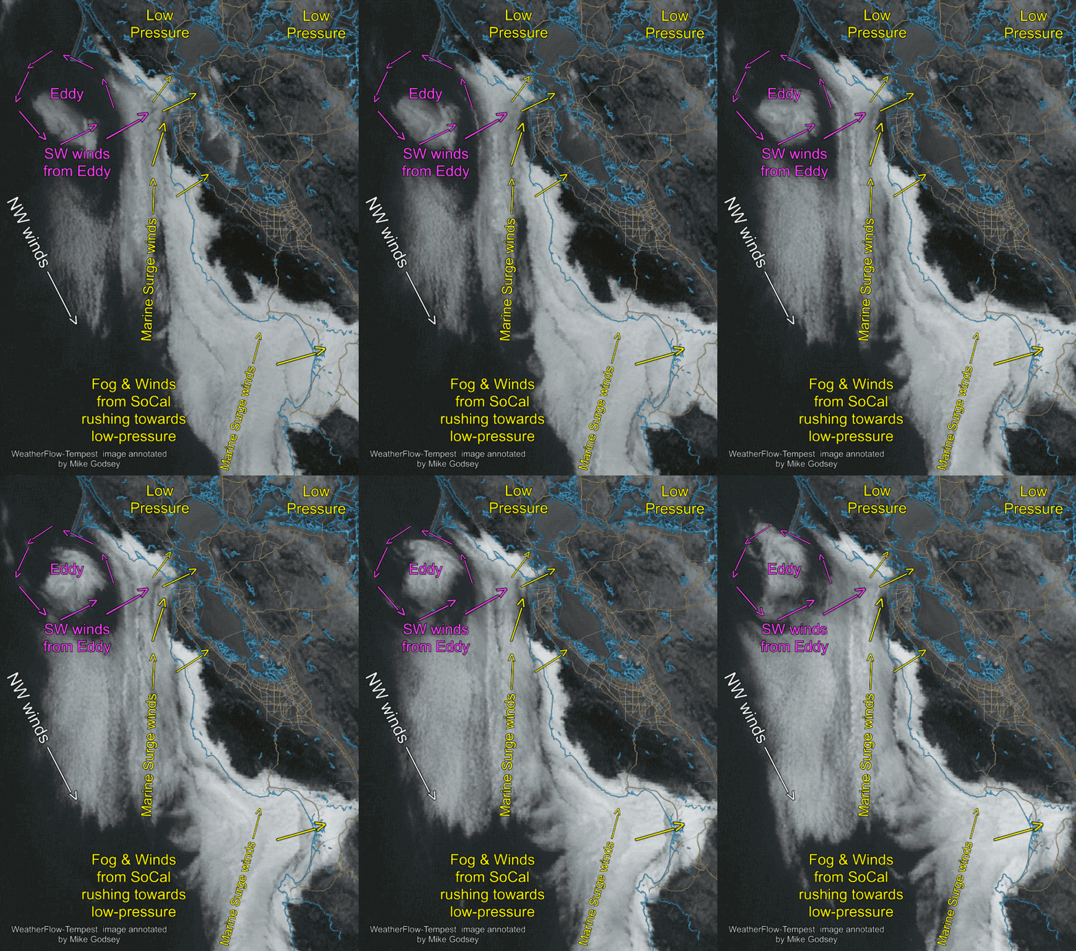
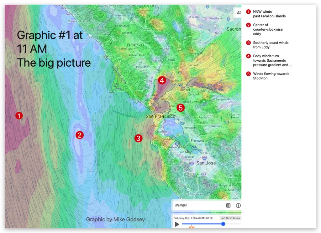
Forecast Jargon Decoder for Friday May, 7, 2024 Wow! That was a strange Marine Surge. Typically a Marine Surge is strong southerly winds flowing from Southern California to a low-pressure in the Marin/Sonoma/Napa and Sacramento area. But today we also had a small counter-clockwise eddy just west of Pt. Reyes that turbocharged the SW winds….

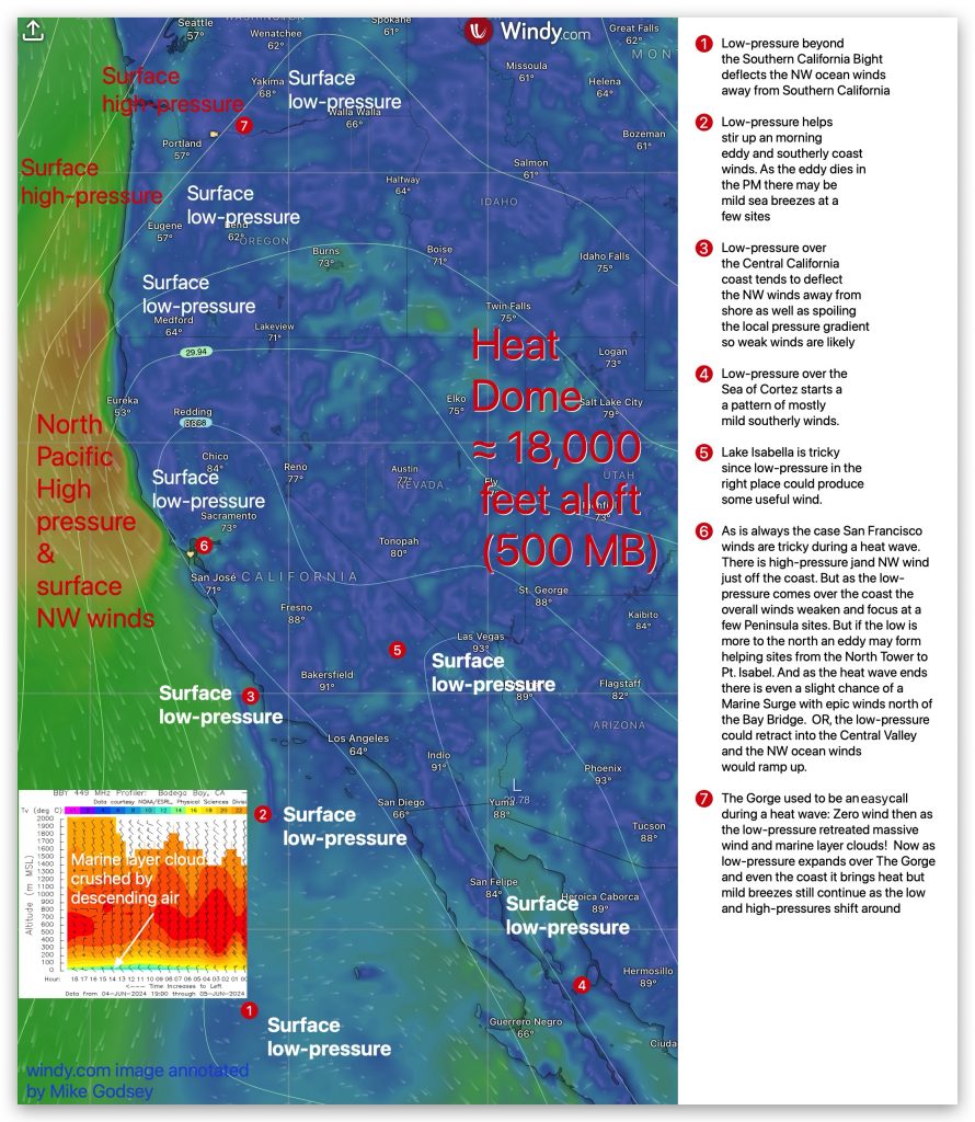
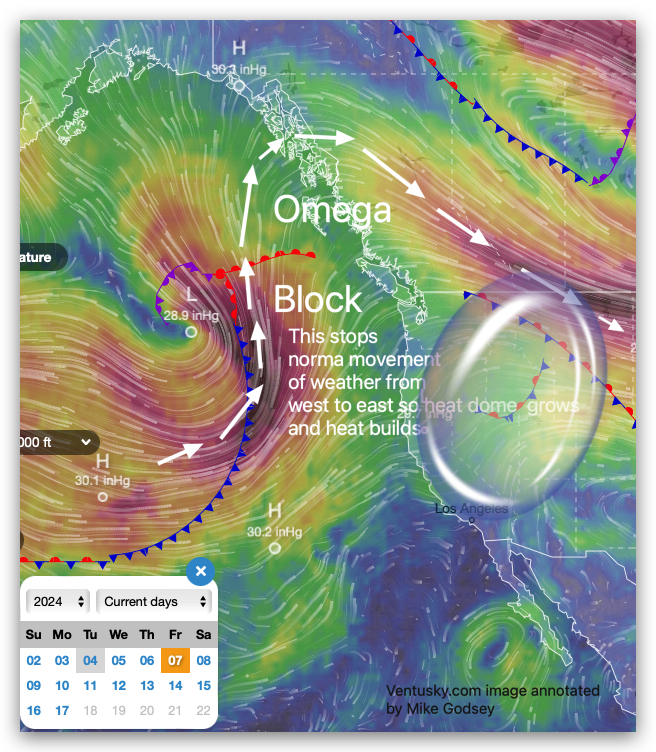
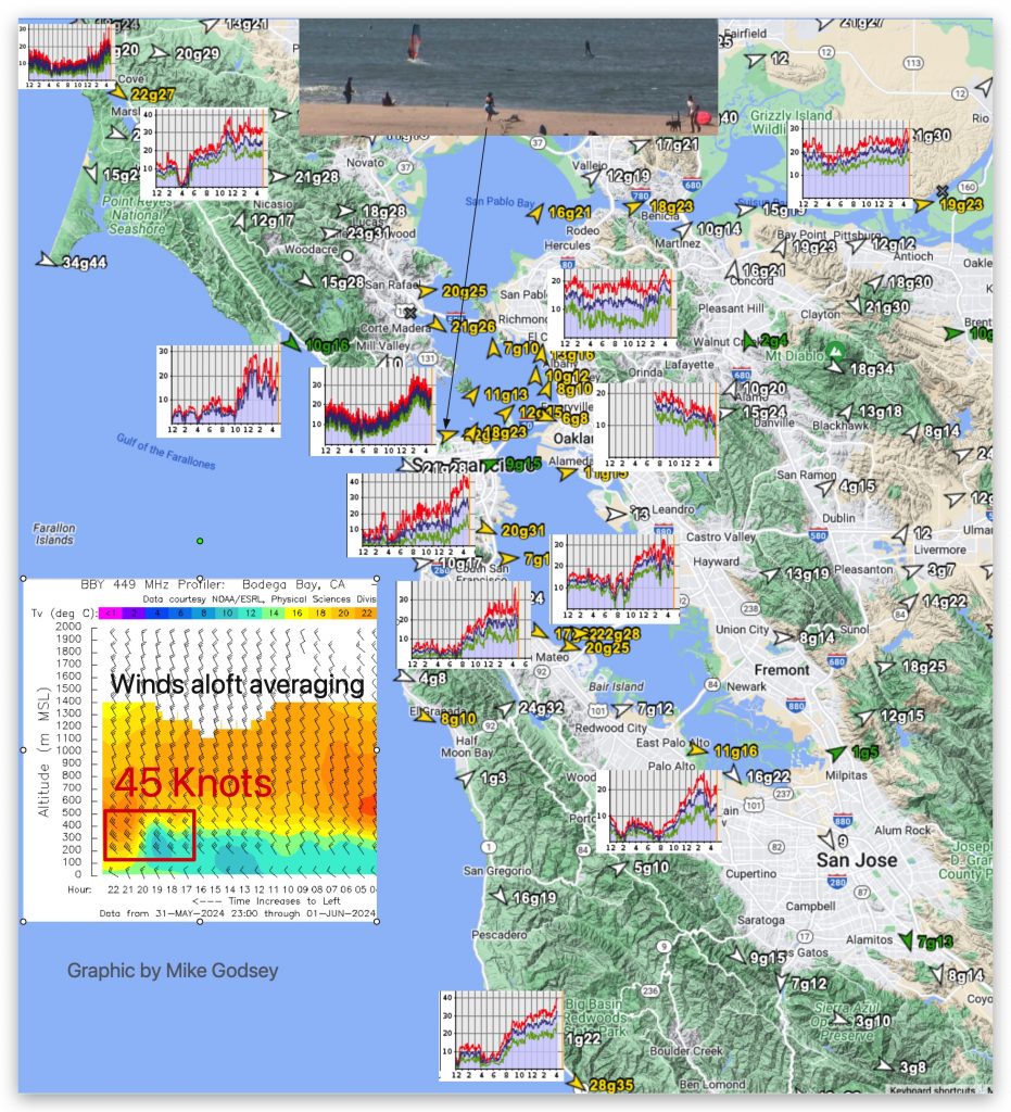
This graphic gives a simple overview of what a heat dome does to the winds at select wind sports venues on the West Coast.

The news is full of dire warnings of a “Heat Dome” over the western USA. You may know that that a heat dome traps hot air in like a lid, causing scorching temperatures. If, not you surely know that a heat dome spells misery. But exactly who does all this happen? And are “Heat Domes” becoming more…

E’nuf Said: Cause & Effect Click here for Cause and look below for Effect:

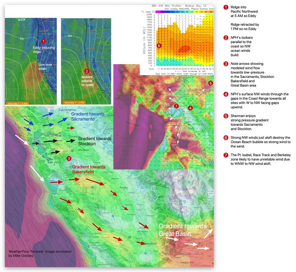
Forecast Jargon Decoder. Saturday, June 1, 2024 Ye Haw! Can you count to 7? It takes that many numbers to bring low to mid to upper 20’s+ winds to the entire coast and most of San Francisco as: 1. Overnight, the North Pacific High retracts the high-pressure ridge that caused the WSW coast eddy winds….

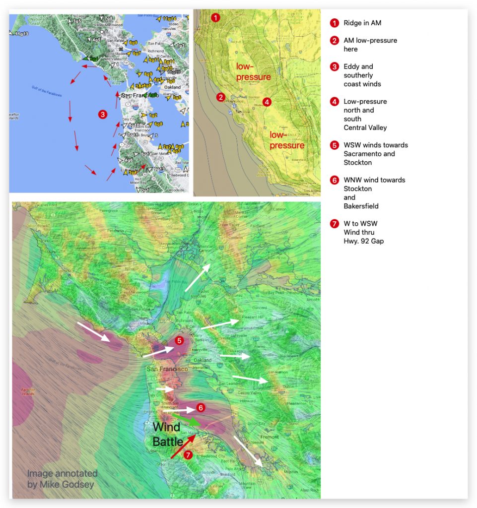
Forecast Jargon Decoder: Sunday, May 26, 2024 1. The North Pacific High pushes a ridge into far Northern California in the AM. 2. This brings a small lobe of low-pressure over the Golden Gate and there is an AM eddy and southerly coast winds. 3. Mid-morning the NPH ridge disappears as does the eddy and…

Thursday May 23, 2024 Todays forecast: Strong Gusty winds Coast, including OB and from Crissy to all Peninsula launch sites and outer waters + R&G and Sherman. The Bodega profiler shows 35 knot NW winds 200 meters aloft while Mt. Diablo is 28g34. This afternoon these winds blast to the surface due to: 1. A…

SFYC J/105 Invitational using sailflow.com 1 and 3 km WF-WRF model
