Mike Godsey
Forecast Jargon Decoder, April 26, 2024
Powerful GUSTY EARLY winds hit Bay from Ocean Beach to Benicia and Sherman Island and Crissy to Palo Alto.
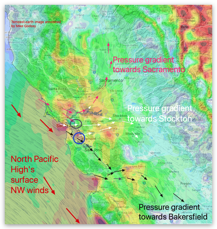
Whitecaps at Anita Rock at dawn foretell the AM story up and down bands of strong wind. Looking at the graphic you can see that this wind develops as:
1. A very large North Pacific High delivers even stronger NW winds to the coast.
2. But the pressure gradient is different than Thursday since it is strongest towards Stockton and Bakersfield.
3. This causes the NW ocean winds to curve into WNW winds as they accelerate through Coast Range gaps and head toward Stockton and Bakersfield.
Use caution launching kites, especially at Stinson, Alameda, 3rd. Ave. and Ocean Beach!