by Mike Godsey
Forecast Jargon Decoder: April 7, 2024
Strong coast winds and GUSTY LATE winds Crissy Beach to Alameda to Peninsula launch sites. Weaker WNW for Benicia, Pt. Isabel, Race Track and Berkeley.
Update: Getting skeptical about the strong wind forecast inside the Bay given the current weak NE
winds? I am keeping to the current forecast since Waddell is gusting to 26 and Bodega Tomales and Stinson are building fast. I suspect the winds will arrive inside the Bay LATER than forecast but still reach forecast values.
From 7:30 AM: I understand that the glassy waters in the Crissy cam and the depressingly low 2g3 wind reports about the Bay might have you suspicious of my strong wind forecast last night. However, a ship west of the US is reporting NW 22, and the precipitous tip of Pt. Reyes has NW 18g22.
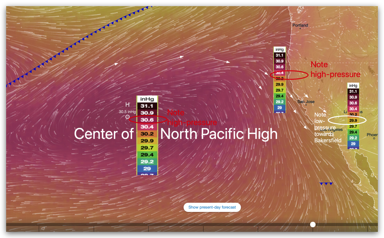
So I am just fine-tuning last night’s forecast and the expected typos: Expect a weird day that starts with North Pacific High thrusting a wind-killing high-pressure ridge over the Bay almost to Salt Lake City, creating weak N. winds just aloft over the greater Bay Area.
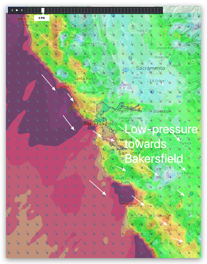
Then ABRUPTLY, the ridge retracts in our area, so strong NW ocean winds ramp up along the coast, reaching the upper-teens to low 20’s+. The max pressure gradient to the Central Valley is focused towards Modesto to Bakersfield which sucks those NW oceans winds into the Bay towards the SE with GUSTY upper-teens to low 20’s winds in the mid Golden Gate to the Climbing Wall to Almada to the Coyote and 3rd. launch sites and Palo Alto. Upper-teens WNW winds for Pt. Isabel, Race Track and Berkeley.