Mike Godsey
“There is no North Pacific High this spring” (heard on the beach at Crissy Field)
Are you are an avid West Coast surfer, kiteboarder, windsurfer, winger or sailor or just love to watch huge surf?
Then you love the NW clearing winds and waves from the North Pacific High that commonly follow a spring storm.
The typical pattern is for a day or two of southerly winds and rain which taper off leaving California with weaker and less reliable winds until the next storm approaches. Lets take a deeper look at storm winds.
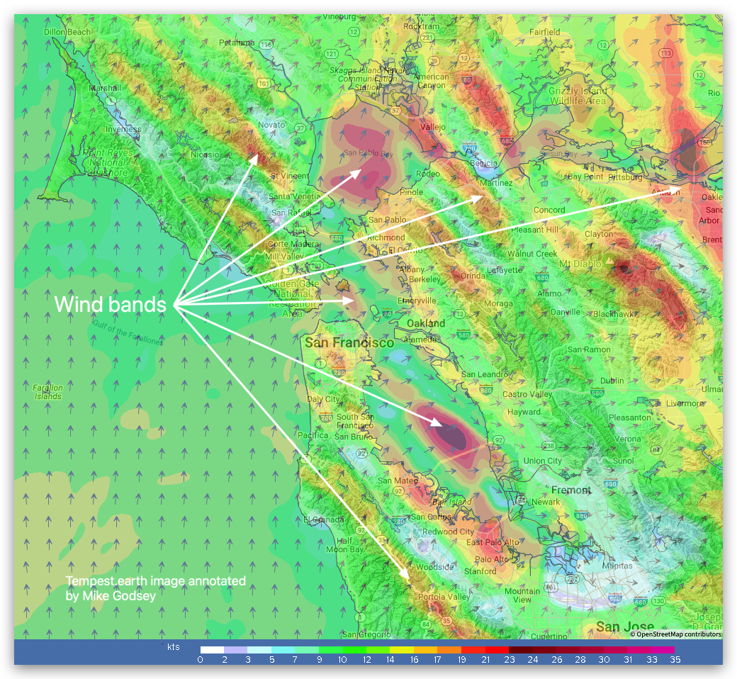
Southerly Storm Winds: As a storm approaches the clouds increase and bands of showers and
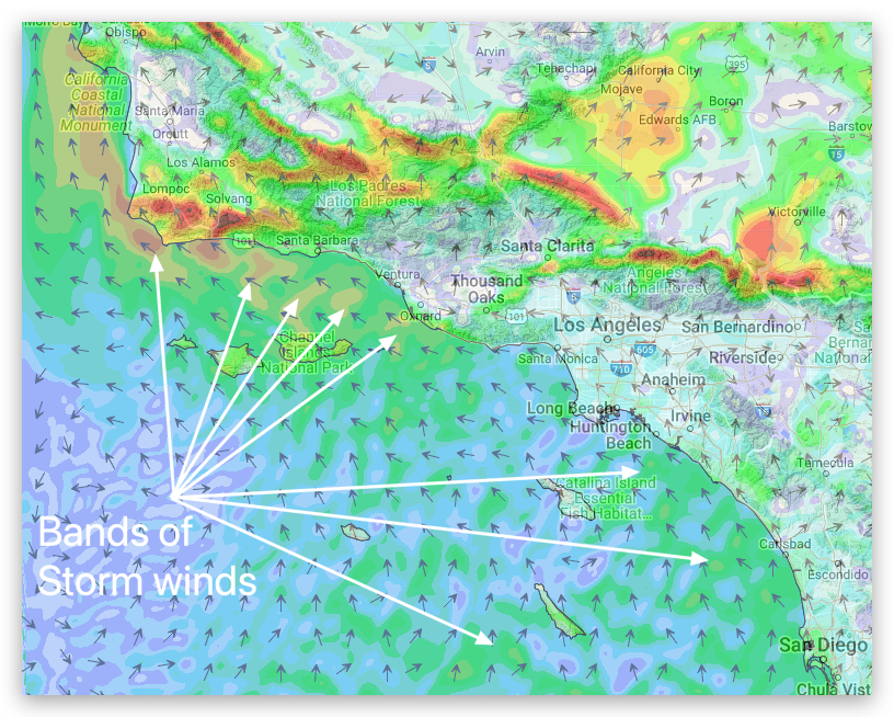
rain sweep over the San Francisco Bay Area and Southern California. This is especially clear on the ridge tops. Typically we see bands of unreliable southerly storm winds that blow for about a day or two and are usually unreliable at most launch sites.
So the obvious question is “Where does the North Pacific High and its NW winds go when southerly winds rule the coast of Southern California and the San Francisco Bay Area?”
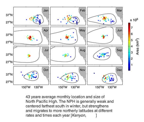
Winter: As winter storms frequently roll across the Pacific and hit California the North Pacific High retreats southward to the latitude of Baja for days to weeks to months. From that location it contributes to the Sea of Cortez’s famed El Norte winds. This graphic shows the average monthly location of the NPH over 43 years. It is worth noting that the North Pacific High’s average location has changed in the last 2 decades which has mostly negatively impacted Baja, Southern California, San Francisco and Gorge winds.
Spring: In spring storms are less frequently and often have a more northerly track.
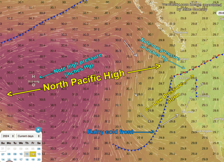
This image shows a typical spring storm scenario. Notice the North Pacific High, represented the red and clockwise winds, has been bumped away from the coast. Especially notice the modeled pressure readings in black that define the NPH. Then notice the low-pressure area and counter-clockwise storm winds in the yellow area and lower pressure readings.
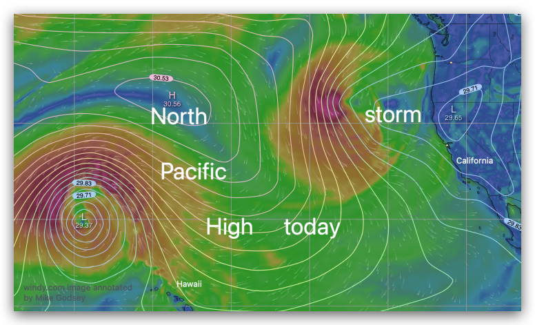
Notice that there are still NW winds from the North Pacific High but they are far west of California as the entire NPH is bumped away from the coast by the low-pressure storm and its associated upper level winds. Now, can you imagine why the North Pacific High’s easterly Trade Winds often improve when California loses its NW ocean winds?
Now imagine if a whole string of storms are inbound across the Pacific? Next, can you figure out why we have winter forecasts for Baja, Then start early spring forecasts for Southern California, them mid spring forecasts for the Bay Area and late spring forecast for The Gorge?