By WeatherFlow meteorologist Shea Gibson. My latest tropical update 9/26/16 at 10:00PM: Stay safe! Shea Gibson WeatherFlow Meteorologist SE Region/East Coast/Tropics Outreach & New Weather Station Projects Twitter: @WeatherFlowCHAS
By WeatherFlow meteorologist Shea Gibson Talk about unsettled weather in the SE Region… You can easily see a temperature difference and cloud line in NC, but there is quite a bit going on here: Screenshot of the GRE image by Daniel Cawley of the Foothills Weather Network in Burke County, NC. You can see the warm…

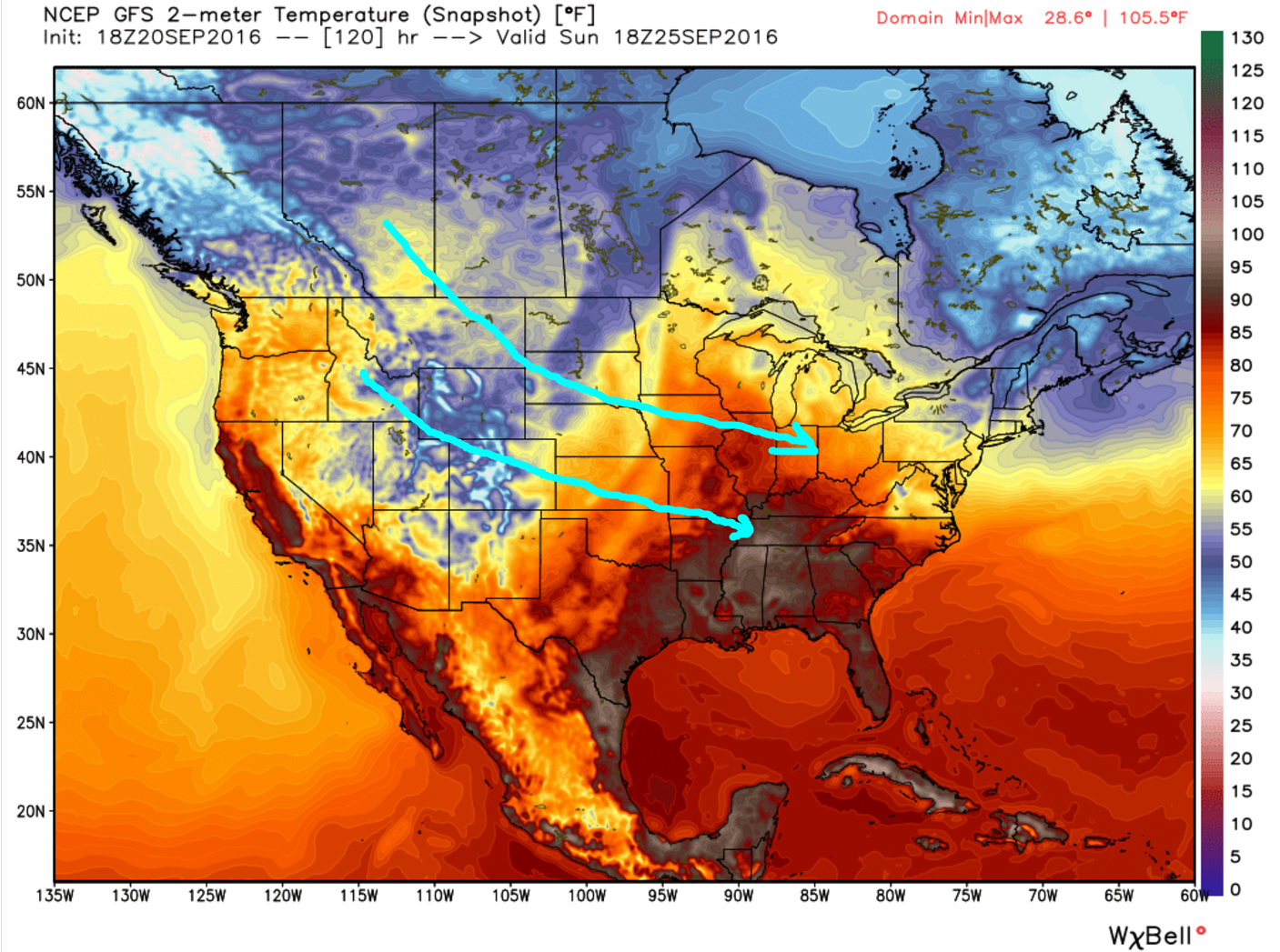
By WeatherFlow meteorologist Shea Gibson 9/20/2016 The Polar jet is starting to show a couple of strong dips from the north as we head into fall. Two Rossby waves (jet stream dips) are shown forming here that creates what is called an “Omega Block” Ω – this shows two upper Lows pinched off in the…
By WeatherFlow meteorologist Shea Gibson Latest look at the tropics: Stay safe out there! Shea Gibson WeatherFlow Meteorologist/Wind Forecaster SE Region/East Coast/Tropics New Stations Projects & Outreach Twitter: @WeatherFlowCHAS
by WeatherFlow meteorologist Shea Gibson Here is my 7:00PM tropical update on Invest 99L. Shea Gibson WeatherFlow Meteorologist/Wind Forecaster SE Region/East Coast/Tropics New Stations Projects & Outreach Twitter: @WeatherFlowCHAS

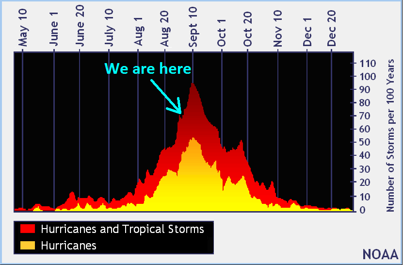
by WeatherFlow meteorologist Shea Gibson As we head into the last half of August, we typically begin to see the Atlantic basin become more active along the ITCZ (Intertropical Convergence Zone) and other areas such as the Caribbean and Gulf of Mexico. Right now there are 3 areas being monitored as activity has ramped up…

By WeatherFlow meteorologist Shea Gibson 8/14/16 There has been quite a unique optical phenomenon occurring along the SC coast lately with reference to sunrise and sunset beams stretching across the sky. I witnessed a somewhat rare catch Friday morning over Charleston, SC as sunbeams appeared not only at the sunrise horizon, but over the opposite side…

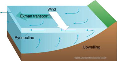
By WeatherFlow meteorologist Shea Gibson 7/26/16 We are seeing a couple of cold pools along the northern OBX NC coast right now known as a “Cold Water Upwelling” event. This is a normal occurrence that shows in small spatial scales along the middle and northern Outer Banks of NC when we see surges or prolonged periods…

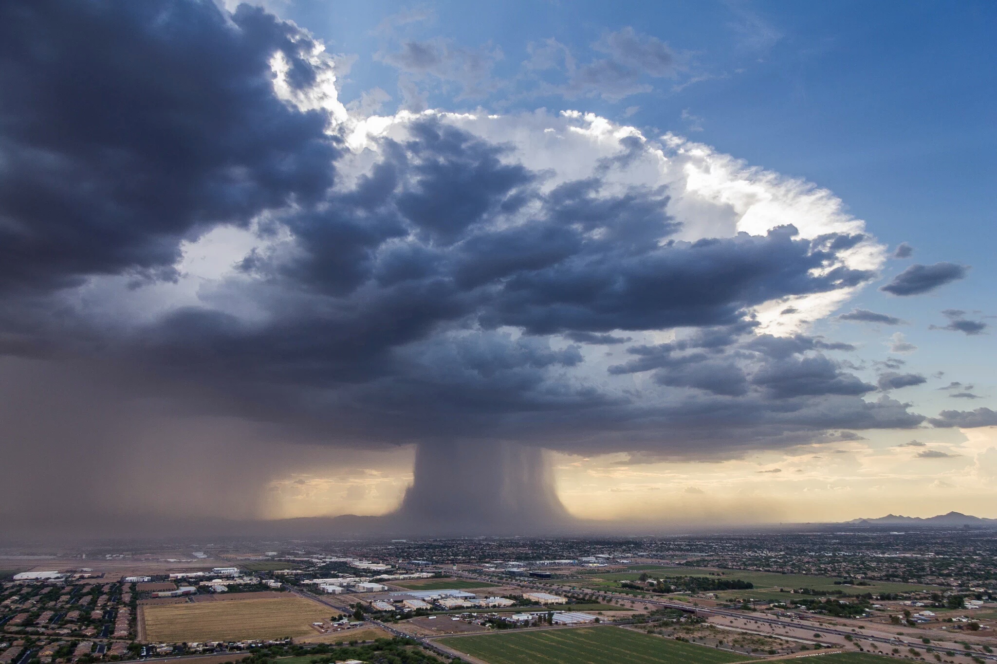
By WeatherFlow Meteorologist Shea Gibson Ever been in a thunderstorm and a sudden burst of strong winds and rain comes down at the same time? This is called a “wet microburst”, which packs quite a punch when it comes to the strong winds associated with them. They can be particularly dangerous for airplanes and can…

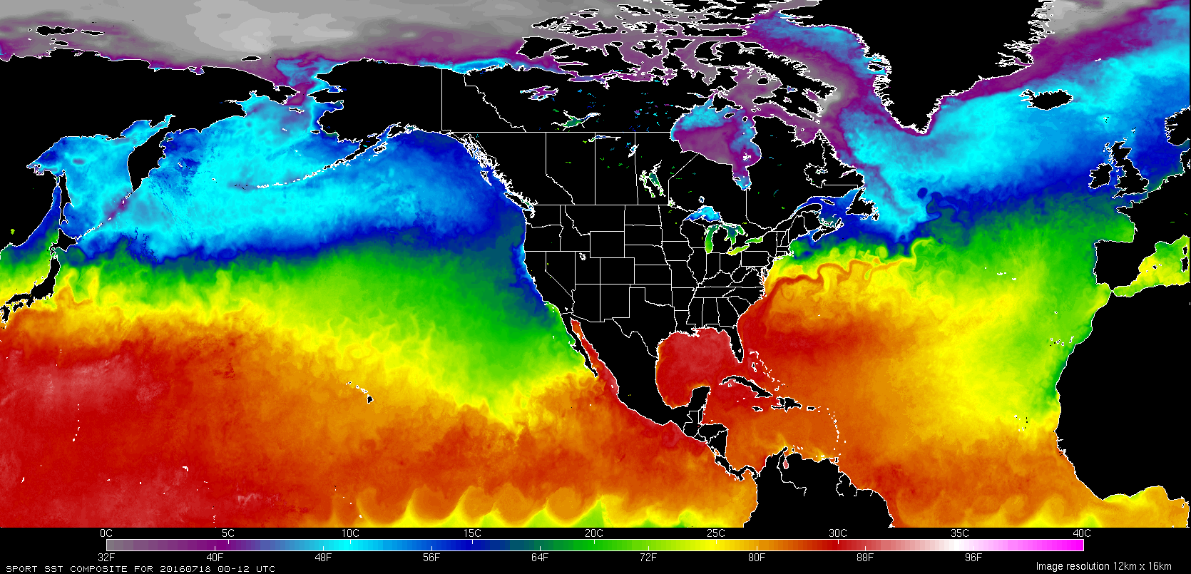
By WeatherFlow meteorologist Shea Gibson Written on 7/18/2016: Tropics Update: We started the late spring somewhat active along the SE United States and western Caribbean for the Atlantic Hurricane Season 2016. Don’t forget – we had an early storm in the eastern north Atlantic in January, which was Hurricane Alex (and still our strongest so…

