West Coast Wind Blog: High pressure in the USA takes today off but… tomorrow!
by Mike Godsey: Baja daily human forecast TODAY and TOMORROW in 2 images. TODAY: TOMORROW!
by Mike Godsey: Baja daily human forecast TODAY and TOMORROW in 2 images. TODAY: TOMORROW!
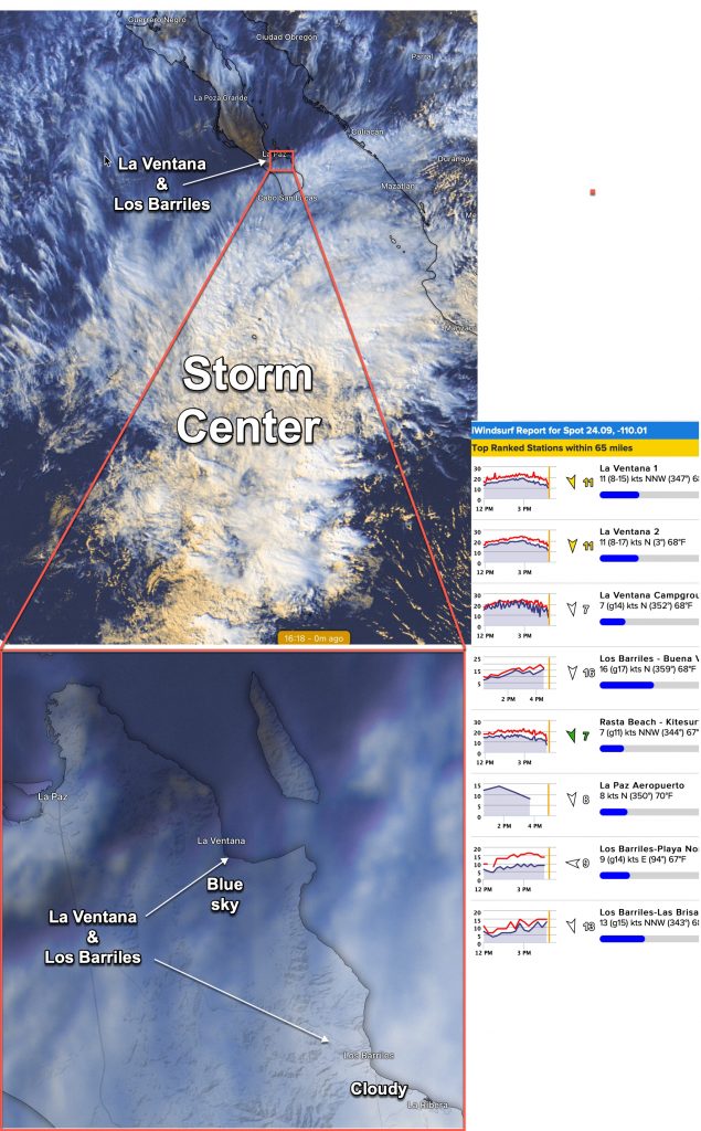
I am sure that at 10 AM yesterday everyone who reads this forecast in La Ventana and Los Barriles were convinced that all my caveats about clouds spoiling the upper teens to low 20’s forecast were correct. The waters were calm and clouds everywhere. But like magic the skies mostly cleared for La Ventana and…
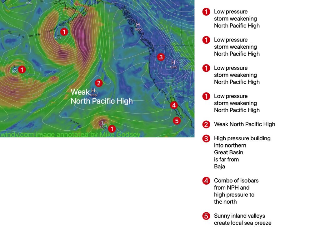
by Mike Godsey: Baja daily human forecast How to use our NEW RASTA BEACH SENSOR north of El Sargento! This is what I call a combo day. All of the factors that make wind for Baja’s East Cape are weak. But they act in concert and COULD bring a moderate winds day. BUT… As this…
by Mike Godsey How to use our NEW RASTA BEACH SENSOR north of El Sargento! Common sense would suggest that after such strong northerly wind Friday today would be at least a moderate northerly day. As usual common sense is wrong. Instead, we are likely to see mild SE winds. In science, it often helps…
by Mike Godsey, Link to daily Baja forecast
by Mike Godsey, Link to daily Baja forecast My forecast barely came true yesterday for La Ventana and Los Barriles as blue skies appeared and the forecast winds briefly moved from the outer water wind line to the shore. Look carefully at this satellite imagery from about 10 am yesterday and you can see the…
by Mike Godsey, Link to daily Baja forecast 9 AM update with satellite imagery of today’s clouds at bottom First, the good news! Due to the generosity of John Salow and some work on his and my part and the support of the great folks at Kitesurfing Planet the Weatherflow.com network has added a beach…
by Mike Godsey, Link to daily Baja forecast Very mild steady winds Tuesday but Wednesday winds build up a notch as the North Pacific High buds of a high pressure that moves towards the 4 corners by Thursday. While some models say only mid-teens for La Ventana Wednesday this model captures the effect of heating…
by Mike Godsey, Link to daily Baja forecast Sometimes really big El Norte winds are crazy gusty. Other times they are just mildly gusty. There are 2 basic reasons for gusts. 1. Surface wind flowing around or over mountains and points often becomes turbulent creating eddies and waves that your wind or kite experiences as…