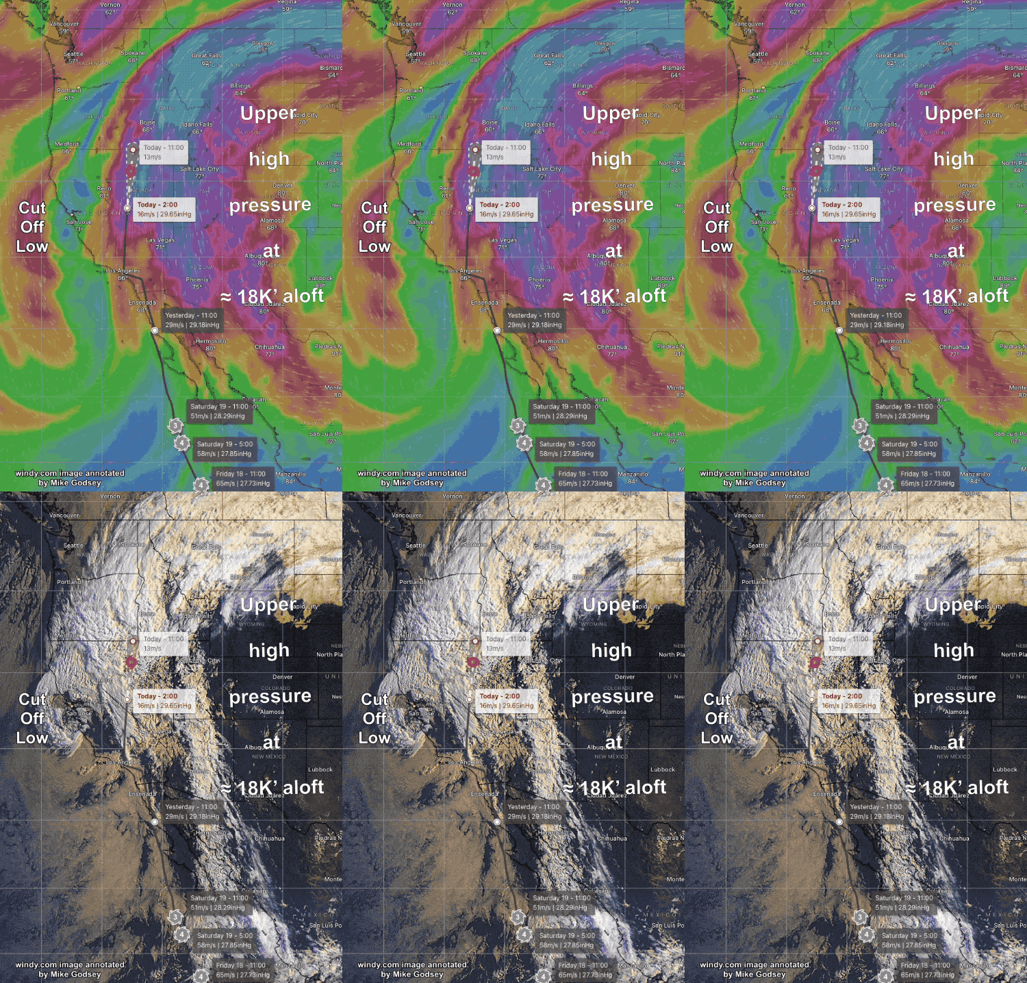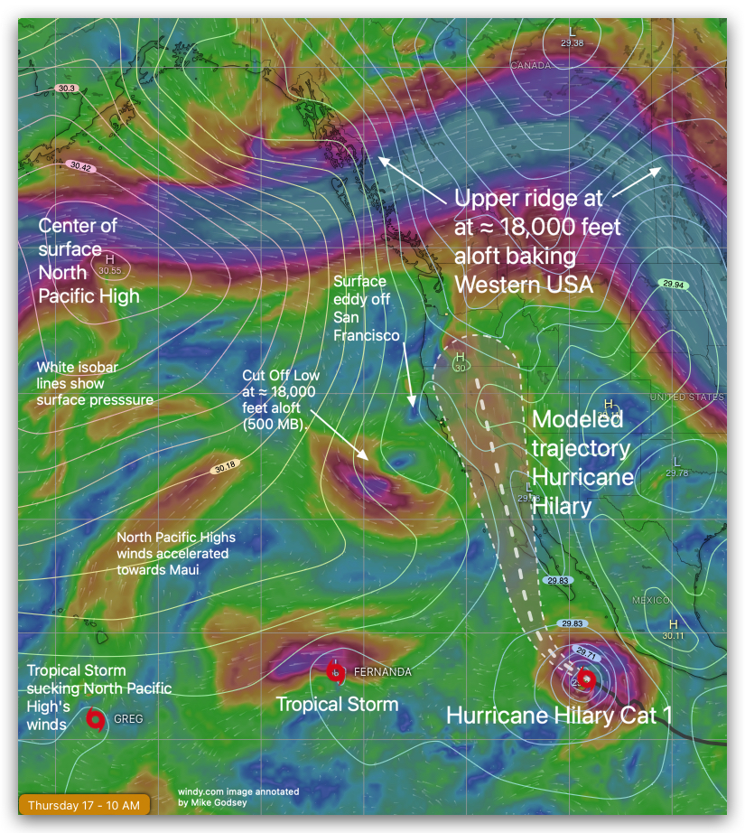
From 7:30 AM: Let’s play Meteorology 101! Which sites will be windy today! coast. 2. Zoom in to the Pacific off California and notice the spiral off Oregon. That is the Cut Off Low that is deepening our marine layer and making southerly wind for the far Northern California coast. 3. Now look south of the…

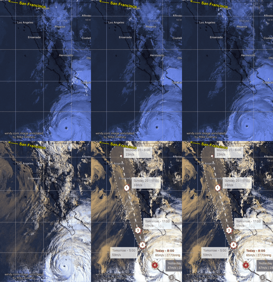
Hurricane Hilary had a very atypical trajectory and strength as it neared Baja Norte and Southern California waters. And today, August 21, moisture from Hilary is high in the atmosphere spreading clouds over large parts of California, Oregon, Washington, Idaho, Montana, North Dakota, South Dakota, Minnesota, Wisconsin and Michigan. Hilary’s rain set all-time records for…

Have you noticed that the wind and weather patterns seem to be getting more extreme? This Sunday, August 20, most models are forecasting weather events that are quite unusual. How unusual? Well, compared to historical data, the modeled trajectory of hurricane Hilary’s remains, as it dies, carries it right up the California coast past Southern…

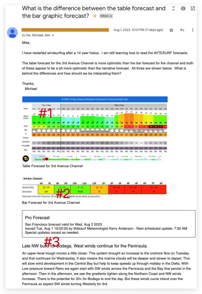
Hi Michael, Welcome back to the sport! Skip to the bottom of this blog for the fast answer to your question. Background: 3rd. Ave. is one of the most complex places in the Bay Area to forecast. It is fed strong ocean WNW to NW wind from the San Bruno Gap and usually weaker W to…

In many places in the San Francisco Bay Area, wind forecasting is difficult. But the most frustrating place for meteorologists and customers is the winds between the San Mateo Bridge channel and the shoreline near the 3rd. Ave. shoreline. Windsurfers, kiters, wingers and kayakers call this area the zone between the 3rd. Ave. launch sites…

These e-mails, forum posts and images are good example of how I learn to improve my San Francisco Bay Area forecasts.

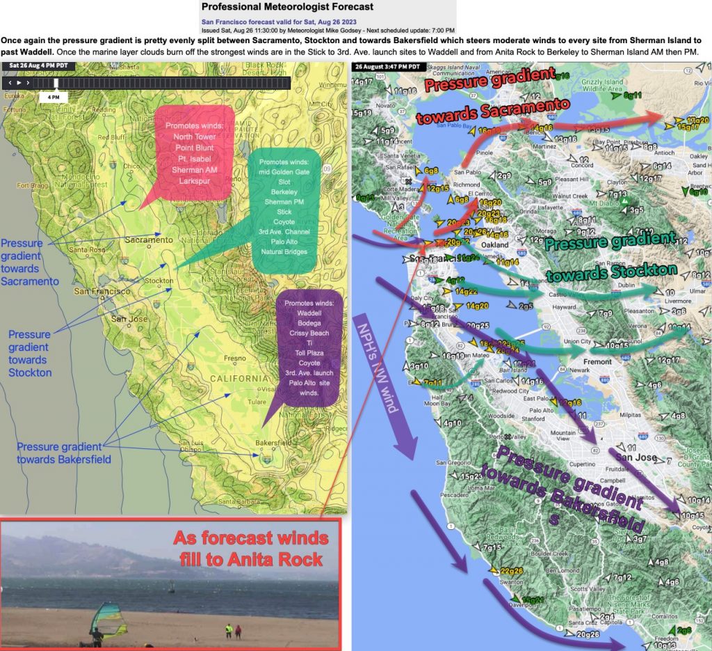
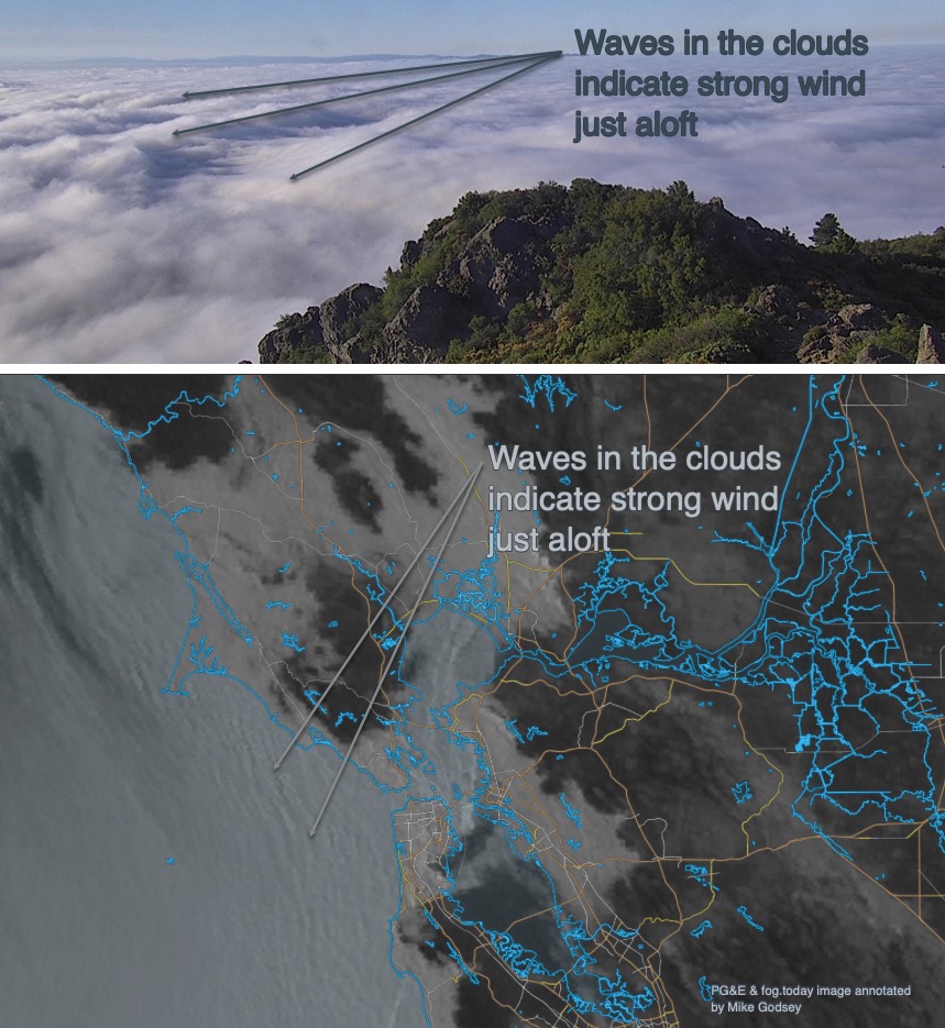
Two of the most useful tools in San Francisco Bay Area wind forecasting are satellite imagery and cam imagery. Unfortunately, using these tools effectively is partially an art. It requires years of practice and even then, you have the foreknowledge that the writing in the fog may change radically by the afternoon. These images and…
