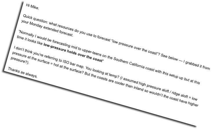
Hi S—–,
Normally the surface air is much cooler than the air above the inversion so denser and relatively high-pressure. But subsiding air from the upper high-pressure is crushing the marine layer clouds so we have very warm air over the coast and just above the surface. Since the models only look at select elevations like surface, 975

mb etc they can usually pick up this lower pressure over the coast. But I also look at the modeled temperatures along the coast and just offshore to make the statement.
Here is the NAM 3 for today. I have not done the Southern California forecast yet today so I don’t know if I agree with my graphic yet.