My forecast day got off to a great start. Waking up at 5AM, I had lots of time to work up a great San Francisco Bay Area forecast. This was earlier than my usual start time but a was excited since it was the first day of my Thursday-Sunday shift.
There is just one major problem with such an early start.
It is too dark for the regular satellite imagery to see the fog critical to Bay Area winds.
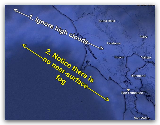
So at 5 AM, the satellite image looked like this first image. The high clouds show clearly since their temperature is much cooler than the surface.
But fog inside the Bay was not visible in part because it was so early and in part due to the high clouds. But this was no problem since there are so many cams I could use to map out the fog distribution.
But I could not see the fog along the coast and offshore.
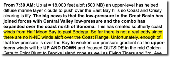
All the models suggested a hint of an eddy that would quickly die.
With the North Pacific High’s surface NW winds far from shore, the coastal sensors showed what I expected… weak southerly coast winds since the max pressure gradient was towards Sacramento.
So after looking at all the other data, I issued this 7:30 AM forecast above explicitly saying there was no sign of a “real eddy”.
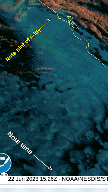
What is embarrassing about this forecasting is that the GOES-West satellite Night Microphysics animation clearly showed the eddy even at 4 AM.
I simply did not check that tool before I issued the 7:30 AM forecast.
Why?
I was lazy and hungry for breakfast plus none of the models showed an eddy.
Plus, I did not think through what it meant that there was no visible fog in the Bodega area in the regular satellite. ie. there could be an eddy but I simply could not see it!
If I had looked at the Night Microphysics animation I would have noticed that it was clearly showing a building eddy in the water vapor near Bodega even though there was no visible fog yet.
There is a good ending to this story.
I try to watch the Bay Area off and on during the morning so I can post a “Special Update” if i see something unexpected that will impact the wind.

And by 10:30 AM, I was seeing this in the visible light satellite imagery.
A fog bank was moving rapidly towards the coasts from the SW.
And as it reached the Bodega area one could FINALLY see that an

eddy had developed and was sending strong than expected WSW winds toward the Bay Area.
So, quickly issue this “Special Update” Then at 11:30 AM I issued a major change in the forecasting upgrading the Larkspur, Pt. Isabel and Berkeley wind while really downgrading the Crissy, Coast, and Crissy winds.
To try to prevent this type of mistake in the future, I try to do an autopsy of my forecast. Then I issued a “BackCast” that night and the next morning. Hopefully, that engraves in my mind what to do to avoid that mistake in the future and also tells customers that we care about our mistakes. Part 2 of this blog covers the results of my autopsy and my “BackCast.”