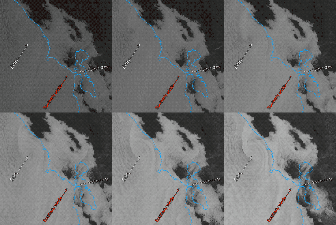
I am sticking to current forecast as the larger eddy expected Sunday begins brewing 12 hours early! Wind Recipe: 1. A small eddy off Golden Gate is creating southerly coast winds and has pushed the marine layer far inland. 2. This eddy probably lingers so residual S. coast winds from Waddell to Bodega. 3. Meanwhile,…

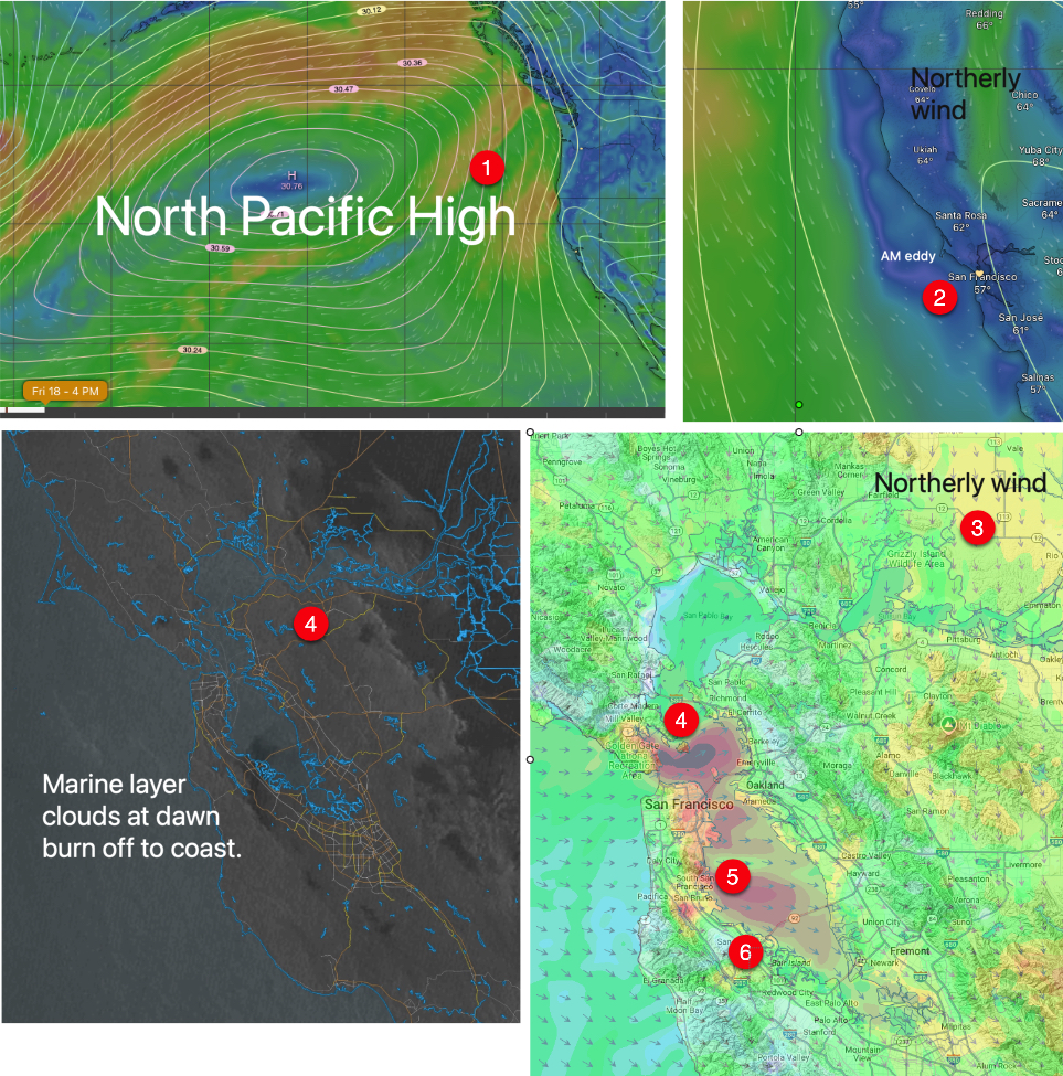
Todays Wind Recipe: 1. A 3000-mile wide NPH already has NW to W wind tickling coast sensors. 2. This kills the eddies southerly coast winds. 3. N. Central Valley wind weaken the Sacramento gradient while enhancing the Stockton and Bakersfield gradient. 4 As the clouds burn off this causes W. ocean winds to curve &…

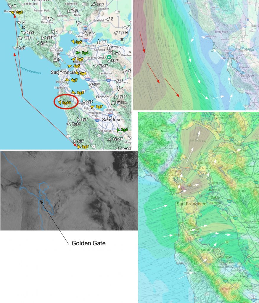
As clouds pull back Sherman blows then Pt. Isabel and Marin followed by TI then North Tower and Tigers. Today’s Wind Recipe: 1. Southerly coast winds continue from Bodega to past Waddell as low-pressure lingers over the coast from Oregon to the North Bay. (Who can figure out why Half Moon Bay has NW winds?…

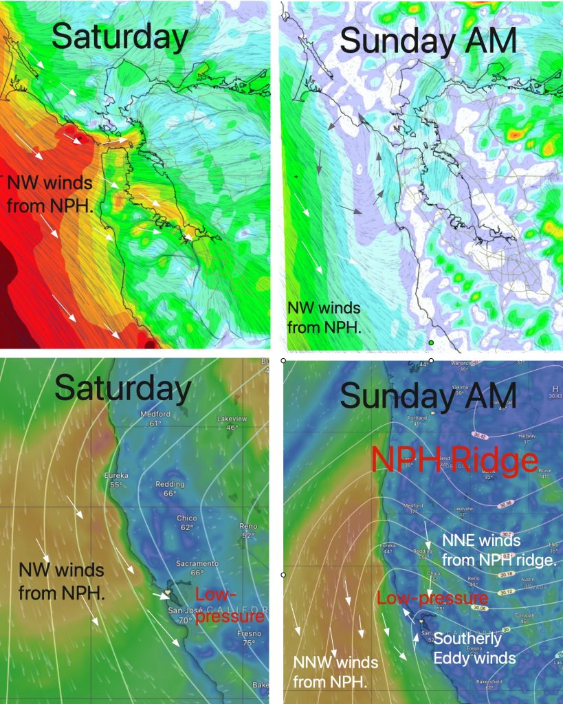
Todays Wind Recipe: Full Human forecast. https://wx.ikitesurf.com/proforecast/2 1. As expected, the NW ocean winds at our ocean buoys have plummeted to the sub-teens and we have weak southerly eddy winds from Waddell to Bodega. 2. This occurred as the NPH pushed a ridge into far Northern California and NE winds developed aloft creating an eddy….
Yep, it is a conspiracy. The fat cat surface weather machines They all follow the dictates of their climate overlord, the jetstream and its northward migration of the upper troughs and upper ridges winds that steer the surface wind machines. The why behind this annual migration is beyond the scope of this blog but let’s…
It is unusual for my Baja forecast to mention a “Red Tide,” but a recent Facebook thread had folks worried about water contact, so I posted the following. As a long ago marine biologist who spent years in the Sea of Cortez I would guess it is Noctiluca scintillans. Noctiluca is a dinoflagellate, a type…
YeeHaw! EARLY, STRONG, GUSTY El Norte winds everywhere. But winds are strongest south of Los Barriles to Cabo Pulmo. Bottom Line: Winds in the low to mid-20s are filled with gusts and lulls, especially near shore. The strongest winds are south of Los Barriles. Today’s Wind Recipe: Grandpa’s FAVORITE! 1. Add a big dollop of high-pressure…

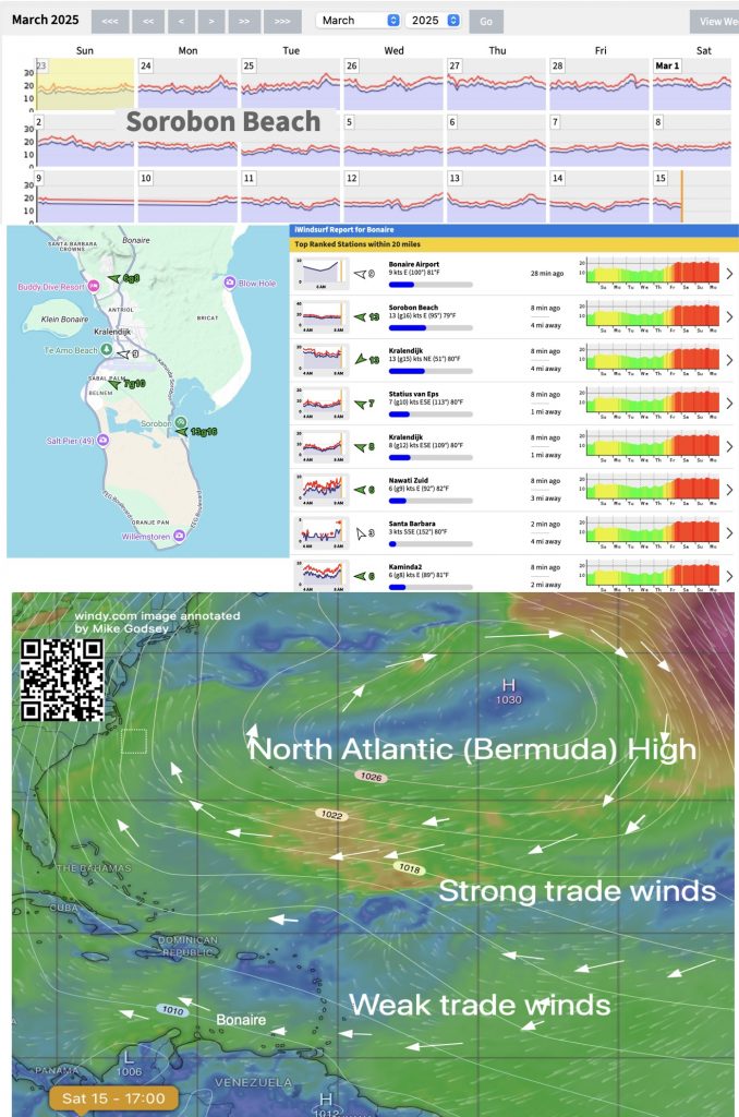
If you look at the ikitesurf.com/iwindsurf.com sensor at Sorobon Beach on Bonaire and click on the Archive link the wind graphs will confirm what you have probably noticed. The easterly trade winds have been a bit weaker than usual in recent days. Most of the wind in Bonaire comes from the North Atlantic High Pressure,…

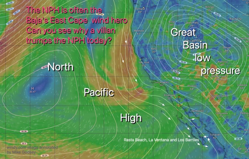
The NPH is often the Baja’s East Cape wind hero Can you see why a villain trumps the NPH today?
This year most of our wind on Baja’s East Cape has been a combo of mild local thermal winds and moderate large scale winds. In past decades most of that large scale winds originated in the 4-Corners region of the USA and roared down the Sea of Cortez with a N to NNE angle. That…
