Sometimes pictures tell the story better than lots of words. Usually, in the San Francis Bay Area, Central Coast and Southern California the winds are very different at different sites but today almost every site sees stronger than typical winds. Take a look at the model forecast for the Bay Area today at 4 PM….
Until 25 years ago summertime eddies off the Golden Gate were uncommon. Since then these counterclockwise air masses have become increasingly common and some summers they are a dominant force in determining the wind distribution in the Bay Area. This increasing eddy pattern is associated with the increasing frequency of the North Pacific High developing…
Last week there was somewhat atypical weather and winds for the San Francisco Bay Area, Southern California and the Columbia River Gorge. The Gorge saw very frequent blue skies and warm dry air plus westerly winds. Southern California saw many days of strong NW wind that curved into the coast. While San Francisco saw a…
Many coastal locations around the world have weak morning land breezes that blow from inland towards the ocean followed by local sea breezes that blow from the sea towards the land. The AM winds are caused by the land cooling overnight making for denser high-pressure air compared the warmer air over the water. Then as…
This La Nina year has brought exceptional winds to Baja’s Sea of Cortez. Typically the winds in the El Sargento Los Barriles zone is an everchanging mixture of northerly winds from high pressure in the Great Basin and the local sea breezes generated by heating in the local inland valleys. And the only role of…
Yesterday, March 22, saw strong winds in the El Sargento to Los Barriles area. These wind developed as the North Pacific High created a solid pressure gradient down the length of the Sea of Cortez. Today the North Pacific High is in the same location and same strength and continues to send strong northerly wind…

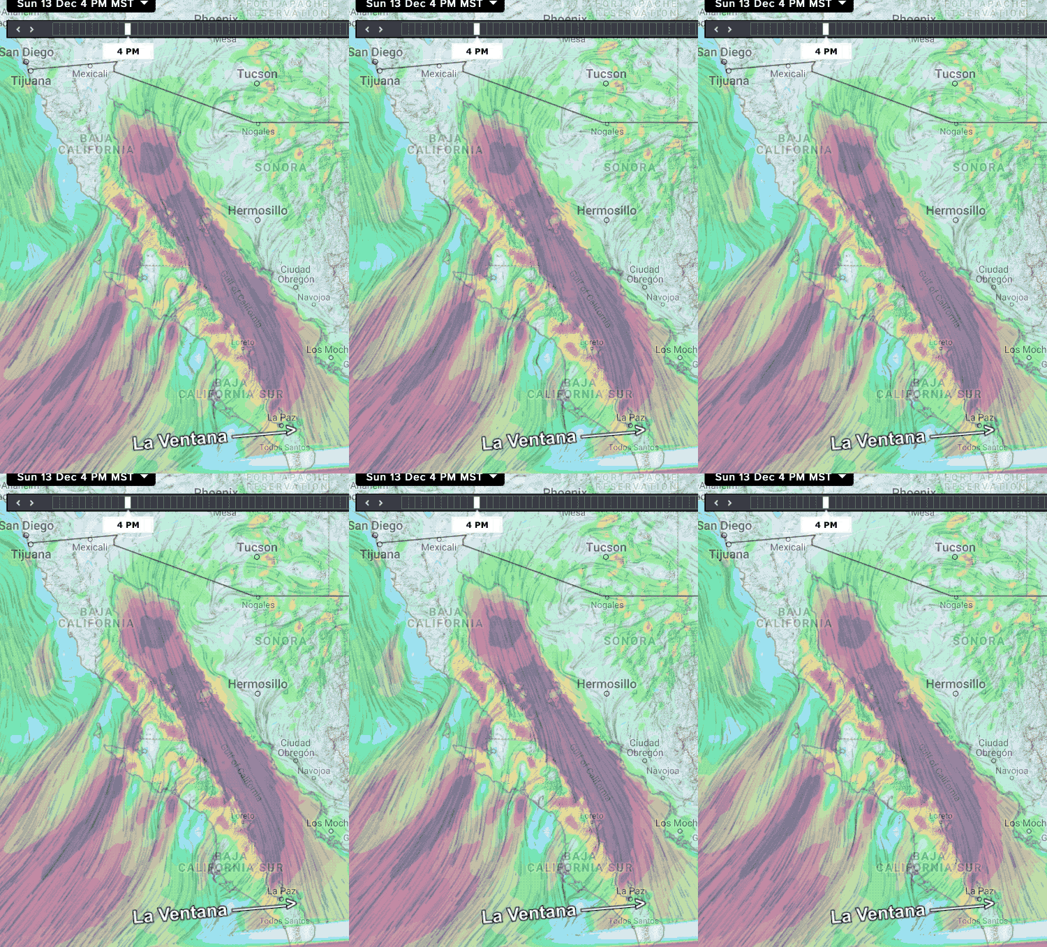
So for days, my Baja forecast has been calling for very strong winds Sunday, Dec 13, 2020. But as the date finally arrived I was only calling for upper-teens to low 20’s for the La Ventana to Los Barriles area. Why? Well the expected high pressure developed in the 4 corners (where all the USA…

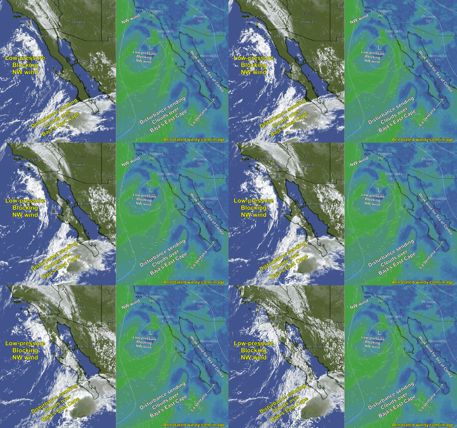
The Baja’s East Cape kiteboarding and windsurfing sites Los Barriles and La Ventana have seen almost 2 weeks of great wind. But on December 9, 2020, those winds came to a grinding halt. This occurred as 2 low-pressure systems blocked both of the Baja wind machines. In this animation of both satellite imagery and model output,…

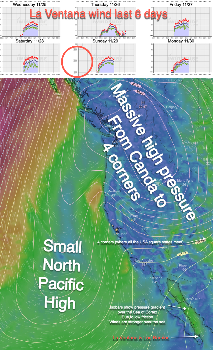
The last week of November 2020 has see day of winds over 20 knots for La Ventana, Baja Sur, Mexico. The graphic below shows the large high pressure area that has changed shape and size a lot over this period but has stay centered in the Great Basin and 4 corners (where all the USA…
This animation shows how large scale events distant California both vertically and horizontally can impact our temperatures and winds. Looking at this animation first notice the upper trough and upper ridge that are moving towards the Golden State from the west. Focus on the upper ridge which is a northward extending loop of upper-level winds at…

