The San Francisco Bay Area winds are much more complex than Southern California or The Gorge. In the Gorge, the ocean winds sweep through a single gap in the Coast Range, following a single pressure gradient to the Columbia Basin. While Southern California ocean winds mostly blow along the coast or sweep over flat coastal…

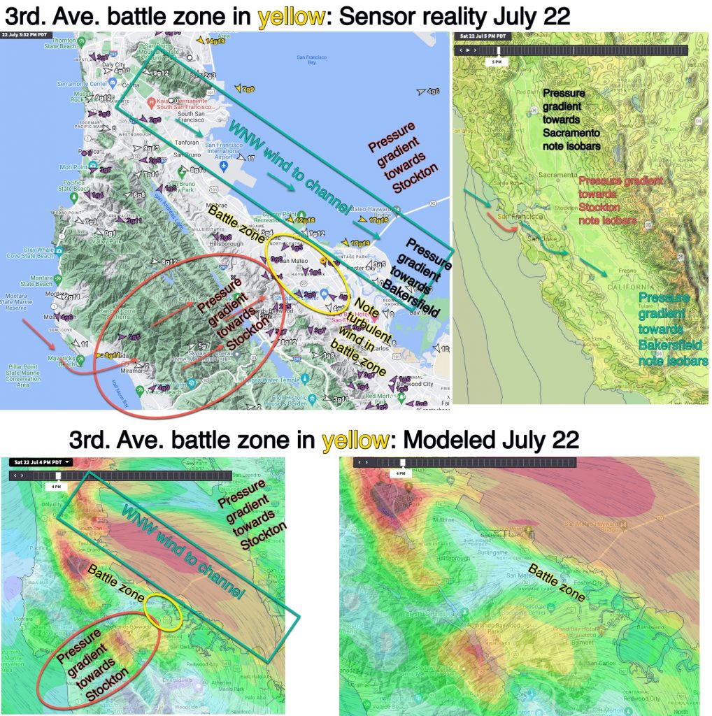
This visual blog tells a bit of the story behind my 3rd. Ave. launch site forecast today: Note: I am going to stick to last night’s forecast below except to mention that the eddy is weaker and will impact Pt. Isabel and 3rd. Ave. less than I thought. Blog about 3rd. Ave. launch site winds…
Looking at all our sensors at 9:30 AM today from Bodega to Waddell and Crissy to Sherman Island, you might think that the forecast of strong NW ocean winds curving into the Bay was THC induced. The first image below seems to confirm that diagnosis But look at the satellite animation in the 2nd. image….
Hi S—–, Normally the surface air is much cooler than the air above the inversion so denser and relatively high-pressure. But subsiding air from the upper high-pressure is crushing the marine layer clouds so we have very warm air over the coast and just above the surface. Since the models only look at select elevations…
My forecast day got off to a great start. Waking up at 5AM, I had lots of time to work up a great San Francisco Bay Area forecast. This was earlier than my usual start time but a was excited since it was the first day of my Thursday-Sunday shift. There is just one major…

Weatherflow forecast for San Francisco Bay Area, June 18: Mt. Diablo is already NW 22g31. Strong winds ALOFT always arrive first since they are above the topographic friction and have already scoured out the clouds. The SURFACE NW winds have reached Bodega and the S.F. ocean buoy is now 21g27. In the next few hours,…

If you have lived in the San Francisco Bay Area for long, you know that southerly ocean winds in the summer mean a deepening of the Marine Layer Clouds. And with the increasing frequency of eddies and southerly coast winds, it often seems that our fog is becoming thicker despite all the research suggesting that…

We have had frequent, long-lasting eddy patterns in the greater San Francisco Bay Area. Today, June 15, one of the longest eddy patterns continues, with southerly coast winds the most reliable Bay winds north of the Bay Bridge. In this first image from June 13, notice how the NPH has shoved a ridge into the…

By now, you’re likely curious about the underlying factors responsible for the persistent occurrence of eddies and southerly winds along the coast. Actually, if you play north of the Bay Bridge, you have probably been too busy enjoying the WSW eddy wind to give it a thought. But if you ply the waters of…
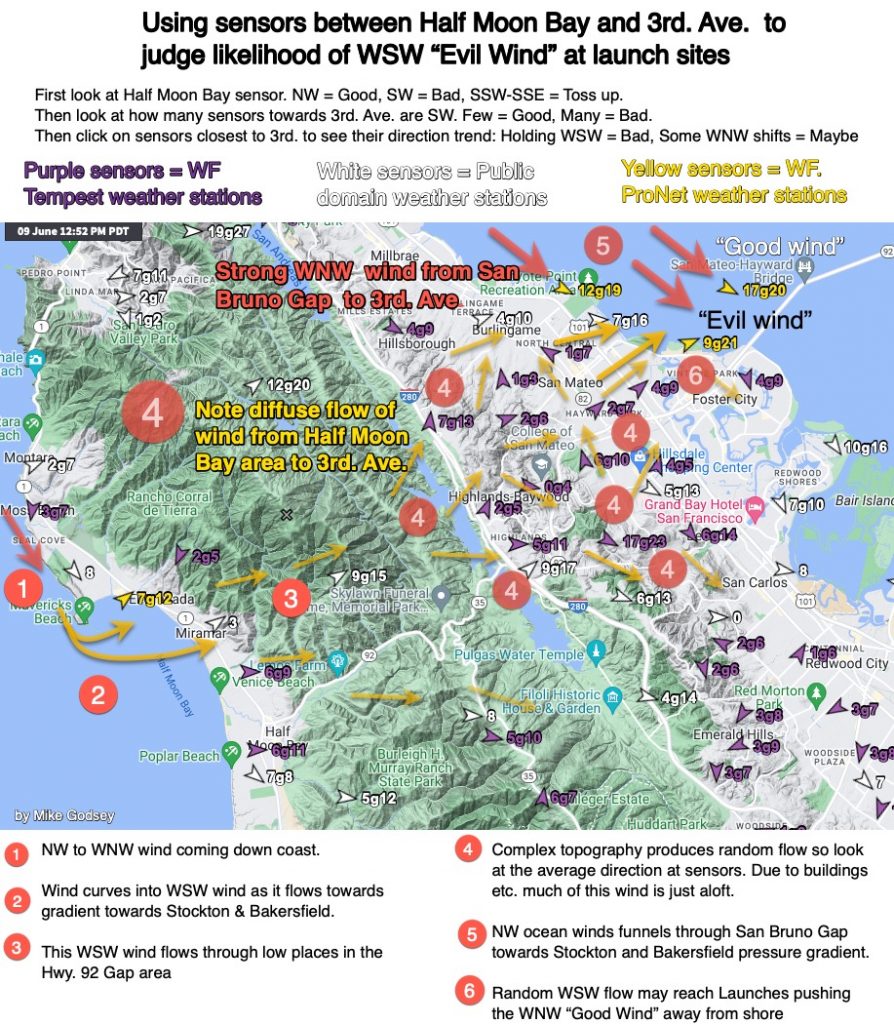
In the last decade, we have seen more days with WSW flow in the Hwy in 92 Gap and the nearby coast range area. These winds, sometimes called “Evil Winds” can mess up the launch site winds. They also make our forecast for good channel winds frustrating. (This recent blog talks about one of the…