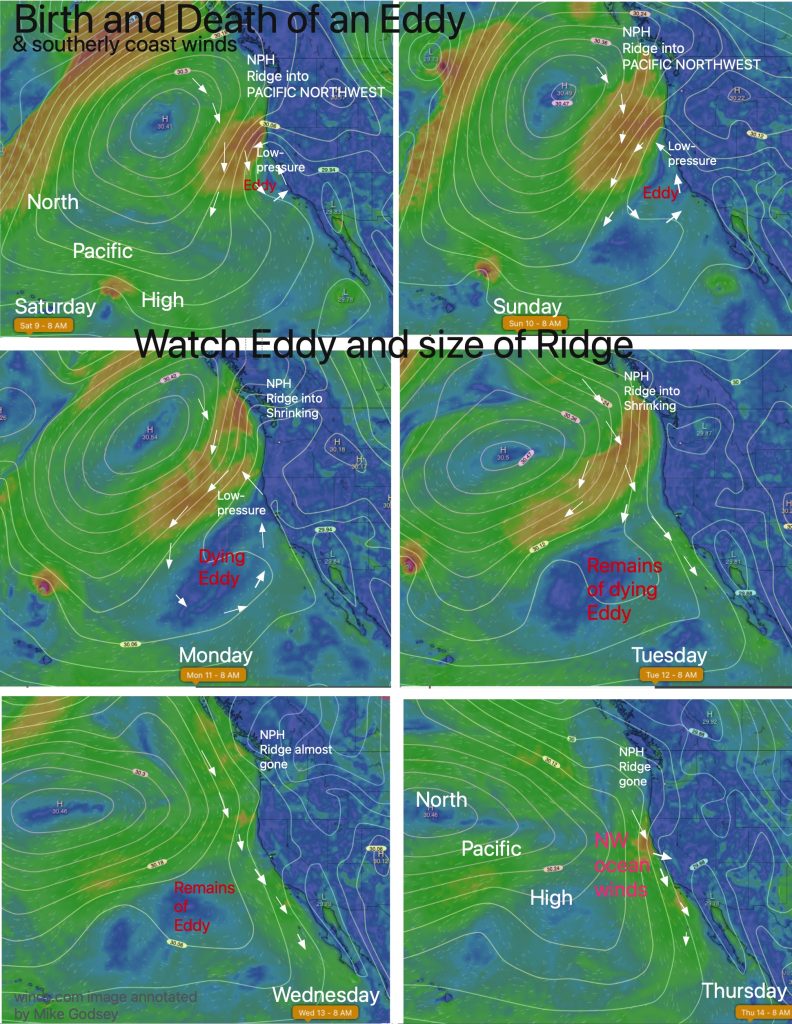
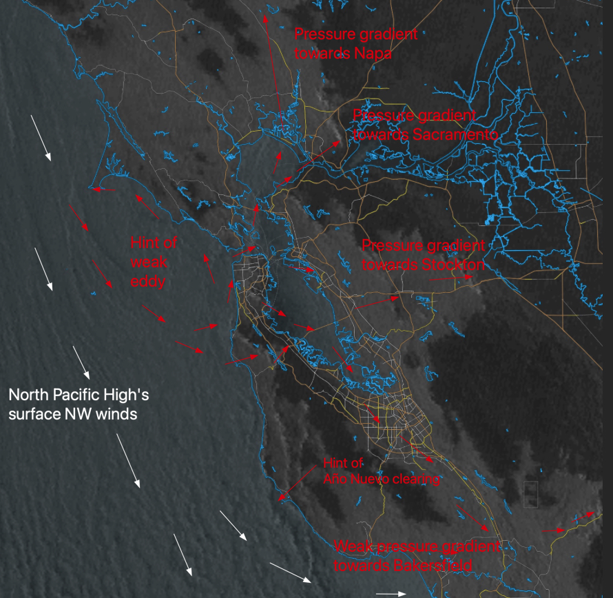
Day by day, watch the dance of the North Pacific High and its ridge extending into and beyond the Pacific Northwest, and the low-pressure extending from the Central Valley. Note the shrinking and retreat of that ridge and the low-pressure impact on the size and location of the surface eddy that is bringing southerly coast…
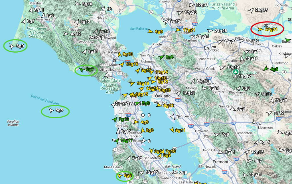
Friday’s Wind Recipe: 1- A lobe of the North Pacific High has moved into the Pacific Northwest and far Northern California while the Central Valley low is bulging way west of the Marin/Sonoma coast. 2-This creates an S. to N. pressure gradient, so southerly eddy coast winds are blowing from Waddell to Pt. Reyes this…
Sunday’s Wind Recipe: 1- Surrounded by unseasonal low-pressure storms to the West, North and South the North Pacific High’s isobars are compacted along the coast just like a typical May day.2- This causes very strong NW ocean winds with the San Francisco ocean buoy surface NW winds are NW 20g25 3- Sunday sees strong pressure…
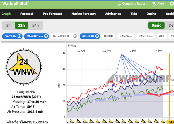
We are all used to seeing random gusts and lulls in the kite and windsurf wind graphs. This gives the wind graph a a jagged appearance. On good days the jags are small on bads days they are huge This first image shows a typical random wind pattern at Waddell on Thursday, July 31. But…
Thursday’s Wind Recipe:1- A huge Cut Off Low in the Gulf of Alaska anchors mild North Pacific High’s surface NW winds ramp up in the PM but maintains coast fog. 2- Southerly winds prevail in the AM from Half Moon Bay to Stinson but turn westerly as the eddy dies in the PM. 3- There…
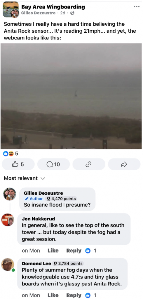
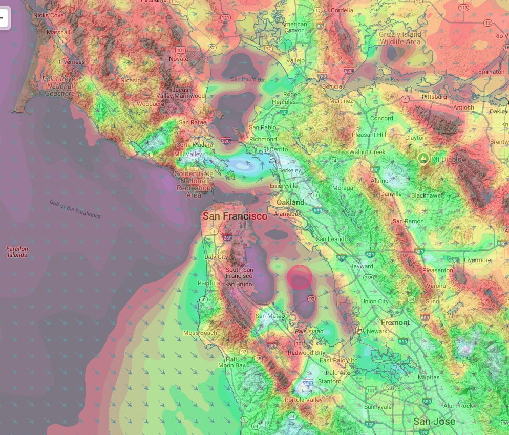
No, the sensor does not lie. Indeed, on days when there are NW ocean winds and a strong pressure gradient towards Stockton and/or Bakersfield it is very accurate. But when there is WSW wind due to an eddy or Marine Surge or a very strong Sacramento pressure gradient, the Anita Rock sensor will read much…
Wind Recipe:1- The Cut-Off Low ≈ 18,000 feet continues to block most of the NW ocean winds while enhancing:a. Coastal eddies. b. WSW ocean winds. c. Strong ≈ 1000 feet aloft WSW turbocharges surface wind at Sherman/TI/N. Tower. d. broken atypical marine layer. d. Cool weather. 2- The WSW ocean winds accelerate through gaps in…
Saturday’s Wind Recipe: Rio Daze is milder but solid!1- The North Pacific High FINALLY gets rid of that eddy inducing ridge into far Northern California. So Eddy DIES! 2- So our ocean winds turn from SSW to WNW and curve to almost every site in the Bay Area as… 3- The Central Valley low retreats…
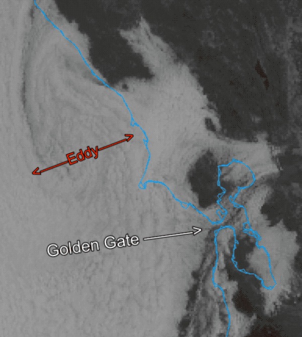
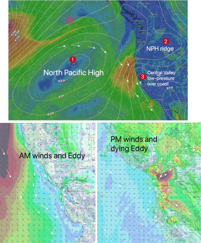
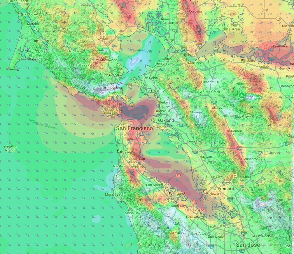
For nearly two weeks, a persistent counter-clockwise eddy off the coast of San Francisco has been the dominant meteorological feature, overriding the typical summer wind patterns of NW ocean winds and funneling strong southwesterly winds through the Golden Gate and into much of the San Francisco Bay. This unusual and prolonged event is the result…