Mike Godsey

Hi Guys,
I have spent hundreds of hours studying this issue by driving around the Peninsula especially the Half Moon Bay area. It is frustrating for me not to have a simple solution.

Basic information:

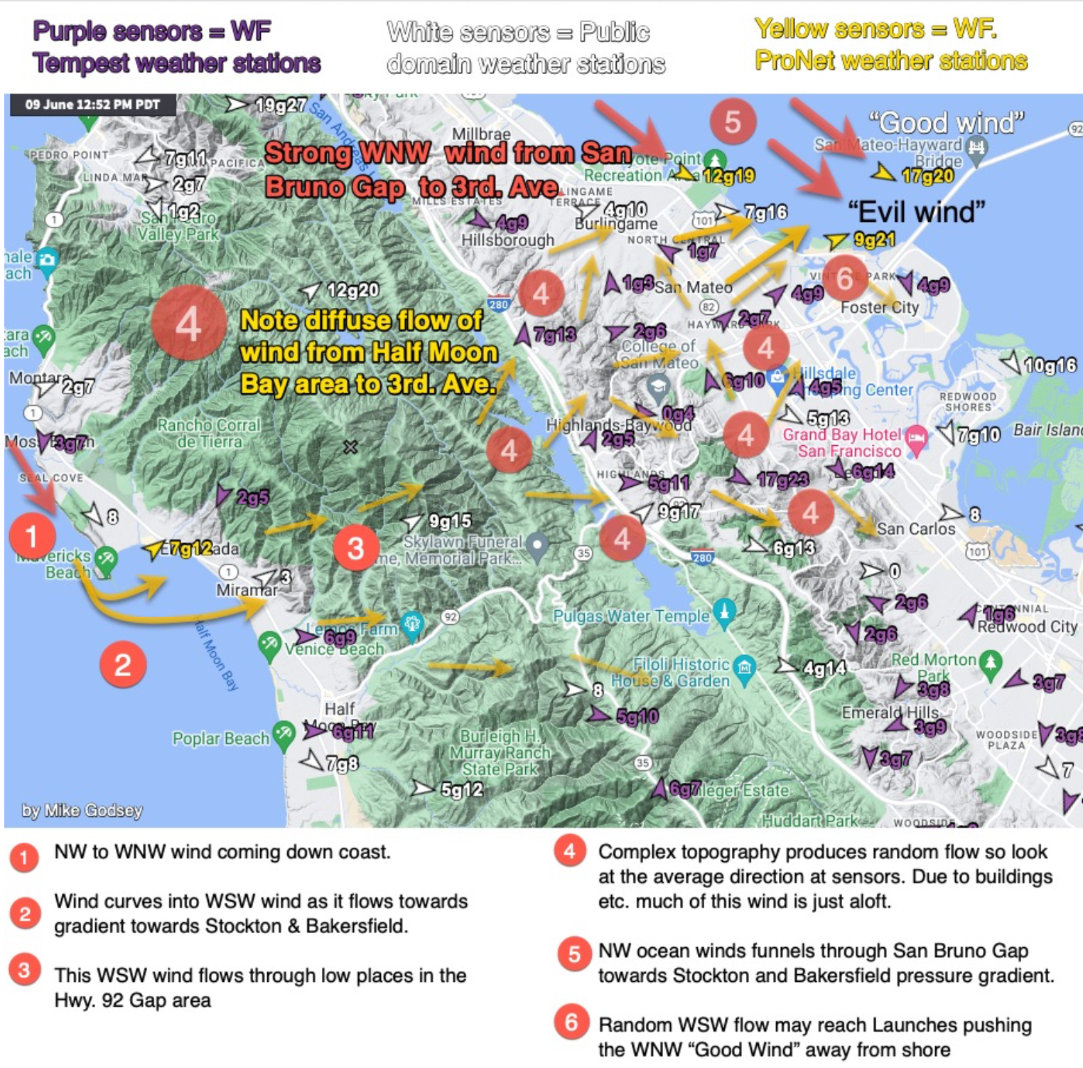
Unlike most Bay launch sites, the 3rd Ave. area is fed wind from 2 different gap areas in the Coast Range:
1. The broad NW-facing San Bruno Gap, which our 1km model resolves pretty well.
2. The narrow, winding, WSW-facing Hwy. 92 gap area that our 1 km model can not resolve.
Having 2 gaps often results in a wind battleline between strong WNW and weaker WSW flow in the 3rd. Ave. area. To compound things there are 2 different pressure gradients that suck winds over the area.
The location of the battleline is critical to where the transition will be from WNW flow or W to WSW flow. The location of the battle line fluctuates during the day. I can often forecast roughly where the battleline will be, but much can change between my update and the afternoon winds.
The data tables on phone apps do not allow you to visualize this battleline and or estimate the chances of WNW vs. unfavorable W to WSW flow. Bluntly, they are a waste of time when it comes to this issue.
The best bet is to use these links to get a rough idea if there will be a WNW vs WSW battle line and where it may be located:
1. Flow Map: https://wx.iwindsurf.com/map#37.552,-122.356,12,880262
2. Our Tempest Weather Stations between Half Moon Bay and 3rd. Ave.: https://tempestwx.com/map/77638/37.5473/-122.2955/13 (this is a slow but detailed view)
3. Zoom in to our IW wind map and look at Tempest stations: https://wx.iwindsurf.com/map#37.513,-122.34,13,19
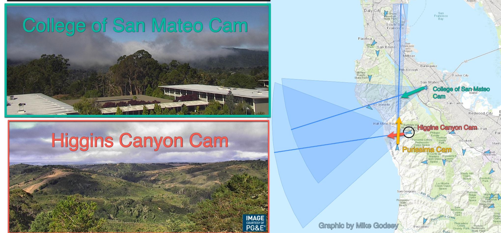
4. Use cams to view the fog in the Hwy 92 area.
5. At launch sites watch flags in the distance to the SW.
Below, you will find links to some of the many blogs I have written about the 3rd. Ave. WNW vs WSW battle line.
The further the battle line is from the 3rd. Ave. better the winds.
The ultimate solution to this problem:
1. A much higher resolution model which is computationally demanding is not fiscally possible now.
2. Using ML
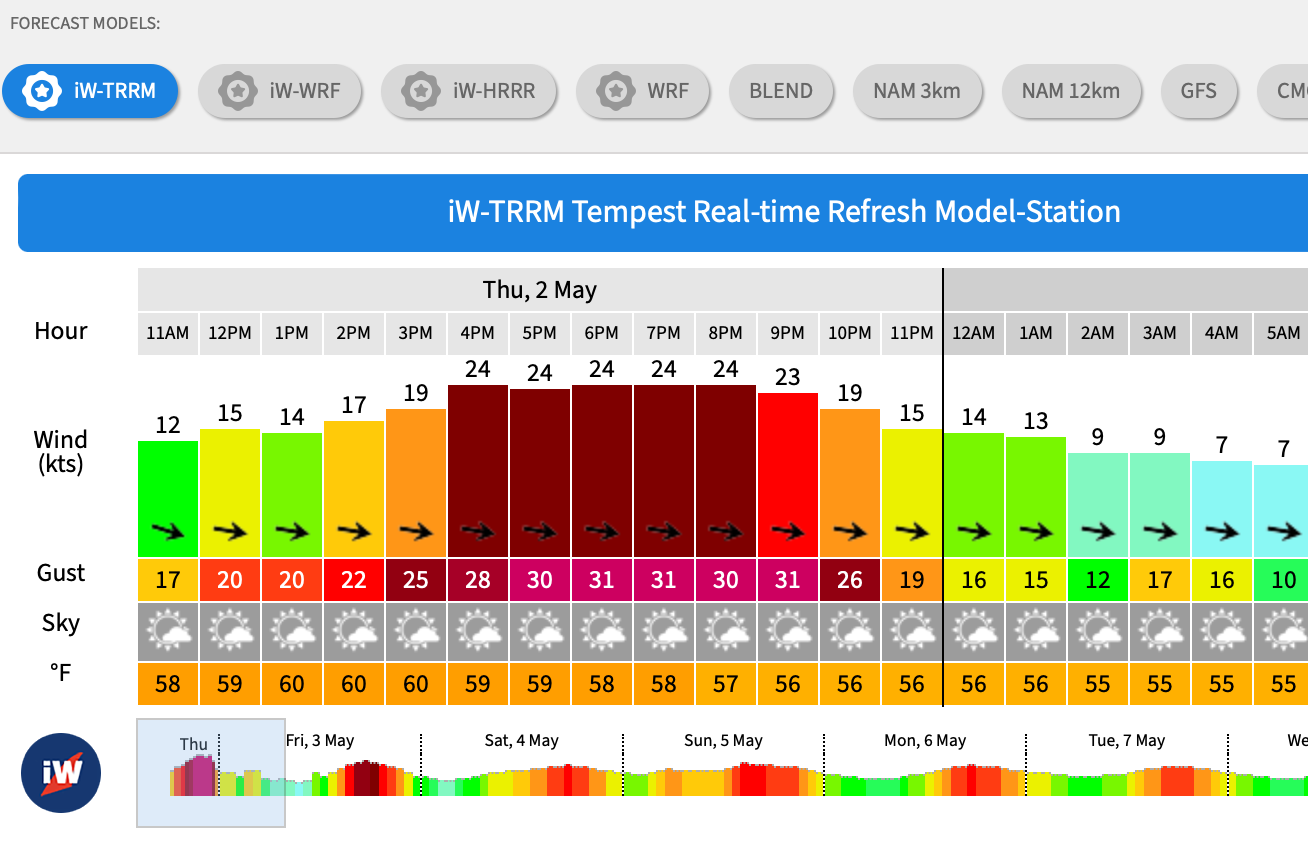
The further the battle line is from the 3rd. Ave. better the winds./AI to produce a forecast based on recent observations of sensor arrays. We are working fast on this. Click on the 3rd. Ave. Channel sensor and see our prototype ML/AI Tempest Real-time Refresh Model (TRRM) forecast. We don’t have ML/AI for the launch site yet. This link gives the details:
Deeper Detail:
1. The San Bruno Gap funnels NW ocean winds, which can take different curving pathways towards 3rd. Ave.
a. IF the strongest pressure gradient is towards Bakersfield, the San Bruno Gap wind curves into WNW wind in the channel and near or at the launch sites as it is sucked through the 90-mile Santa Clara Valley from San Jose to Hollister. This gradient means WNW winds in the Channel and at or near the launch sites.
b. If the max pressure gradient is towards Stockton, wind from the San Bruno Gap takes a more westerly flow as it is sucked through gaps in the East Bay Coast Range. When this happens, you see strong winds at the San Leandro Channel and probably at the 3rd. Ave. Channel sensor but much weaker winds at the 3rd. Ave. launch sites.
The San Bruno Gap is a large gap and is pretty well resolved by our 1 km WF-WRF so the model forecasts are pretty accurate in this pattern.
2. The Hwy. 92 gap area can funnel unfavorable WSW winds to 3rd. Ave launch sites and even the channel in 3 different scenarios.
a. If the max pressure gradient is towards Stockton some of ocean winds goes through the San Bruno Gap and some of it flows through Hwy. 92 gap as WSW wind. This creates a wind battle between WNW and WSW winds.
b. When there is an eddy there is WSW flow in the Hwy. 92 gaps that may die in the afternoon, allowing WNW wind to reach 3rd. Ave. We can forecast that pattern fairly well.
c. During a classic Marine Surge through and over the Hwy. In the 92 gap area, our forecasts are almost always accurate.
Blogs: