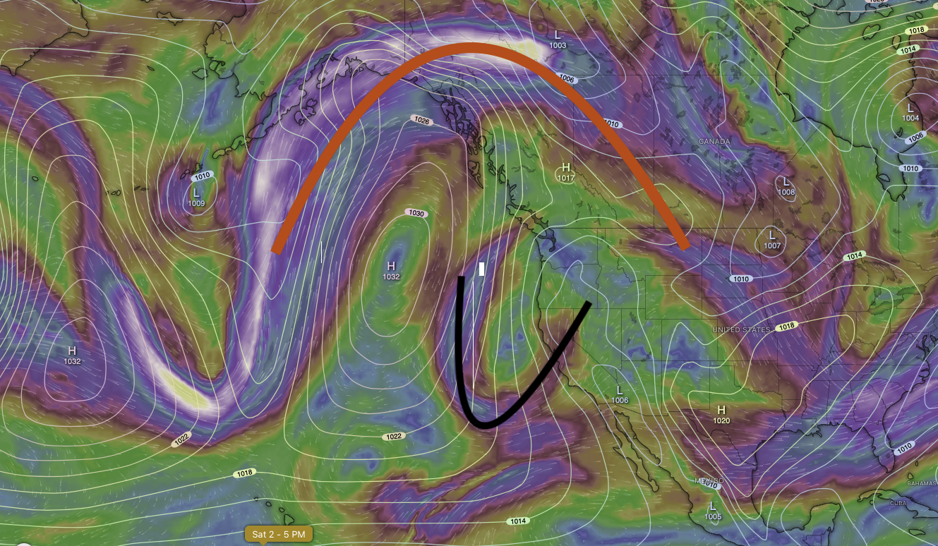
When forecasters use the terms “cut off low,” we are referring to a smaller, trough or low pressure in the upper atmosphere that is not part of the larger and main flow. Notice in this image and outline in red there is a larger flow of the upper level winds? Below, there is a smaller flow outlined in black. That is the cut-off low. A cut-off low has less energy than a large-wave upper low that is part of the main flow. Usually a cut-off low would manifest at the surface as a smaller, localized rain event, or as thunderstorms, or as a deepened marine layer at the coast. These events all happened in the subsequent days from when this image was taken in Central and Northern California.