Sun, Jul 21 2024
Forecast looks on track with only the timing of eddies arrival in question. The same pattern continues with solid NW winds from the North Pacific High and strong WNW winds over the Peninsula at ≈ 1000 feet aloft (975 MB). The pressure gradients is split between Sacramento and Stockton but only a mild Bakersfield gradient. This makes for gusty WSW winds north of the Bay Bridge and gusty W to maybe WNW on the Peninsula.
Wind forecast: Bodega NW upper-teens to low 20’s. Waddell NW upper-teens to low 20’s. Coyote and 3rd W to WNW upper-teens low-20s in channel but sometimes W. at the launch sites. Candlestick near 20. Crissy & TI near 20. Berkeley & Pt Isabel upper-teens to 20. Alameda mid-teens. Larkspur/Clark’s Brickyards mid-teens. Sherman Island around 20 in the PM.
Mon, Jul 22 2024
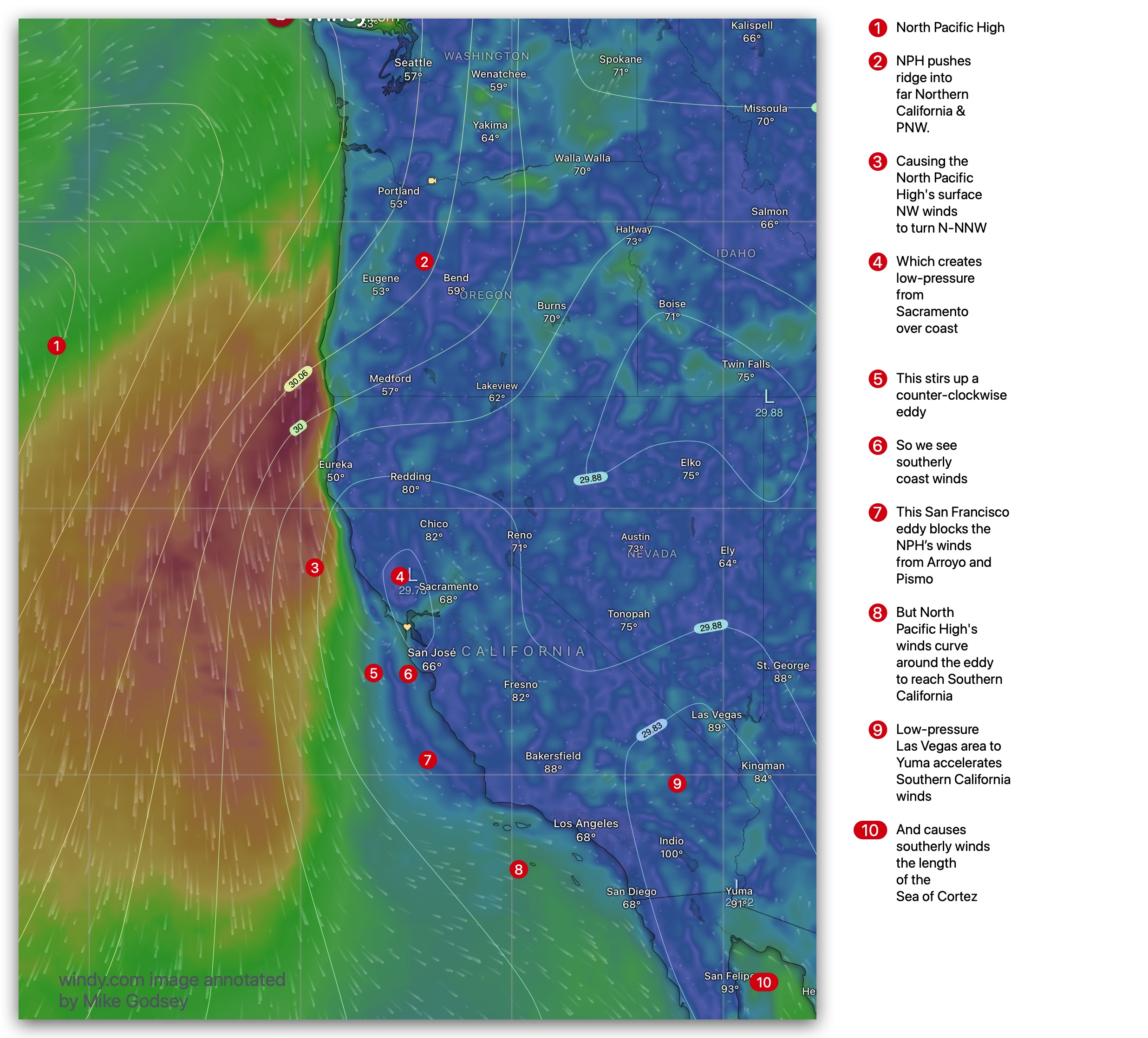
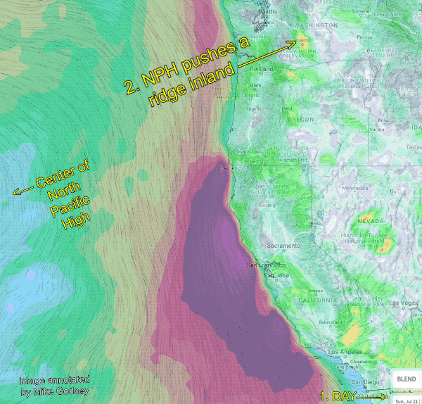
The North Pacific High shoves a high-pressure ridge into far Northern California and the Pacific Northwest, causing low-pressure to bulge over the coast N. of the Golden Gate. This causes the inbound NW to curve around, making for a counter-clockwise eddy and southerly coast winds until mid afternoon. The same low-pressure makes the max pressure gradient towards Sacramento with a lesser gradient towards Stockton and no Bakersfield gradient. So the strongest winds are mid Golden Gate to Pt. Isabel to Sherman Island PM. The Peninsula may have West winds until late afternoon when the launch sites winds turn WNW.
Wind forecast: Bodega NW mid to weak upper-teens if it clears. Waddell NW low-teens. Coyote and 3rd W to WNW upper-teens in channel but often W. at the launch sites. Candlestick upper-teens. Crissy & TI near 20 mid-bay. Berkeley mid-teens & Pt Isabel upper-teens. Alameda low to weak mid-teens. Larkspur/Clark’s Brickyards mid-teens. Sherman Island around 20 in the PM.