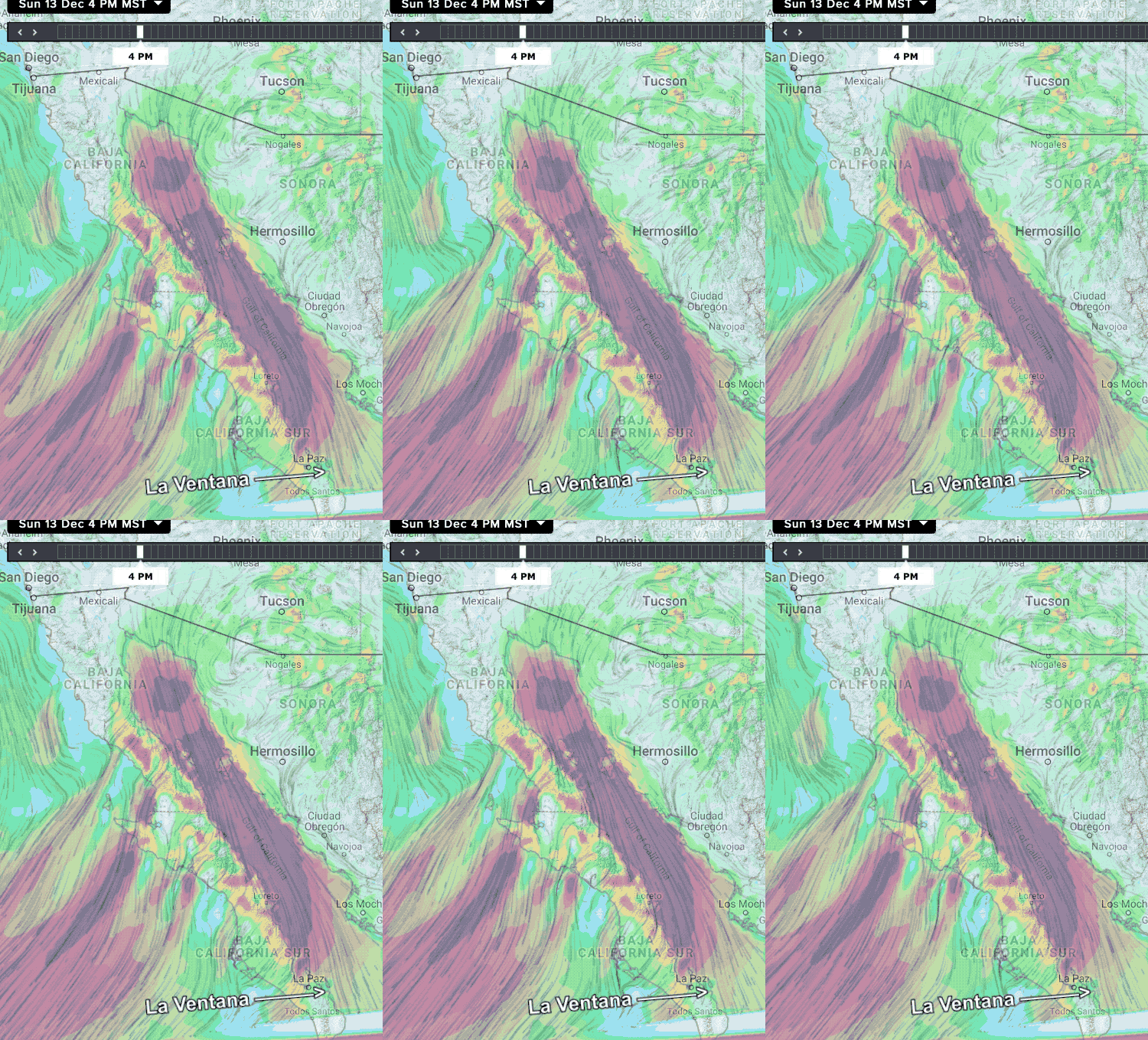
 So for days, my Baja forecast has been calling for very strong winds Sunday, Dec 13, 2020.
But as the date finally arrived I was only calling for upper-teens to low 20’s for the La Ventana to Los Barriles area.
Why?
Well the expected high pressure developed in the 4 corners (where all the USA square states meet) to Canada area.
But my forecast had the strongest winds in the area north of La Paz to the far northern end of the Sea of Cortez.
As you can see in this first image the models agreed with my assessment.
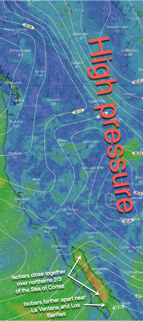
The next image tells the story. Notice the white isobars lines that show areas of equal pressure.
Notice that there is a high pressure zone in Canada that extends all the way into N. Mexico.
This creates a strong pressure gradient over the Sea of Cortez. But if you look carefully you can see the isobars are closest together in the northern 2/3 of the sea.
This is where the pressure gradient is strongest and where the winds will be blasting.
But the isobar lines are further apart in the Los Barriles and La Ventana area. Hence the weaker winds.
In addition, the location of the high pressure made the winds a bit NNE and with low-pressure to the south, some of the wind blowing down the Sea of Cortez took a path through the low areas of the backbone of the Baja Peninsula siphoning some of the power of the wind as it coursed towards La Ventana and Los Barriles.
