The 1000 mile wide North Pacific High is still, weirdly in an early summer location so why is the Santa
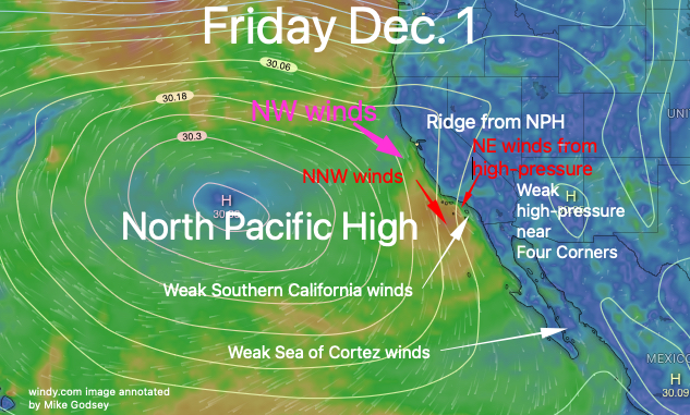
Maria Ocean buoy blowing NNW rather than NW.
And why are NE winds starting to pick up on the Southern California coast?
In this first image you can see part of NPH moving inland into Nevada. This causes the surface winds to clock more northerly winds near Arroyo and even NNE over Southern California. And those directions pose issues for the beach winds.
This surface ridge movement is caused by a change the pattern of the upper level winds
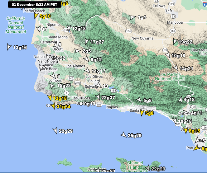
Central California: The Cape San Martin Buoy is a somewhat unfavorable NNW direction 13g16.
As the pressure gradient from Santa Maria to Solvang those winds will try to move to the beaches but they will be battling NE winds just aloft so the beach winds will be weaker and less unreliable than yesterday.
Southern California: The Santa Barbara East ocean buoy is reading 25g29 but those winds turn an unfavorable NNW this afternoon.
That will be the tantalizing story for all of the Southern California coast as “evil” offshore NE winds aloft try to push the good west winds away from the beaches. Only the Topanga to Long Beach Area has a decent chance of up and down usable wind.