Forecast Jargon Decoder: Sunday, May 26, 2024
1. The North Pacific High pushes a ridge into far Northern California in the AM.
2. This brings a small lobe of low-pressure over the Golden Gate and there is an AM eddy and southerly coast winds.
3. Mid-morning the NPH ridge disappears as does the eddy and the low-pressure retracts inland.
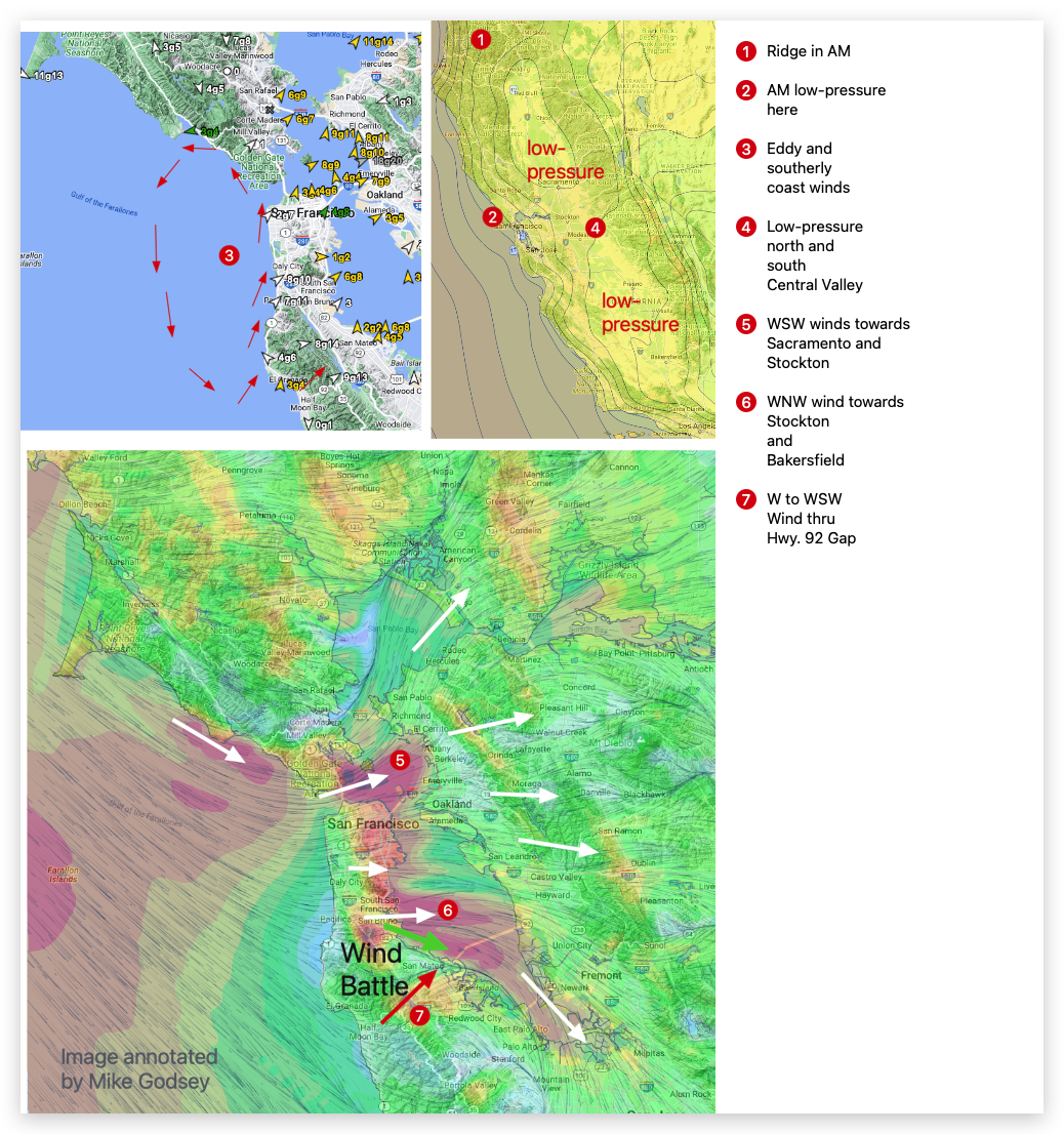
4. This leaves the Central Valley low-pressure pretty evenly split between Sacramento, Stockton and towards Bakersfield.
5. Some of these ocean winds curve from the Gate towards Pt. Isabel, Race Track and Berkeley as WSW winds heading towards Sacramento and Stockton.
6. Some of the ocean winds flow through the San Bruno Gap to the 3rd. Ave. Channel towards Stockton and Bakersfield.
7. Meanwhile, some ocean winds flows through the Hwy. 92 gaps and reaches the 3rd. Ave. launch sites making for unreliable wind until ≈ 4-6 PM despite strong WNW channel winds.
8. We lose the strong west winds ≈ 1000 feet aloft (975 MB) so the surface winds are LATER and less gusty.