Forecast Jargon Decoder for Friday May, 7, 2024
Wow! That was a strange Marine Surge.
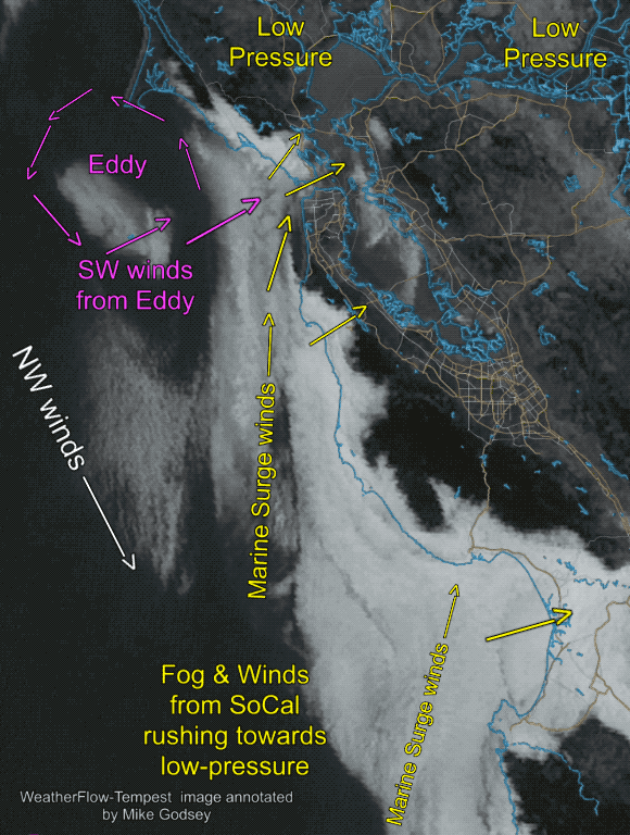
Typically a Marine Surge is strong southerly winds flowing from Southern California to a low-pressure in the Marin/Sonoma/Napa and Sacramento area.
But today we also had a small counter-clockwise eddy just west of Pt. Reyes that turbocharged the SW winds.
Note: If you have never seen an approaching Marine Surge flooding through the Golden Gate watch this NEW LINK to an old video: https://windnotes.smugmug.com/Videos-WindsurfKite/1-Gorge-Videos/i-w8Gt9Lv/A
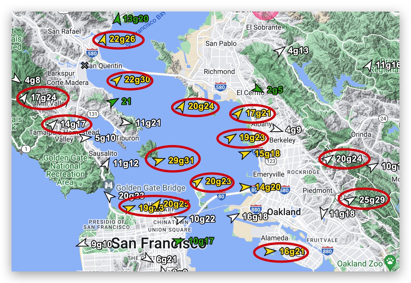
Check out these numbers: Larkspur Channel 24g32, Berkeley Reef, 22g26, Point Blunt 29g31 plus gaps
in the East Bay were hitting 28g32 which reflects the WSW Marine Surge winds being sucked through the Hwy. 92 Gap towards Sacramento so even the 3rd. Ave. channel recorded SW 16g20.
This animation shows both the Marine Surge and the counter-clockwise eddy winds funneling into the Bay Area toward to pressure gradients.
This combined flow caused the strong numbers you see in the wind map above.